Breaking · Weather / World
Forecasters expect Isaias to strengthen to 120 mph today — the season's first major hurricane — before striking near Pensacola late Friday, the first U.S. landfall since Hurricane Milton.
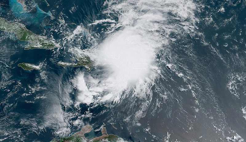
Hurricane Isaias landfall tonight is now the central forecast for the northern Gulf Coast. The Gulf of Mexico gave fair warning, and then the storm ignored the plan anyway. Hurricane Isaias, spinning toward the Florida Panhandle on Friday morning, was a Category 2 hurricane packing 110 mph winds at daybreak — and the National Hurricane Center expects it to keep strengthening, briefly touching Category 3 status with 120 mph winds later today before landfall late tonight or early Saturday somewhere between Mobile, Alabama, and Destin, Florida.
It would be the first hurricane of the 2026 Atlantic season and, as USA Today noted, the first hurricane to strike the United States since Hurricane Milton — two years ago to the day. Preparations, in the hurricane center's words early Friday, “should be rushed to completion as the weather will go downhill quickly today.” The warning is less about a distant point on a cone than about the shrinking time left for people to move, secure property and get off vulnerable roads.
What the latest NHC Hurricane Isaias advisory says
The numbers are precise and the window is narrowing. As of Friday morning, Isaias's center sat about 320 miles south-southeast of the mouth of the Mississippi River, moving north-northeast at 15 mph — faster and larger than it was 24 hours earlier. The hurricane center's bulletin placed the center roughly 30 miles south of Pensacola Beach by 7 p.m. ET Friday, with actual landfall a couple of hours later, likely between Mobile and Destin.
At landfall the storm is forecast to carry sustained winds near 100 mph, after peaking at 120 mph earlier in the day. Hurricane-force winds extend outward up to 30 miles from the center; tropical-storm-force winds reach 185 miles out — a footprint that puts communities from New Orleans to Panama City inside the storm's reach. The Isaias storm surge forecast includes 3 to 5 feet from the mouth of the Mississippi to Biloxi and 1 to 3 feet in Lake Pontchartrain.
The National Weather Service office in Mobile expects impacts to peak Friday afternoon through early Saturday morning. Gov. Ron DeSantis on Thursday expanded the Florida state of emergency for the hurricane to 27 North Florida counties, up from 25 on Tuesday. Bridges in the Panhandle close once sustained winds exceed 39 mph — a threshold Pensacola is expected to cross by Friday afternoon.

Why this Gulf Coast hurricane in October 2026 matters
October hurricanes in the Gulf are not supposed to do this. The climatological script says a storm this late in the season should be running out of fuel: cooler water, stronger shear, a landfall that fizzles into a rain event. Isaias ripped up the script by strengthening from a tropical storm on Wednesday to the cusp of a major hurricane by Friday morning — 85 mph to 110 mph in about 24 hours.
That acceleration is consistent with a Gulf that remains exceptionally warm deep into the season; warm water is the storm's fuel tank, and this October it is still nearly full. The deeper significance is not just meteorological. This is the first hurricane landfall in the United States in two years — the first since Milton — which means disaster-response systems, grid operators, local governments and insurers are about to face their first major live test of the post-Milton period.
Every assumption made since 2024 about building codes, flood maps and evacuation routes is about to meet a real storm. The timing could hardly be more loaded: Isaias is bearing down on the same Panhandle communities that spent this week under mandatory evacuations and watched the Alabama–Georgia weekend and a Trump visit get swallowed by the forecast cone. The region has been living inside this storm for days. Tonight it arrives.
Hurricane Isaias vs. Hurricane Milton: a different coast, a familiar test
The comparison is not a claim that the two storms are identical. Milton's track, surge geometry and affected communities were different. The useful comparison is institutional: Isaias will reveal whether lessons on evacuation timing, emergency communications, backup power and claims handling survived the quiet two-year interval between U.S. hurricane landfalls.
How the Hurricane Isaias track changed in October 2026
Isaias's path to tonight was visible all week. By Tuesday the storm was a tropical system organizing in the Gulf; by Wednesday night the National Hurricane Center was warning that rapid intensification was a distinct possibility as it raced over very warm water. Thursday's advisories had it at 85 mph, moving east-northeast at 10 mph, about 355 miles south of the Mississippi's mouth.
Overnight Thursday into Friday, it did what forecasters feared: it strengthened, growing faster, larger and more dangerous in a single day. Thursday also brought the policy response into focus — Florida's Department of Transportation and local sheriffs pre-positioned for bridge closures, Bay County closed its M.B. Miller Pier at 7 a.m. Friday as double-red-flag surf closed the beaches, and DeSantis expanded the emergency declaration.
What changed between the site's October 7 coverage and today is simple: the forecast shifted from a Category 2 brush to a Category 3 peak before a direct hit, and the landfall window moved from “sometime Friday” to tonight, probably near midnight. That is why old plans become immediate decisions.
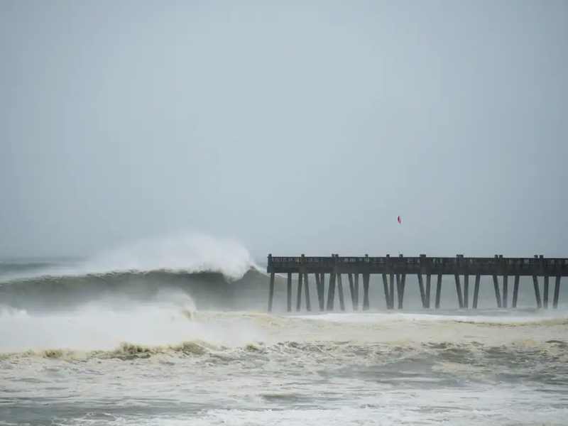
Hurricane Isaias at 120 mph: what the numbers actually mean
Category 3 begins at 111 mph — “major hurricane” status, the threshold where the Saffir-Simpson scale moves from extensive exterior damage toward the risk of major roof-deck loss and structural failure in some buildings. A 120 mph wind exerts roughly 1.4 times the pressure of a 100 mph wind because wind loading rises approximately with the square of velocity. The difference between 110 mph and the forecast peak is not just a number; it can push damage into a more severe class.
Consider the geometry. A 185-mile radius of tropical-storm-force winds means that while the center is still offshore of Pensacola Beach, hazardous conditions can already be lashing communities from southeast Louisiana to the Florida Panhandle. A 3-to-5-foot surge can sound modest beside the double-digit surges of recent major hurricanes, but surge follows local topography. On low-lying parts of the Mississippi and Alabama coasts, four feet of water directed into the wrong inlet can put homes and roads underwater.
Rainfall is the quieter killer. Pensacola could see about 2.5 inches between 2 and 7 p.m. and another 3.3 inches overnight, with bands capable of training over the same ground. The tornado threat in outer rain bands from Friday evening into Saturday is another reason the danger extends well beyond the landfall point.
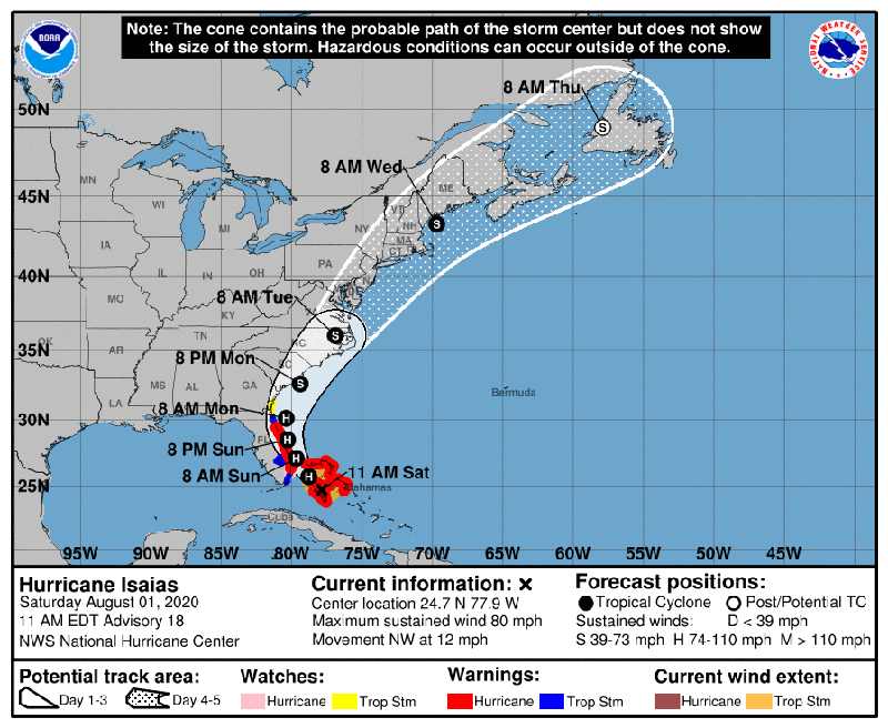
Who bears the cost of Isaias's Florida Panhandle impacts
The certain losers are the small coastal economies in the cone — beach towns whose October shoulder season, the quieter business that carries them through winter, is being erased in a single weekend. Charter-boat operators, beachfront restaurants and short-term rental owners lose more than Friday night; cancellations can ripple across the remaining season.
Florida's insurers face a different test after rebuilding balance sheets and repricing risk in the Milton era. A Category 3 peak followed by broad wind-field damage across the Panhandle is the kind of tail event those models were supposed to absorb. Power utilities confront the operational version of the same question: the hurricane center is warning of extended outages, and gusts of 40 to 50 mph may reach well into central Alabama early Saturday.
Almost nobody “wins” a hurricane. The better-positioned communities are inland areas outside the surge zone and emergency managers who moved early. Okaloosa County's evacuations, ordered days before landfall, look prudent in Friday's forecast light. The longer-term question is whether recovery strengthens confidence in the Panhandle's rebuilding system or exposes gaps through disputed claims, slow repairs and contractor fraud. The storm decides the first damage. Institutions and people decide what follows.
What happens next in the Isaias Pensacola landfall window
Three clocks are running. The first is the landfall clock: somewhere between Mobile and Destin, likely near midnight local time, the center comes ashore. The surrounding six to eight hours are expected to contain the storm's worst conditions — roughly 90 mph sustained winds near Pensacola around 10 p.m., gusts near 110 mph, peak surge and the possibility of tornadoes embedded in rain bands.
The second is the Saturday-morning damage clock. As Isaias moves inland and weakens, its broad wind field is forecast to carry 40-to-50 mph gusts and torrential bands into central and eastern Alabama, with an isolated tornado threat lingering into the afternoon. Flooding may become the second act as repeated rainfall meets saturated ground.
The third is the week ahead. Search and rescue gives way to damage assessment, power-restoration estimates, insurance inspections and the first hard evidence on how post-Milton building practices performed. Watch each new advisory for an east-west wobble in the track — a 20-mile change can decide whether Pensacola or Mobile takes the worst surge. Also watch central pressure, not only wind speed: falling pressure near landfall can signal that the storm still has room to intensify.
Sources
- USA Today, October 9
- Pensacola News Journal, October 9
- WBRC First Alert Weather, October 9
- Panama City News Herald, October 9
- Pensacola News Journal, October 8
- National Hurricane Center — 7 a.m. CDT public advisory
- Florida Governor's Office — preparedness update and 27-county emergency declaration
Forecast details are a snapshot from the morning of October 9, 2026. Conditions and official warnings can change quickly; residents should follow emergency officials and the latest National Hurricane Center advisories.