After a record-long wait for 2026's first hurricane, Florida declared a 25-county state of emergency as the National Hurricane Center warns of rapid strengthening, flooding rain, storm surge, and a king tide converging on the northern Gulf Coast.
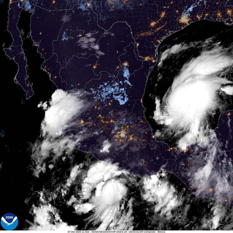
Tropical Depression Nine became Tropical Storm Isaias early Wednesday, October 7, 2026, spinning in the southwestern Gulf of Mexico — and the National Hurricane Center's forecast for the Tropical Storm Isaias landfall is already setting off alarms along the northern Gulf Coast. At 5 a.m. Eastern Time, the storm packed maximum sustained winds of 40 mph and was drifting east-northeast at 8 mph near 22.0°N, 94.1°W, roughly 580 to 600 miles south-southwest of the mouth of the Mississippi River and 721 miles southwest of Pensacola, with a minimum central pressure of 1004 millibars. Tropical-storm-force winds extend outward up to 45 miles from the center. Forecasters say Isaias will become a hurricane by Thursday and peak as a strong Category 2 with 110-mph winds Thursday night into Friday, before coming ashore late Friday, October 9, or early Saturday, October 10, somewhere between Biloxi, Mississippi, and Panama City, Florida.
The Hurricane Isaias path: “Rapid strengthening is forecast over the next day or two”
That sentence comes straight from the National Hurricane Center's Wednesday morning advisory, and it is doing exactly what forecasters intend — focusing attention while there is still time to act. The Hurricane Isaias path first takes the storm north of the Yucatan Peninsula on Thursday, then turns it sharply north toward the northern Gulf Coast. Hurricane watches and storm-surge watches — the 48-hour alerts that warn of 74-plus-mph winds and life-threatening coastal flooding — were expected to be issued for parts of the northern Gulf Coast on Wednesday. NHC hurricane specialist Philippe Papin put the stakes plainly: “It is looking more likely that Isaias will be a significant hurricane when it reaches the coast.” Some weakening is possible in the final hours before landfall, a common and fickle trait of Gulf storms, but the official forecast keeps Isaias a dangerous hurricane at the coastline. The projected landfall corridor runs from Biloxi, Mississippi, to Panama City, Florida, though impacts will spread well beyond the center — from southern Louisiana to Florida's Big Bend beginning Friday: flooding rain, powerful winds, storm surge, and possible tornadoes embedded in the rainbands.
Why this matters: a convergence of threats
Analysis: The number that will dominate headlines is 110 mph, one mile per hour shy of major-hurricane status. But the real story of this storm is not a wind number — it is four threats stacking on top of one another at the same time. First, rapid intensification over deep, warm Gulf water, the hardest phenomenon in hurricane forecasting to predict and the one that has produced the costliest surprises of recent years. Second, a new-moon king tide: tides are already running higher than normal, and storm surge rides on top of whatever tide is there. Third, saturated soils from recent rain — the ground cannot absorb what is about to fall, and forecasters see up to about 6 inches of rain in the western Panhandle. Fourth, tornadoes spinning up in the outer rainbands, the kind of threat that arrives with almost no warning. The NOAA Weather Prediction Center flash-flood outlook has placed parts of the Southeast at Level 2 of 4 for Friday and Saturday. Historically, water — surge and inland flooding — kills far more people in hurricanes than wind does. Everything about this setup points toward a water-heavy event, and that is why emergency managers are treating a “mere” Category 2 with the gravity of something worse.
A record-long wait: how the 2026 season got here
Isaias is the 9th named storm of the 2026 Atlantic season, yet it will be the first Atlantic hurricane of the year — a record-long wait tied to the effects of a likely record-strong El Niño. The mechanism is well understood: El Niño strengthens upper-level winds over the tropical Atlantic, and that wind shear tears developing storms apart before they can organize. All season, would-be hurricanes have been shredded aloft. Isaias found the exception — a pocket of the Bay of Campeche where shear relaxed over deep warm water, and the season's first real hurricane was born there. There is a precedent worth noting: if Isaias makes landfall as a hurricane, it will be the first U.S. hurricane landfall since Milton in 2024 — and Milton also formed in the Bay of Campeche, the same warm incubator. The timing adds one more compounding factor: the storm's approach coincides with a new-moon king tide, when tides run at their monthly peak and every foot of surge pushes further inland.
Category 2 hurricane 2026: what the season's first hurricane tells us
That the season's first hurricane is arriving in October, aimed at the Gulf Coast, is a reminder that the calendar matters less than the conditions. Late-season Gulf storms have a long history of rapid intensification — warm water lingering into fall, and systems that tap it can strengthen with terrifying speed.
What's at stake along the northern Gulf Coast
Start with the people in the water's path: coastal residents in low-lying surge zones from Louisiana to the Big Bend, many of whom have not faced a hurricane landfall since 2024. Then the economy of the Florida Panhandle — tourism and small businesses heading into the fall season, when a single storm can erase months of revenue. Then the less visible ledgers: an insurance market in Florida that is still fragile after recent seasons, and Gulf energy infrastructure — platforms and refineries that can send fuel prices twitching on a landfall headline. There are no real winners in a hurricane, but there is one genuine advantage this time: lead time. Watches going up Wednesday give coastal communities more than 48 hours — the difference between an orderly evacuation and a chaotic one. The critics' caution, and the forecasters' own, is about false precision: do not fixate on the exact dot where the eye is projected to come ashore. The hazards — surge, flooding rain, tornadoes — extend far outside the center, and small wobbles in track can shift the worst impacts by a hundred miles. Uncertainty is not a footnote here; it is the central fact of the next 48 hours.
Isaias spaghetti models and the uncertainty inside the cone
The individual model runs — the “spaghetti” plots circulating online — disagree on the exact landfall point, and that disagreement is normal and expected this far out. The National Hurricane Center's cone is the authoritative product; the models are guidance, not gospel. What the guidance broadly agrees on: a northern Gulf Coast landfall late Friday or early Saturday, with a dangerous hurricane at the coast. Treat the exact town in any single model run as trivia, and the hazard field as the message.
By the numbers: reading the Isaias Gulf Coast forecast like a forecaster
110 vs. 111. Category boundaries are wind-speed thresholds, and Category 3 begins at 111 mph — so Isaias is forecast to peak one mile per hour below “major” status. That single mile per hour is trivia, not comfort: the damage-potential scale rises steeply with wind, and a 110-mph Category 2 is a destructive storm by any honest measure; nothing meaningful separates it from the bottom rung of Category 3 except the label. Consider the trajectory: 40 mph on Wednesday morning to 110 mph by Friday — nearly a tripling of wind speed in about 48 hours. Rapid intensification is formally defined as a 35-mph increase in 24 hours, and it has historically been the hardest part of hurricane forecasting; the NHC is stating it plainly this time, which is itself a signal of forecaster confidence. Consider the pace: 8 mph forward motion is unhurried, and a slower storm wrings more rain out over the same places — more flooding for the same wind. Consider the clock: hurricane watches at 48 hours, warnings at 36 — county emergency managers must finalize evacuation decisions by Thursday, because Friday morning is too late to start. And consider the water physics: storm surge is measured on top of the tide, so every extra foot of king tide is an extra foot of water pushed inland, before a single wave is counted. Six inches of rain on saturated soil has nowhere to go but into streets and living rooms — which is exactly what a Level 2-of-4 flash-flood risk is describing.
Northern Gulf Coast landfall: what 110 mph means from Biloxi to Panama City
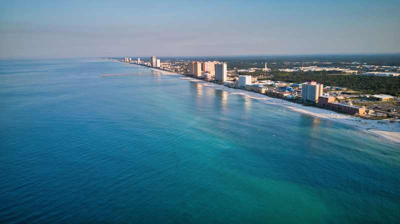
Within the projected corridor, 110-mph sustained winds will snap trees and power poles, peel roofs, and turn debris into projectiles — and the surge, amplified by the king tide, is the greater killer. Even well outside the corridor, tropical-storm-force winds and flooding rain will reach from southern Louisiana to the Big Bend. The corridor is where the worst happens; it is not where the impacts end.
What happens next: the day-by-day playbook
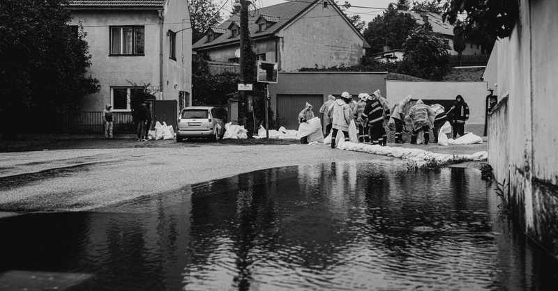
Wednesday is watch day — hurricane and storm-surge watches expected for parts of the northern Gulf Coast, the 48-hour starting gun. Florida is already moving: Governor Ron DeSantis signed Executive Order 26-202 on Tuesday, October 6, declaring a state of emergency in 25 North Florida counties — Baker, Bay, Calhoun, Columbia, Dixie, Escambia, Franklin, Gadsden, Gilchrist, Gulf, Hamilton, Holmes, Jackson, Jefferson, Lafayette, Leon, Liberty, Madison, Okaloosa, Santa Rosa, Suwannee, Taylor, Walton, Wakulla, and Washington. “This order will allow the Florida Division of Emergency Management to stage critical preparedness resources and ensure Florida is ready to respond,” DeSantis said. Staged in Tallahassee and the Santa Rosa area: generators, fuel, flood barriers, sandbags, bottled water, shelf-stable meals, and tarps. Thursday is warning day — the storm passes north of the Yucatan, turns north, and preparations along the coast should be completed by Friday morning. Friday is impact day: flooding rain begins, surge builds on the king tide, tornadoes become possible in the rainbands, and landfall arrives late Friday or early Saturday. Three scenarios bound the possibilities. Best case: pre-landfall weakening and a track shift that spares the densest coast — still a major rain and surge event somewhere. Most likely: a strong Category 2 landfall between Biloxi and Panama City with damaging wind, significant surge on a king tide, and widespread flooding rain. Worst case: the storm holds together or briefly touches 111 mph, stalls near the coast, and parks surge and rain over the same communities for hours. None of these is a prediction — track and intensity forecasts are not set in stone, and the honest guidance is to check each new NHC advisory rather than any single forecast.
Florida state of emergency hurricane order: what's staged and where
The 25-county emergency order covers the entire Florida Panhandle and Big Bend region. The staging choices — Tallahassee and the Santa Rosa area — put generators, fuel, flood barriers, sandbags, bottled water, shelf-stable meals, and tarps within striking distance of the projected impact zone before a single road floods. DeSantis also urged Floridians to have disaster plans in place and emergency supply kits stocked — the part of preparedness no executive order can do for you.
Hurricane preparedness Florida: what to do before Friday
Know your evacuation zone and your route now, not when the order comes. Fuel vehicles and generators. Gather documents, medications, and supplies for at least three days. Secure outdoor items, shutters, and sandbags while stores still have them. If you are in a surge zone or a mobile home, plan where you will go — and go when local officials say go, not when the water arrives. Follow county emergency management and the National Hurricane Center, not viral model runs.