World / China — The Tibet earthquake magnitude 7.0 recorded late on Thursday struck a high-altitude county in Nagqu prefecture, the strongest earthquake to hit China since January 2024. It was far from certain on Thursday night what it had done to the people in its path.
A Tibet earthquake of magnitude 7.0 struck northern Tibet at 10:33 p.m. local time on Thursday, October 22 (14:33 UTC), shaking a remote, high-altitude county in Nagqu prefecture near the border with Qinghai province. The United States Geological Survey (USGS) measured the quake at magnitude 7.0, with an epicentre roughly 183 to 191 kilometres east-northeast of the city of Nagqu, and China's own monitoring agency, the China Earthquake Networks Center (CENC), recorded the same magnitude. CENC said the quake was clearly felt in the local area. In the first hours, no casualties or damage had been confirmed by any official source — a silence that says as much about where this earthquake happened as about what it did.
Track it live: Live earthquake tracker — significant earthquakes worldwide
What the instruments recorded
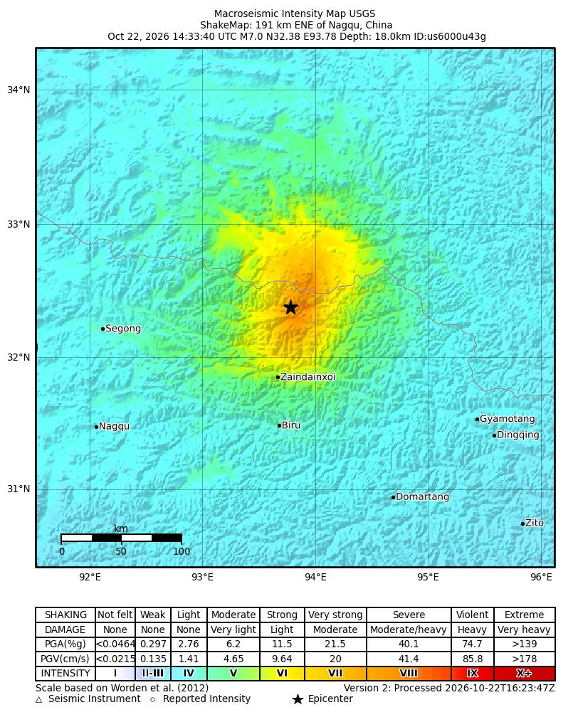
The numbers that matter arrived within minutes, and they were consistent where it counts. The USGS event page lists the earthquake as magnitude 7.0 (moment magnitude, Mw), with a reviewed solution placing the epicentre at 32.38°N, 93.78°E. Some very early wire reports put the magnitude as high as 7.2 before the agencies settled on 7.0; both the USGS and CENC now report 7.0, and that is the figure used throughout this article. CNN, citing USGS data, placed the epicentre 183 kilometres east-northeast of Nagqu; the USGS catalogue title puts it at 191 kilometres. The difference reflects successive refinements of the same calculation, not two different earthquakes.
Depth is the one figure the agencies do not agree on, and it matters. CENC, via Chinese state reporting, put the focus just 10 kilometres below the surface; the USGS origin solution puts it at 18 kilometres, and Europe's EMSC network reported 10 kilometres. Either way, this was a shallow earthquake, and shallow is what does the damage: the closer a rupture sits to the surface, the less its energy dissipates before it reaches buildings. The USGS ShakeMap modelled peak ground shaking at Modified Mercalli Intensity VIII — "severe" on the scale — near the epicentre, and the USGS estimates that around 111,000 people experienced shaking between moderate (MMI V) and severe (MMI VIII).
The earthquake was also, by China's recent standards, exceptional. CENC noted that it was the strongest earthquake to hit China since January 2024. On a plateau that produces magnitude 7 events somewhere along its vast extent every few years, that is a measure of how quiet the country's recent seismic record had been — and of how completely a single shallow rupture in the wrong place can end the quiet.
An epicentre at the top of the world
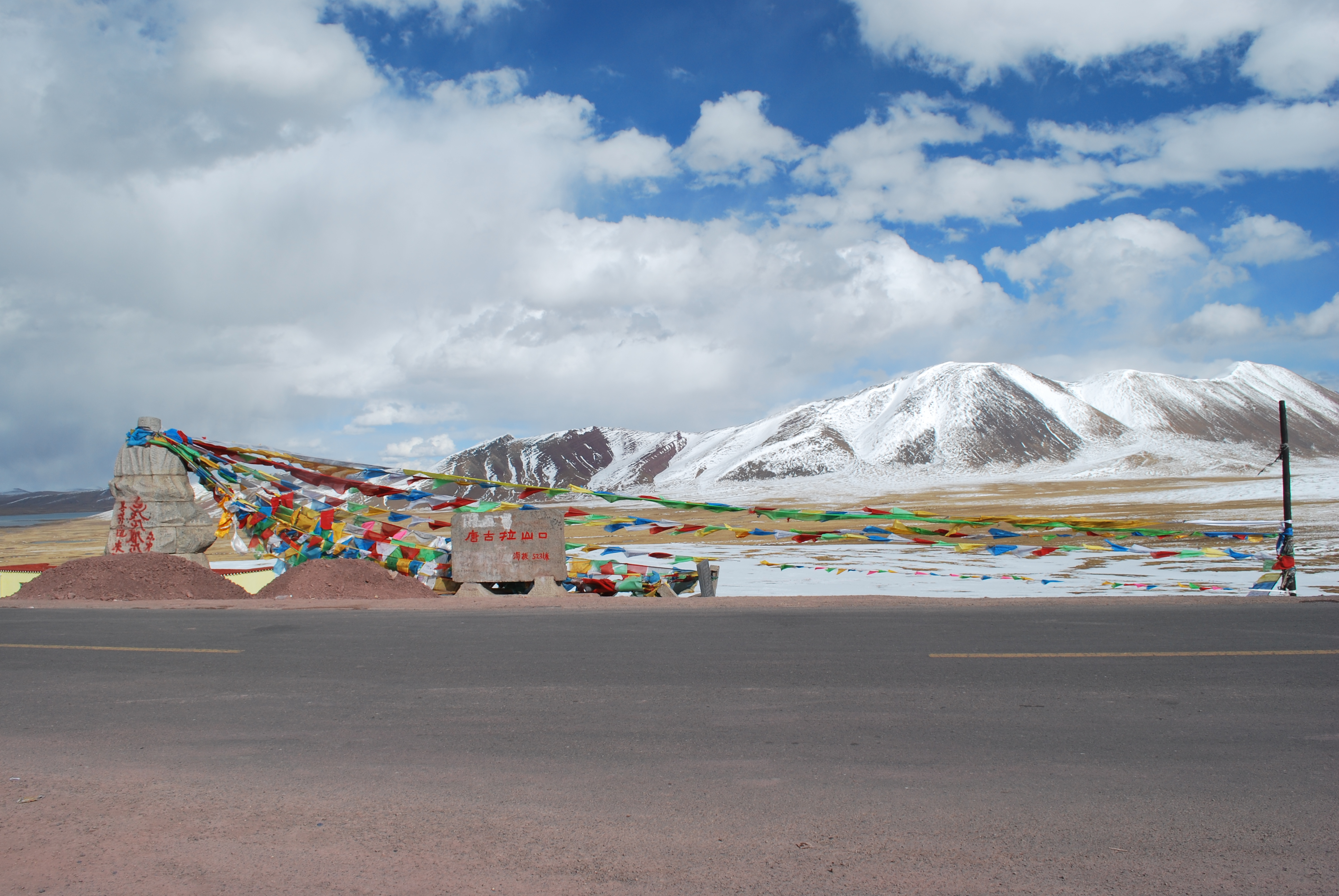
The epicentre was in a high-altitude county of Nagqu prefecture — identified in Chinese reporting as Baqên County — in the Tibet Autonomous Region (Xizang), close to the Qinghai border. CENC data put the average elevation within five kilometres of the epicentre at about 4,864 metres (roughly 15,960 feet), higher than any point in the European Alps. The regional capital, Lhasa, lies around 400 kilometres away by Reuters' reckoning, and Nagqu city itself is a prefecture-level centre of only about 30,000 people, per USGS population data.
This is the northern Tibetan Plateau: a cold, thin-aired grassland of nomad camps, scattered townships and long empty distances, where the population thins to a few people per square kilometre. That sparseness is the earthquake's one mercy. The USGS PAGER system estimates that only about 4,000 people felt very strong shaking and 3,000 severe shaking, with 39,000 feeling strong shaking — small numbers for a magnitude 7.0, and the single biggest reason seismologists will tell you that the same rupture under a plateau city would be a catastrophe of a different order.
What we do not know yet
Reuters' first report carried the sentence that defines the state of knowledge: it was not immediately known if there were any casualties or damage. CNN's brief report said the same in different words — the scope of damage was unclear — and nothing published by CENC, Xinhua or the USGS in the first hours changed that. No official casualty figure exists. No confirmed damage assessment exists. Anyone offering either, this early, is guessing.
There are structural reasons for the fog. The earthquake struck at 10:33 at night, in darkness, in a region where the nearest township may be an hour's drive from the epicentre and where mobile coverage follows the highways rather than the grassland. In remote Chinese plateau quakes, the first reliable ground reports have historically taken many hours to reach provincial capitals, and full township-by-township accounting has taken days. The honest summary on Thursday night is: a major earthquake, severe modelled shaking, a small and scattered population, vulnerable buildings — and no verified word yet on what happened to them.
The alert levels: Yellow for lives, Orange for losses
The USGS PAGER system, which models expected impacts from shaking, population and building data, issued a Yellow alert for shaking-related fatalities and an Orange alert for economic losses. In the USGS's own summary, shaking impacts are likely, some fatalities are possible, and the disaster is potentially widespread. PAGER estimates economic losses at less than 1 percent of China's GDP — a figure that sounds abstract until it is set against the alert's track record: past events with this alert level have required a regional or national-level response.
Two cautions belong with those alerts. First, PAGER is a model, not a measurement: it reasons from how many people live where the shaking was strong and from what their houses are made of. Second, what their houses are made of is exactly the worry here. The USGS notes that the population of this region lives predominantly in structures vulnerable to earthquake shaking — above all adobe block and unreinforced brick with mud mortar — even though more resistant buildings exist. Adobe does not bend in an earthquake; it disintegrates. That, more than the magnitude itself, is the variable that will decide what Thursday night means.
The USGS also issued an Orange alert for landslide hazard in its ground-failure assessment. On the plateau's road network — long highways cut into slopes, including National Highway 317, which runs through Baqên County — rockfalls and slides are a recurring secondary killer in Chinese earthquakes, and a first-order obstacle to any rescue convoy trying to reach the epicentral townships.
The Yushu shadow
Every strong earthquake in this part of China is measured against one date: April 14, 2010 (April 13 UTC), when a magnitude 7.1 earthquake (CENC's figure; the USGS lists 6.9) struck Yushu in neighbouring Qinghai province, roughly 280 kilometres from Thursday's epicentre. It killed at least 2,698 people and left nearly 300 missing, flattening much of the town of Gyegu — a settlement of monasteries, schools and mud-brick and adobe homes at similar altitude. The USGS, in its tectonic summary for Thursday's event, noted the same parallel: the 2010 quake, only 272 kilometres away, resulted in over 2,500 fatalities.
The comparison cuts both ways. Yushu proved what a shallow magnitude 7 can do to a plateau town built of earth and unreinforced brick. But Yushu's rupture ran almost directly beneath a county seat of tens of thousands; Thursday's ran through open grassland with a fraction of the population in the severe-shaking zone. Which of those two facts dominates is precisely what the next 48 hours of reporting will establish. Why this plateau produces earthquakes like this one is a story of a continent still colliding — and of a high plain slowly tearing itself apart under its own weight.
Aftershocks, and the night ahead
The ground did not settle after the main shock. USGS data recorded a magnitude 5.2 aftershock roughly 40 minutes later, at 15:12 UTC, and seismologists expect the sequence to continue for days to weeks, with the USGS explicitly warning that aftershocks — some potentially strong — may follow. For residents sleeping in damaged adobe houses, and for rescuers working beside cracked walls, the aftershock sequence is not a footnote; it is a continuing hazard in its own right.
What happens next follows a pattern China has practised, painfully, many times: provincial emergency response activation, PLA and paramilitary People's Armed Police units moving toward the epicentral counties, highway crews checking the G317 corridor and the Qinghai–Tibet railway — the line, opened in 2006, that is the region's steel lifeline to Xining and the rest of China — and township-level damage accounting compiled by daylight. Whether Thursday's earthquake becomes a footnote or a national disaster story will be decided by what those teams find at first light.

Why this matters
It is tempting, from a distance, to file a magnitude 7.0 in an almost empty landscape as a near-miss. That would be a mistake, for three reasons. First, the human one: "sparsely populated" is a statistic, not an absence. Several thousand people experienced severe shaking in buildings the USGS itself classifies as highly vulnerable, at night, at nearly 5,000 metres, hours from the nearest hospital of any size. The distance between "no casualties reported" and "no casualties" is measured in days of searching, and Yushu is the standing proof of what the plateau hides in that gap.
Second, this earthquake is a reminder of how much critical infrastructure now crosses one of the most seismically alive landscapes on Earth. The Qinghai–Tibet railway, the G317 and G109 highways, power transmission corridors and the headwaters of rivers that supply a significant fraction of humanity — the Yangtze, Yellow and Mekong systems all rise on or near this plateau — share a terrain that has produced 29 earthquakes of magnitude 7.0 or larger since 1900, including the magnitude 8.6 Assam–Tibet earthquake of 1950, the largest ever recorded on land in the region, which killed more than 4,000 people. Thursday's shock will be studied by every engineer responsible for that network.
Third, the event exposes the persistent gap in disaster knowledge between the instrument and the village. Satellites and seismometers characterised this earthquake within the hour — its magnitude, mechanism, modelled shaking, even a first estimate of how many people felt what. What none of them can see is whether a specific school dormitory in a specific township is standing. Closing that gap is the work of the next two days, and it is why the only honest headline on Thursday night pairs the certainty of the geology with the uncertainty of everything that matters more.
For how this story develops — confirmed casualties, official damage assessments and the rescue operation — see our running account of Nagqu earthquake damage and casualties: what we know and what we don't. For the science, read why Tibet has earthquakes. And when the Pacific, not the plateau, is the story, our coverage of the Panama earthquake and tsunami threat and its aftershocks and state of emergency shows the same physics at work on the other side of the world.
Sources
Reuters, "Earthquake of magnitude 7 strikes China's Tibet" (Oct 22, 2026), reporting CENC data — wdsm710.com; CNN, "Strong 7-magnitude earthquake strikes China's Tibet region" (Oct 22, 2026) — cnn.com; U.S. Geological Survey, event page and data products for event us6000u43g (origin, moment tensor, ShakeMap, PAGER, tectonic summary) — earthquake.usgs.gov; The Watchers, "Strong and shallow M7.0 earthquake hits Xizang-Qinghai border region, China" (Oct 22, 2026), summarising USGS and EMSC data — watchers.news; The Weather Channel, "Magnitude 7.0 earthquake strikes remote region of Tibet" (Oct 22, 2026), for the magnitude 5.2 aftershock — weather.com.