Thwaites Glacier sea level rise projections have just doubled. A study published in Nature Communications on October 12, 2026, by glaciologists at the University of California, Irvine and NASA's Jet Propulsion Laboratory found that the glacier's grounding line — long drawn as a line on the map — is in reality a grounding zone several kilometres wide, where tides lift the ice and pressurised warm seawater flushes in underneath it, melting ice that models had assumed was safely grounded. Run through a calibrated ice-sheet model, that hidden melting lifts Thwaites' projected contribution to global mean sea-level rise by 2100 to as much as 30.1 millimetres — roughly twice the previous ensemble estimate, in a scenario that assumes no additional warming at all.
Thwaites Glacier / Seawater is pumping kilometres under the 'Doomsday Glacier' — and its 2100 sea-level forecast just doubled to 30mm
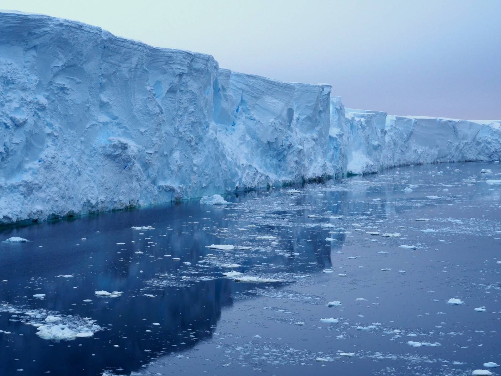
A line that turned out to be a zone
The study, led by Mattia Poinelli of the University of California, Irvine, with Eric Rignot — one of the most senior figures in ice-sheet science — among its co-authors, and collaborators at Dartmouth, UCLA and UC San Diego reported alongside the core UC Irvine and NASA Jet Propulsion Laboratory team, began with a deceptively simple question: what does the satellite record actually show at the place where Thwaites meets the sea? Using synthetic-aperture radar data from the ICEYE satellite constellation, which can measure the ice surface rising and falling by tiny amounts through polar night and cloud, the team watched the glacier's edge breathe. With each tide, the ice lifts. And where ice lifts, water can enter.
What they found is that the transition between grounded and floating ice is not a line but a zone — in the best-fitting simulations, four to six kilometres wide — across which the tides flex the ice and drive pressurised warm seawater underneath it, flushing in and out in a process the researchers describe as tidal pumping. Ice inside that zone looks grounded on a map. Much of the time it effectively is. But twice a day the ocean gets underneath it, and warm water against ice is the fastest melting arrangement nature offers. The zone is, in effect, a hidden margin of melt that the standard models — which treat the grounding line as a fixed, impermeable boundary — simply never counted.
"We have come to acknowledge a different arrangement beneath Earth's major ocean-terminating glaciers," Poinelli said, in comments carried by CNN. That sentence deserves a pause. It is not a claim about one glacier's weather. It is a claim about the architecture of every big glacier that ends in the ocean — that the boundary condition the whole modelling enterprise rests on was drawn in the wrong place, and drawn as the wrong kind of thing.
Why this matters
Start with the narrow point, because it is damning enough on its own. The team tested their idea the way modellers are supposed to: they ran the ISSM ice-sheet model against the satellite record of how Thwaites actually behaved between 1996 and 2023 — its speed, its thinning, and the migration of its grounding line — and asked which version of the glacier's underside could reproduce what the satellites saw. Only the versions with a broad, actively melting grounding zone could. In those runs, retreat and thinning were roughly four times more pronounced than in the runs that treated the boundary as a line. The past, in other words, already contains the new physics; the old models were not merely pessimistic or optimistic about the future, they could not retrodict the present.
Then widen the lens. If the zone-versus-line error is systematic — if marine-terminating glaciers generally sit on kilometres-wide tidal transition zones rather than knife-edge boundaries — then the same undercount is plausibly baked into projections for other glaciers in Antarctica and in Greenland, none of which have yet been re-run with the zone switched on. Nobody can yet say how large that collective correction is. But the direction of the correction is not in doubt, and it is the direction nobody wanted.
Finally, follow the numbers out of the journals and into the world. Coastal cities set sea-wall heights, drainage standards and zoning lines from projections. Insurers price flood policies from them. Bond markets, port authorities and military planners read them. All of that machinery has been running on figures that, for the single most consequential glacier on the planet, now appear to have been about half the defensible estimate. Rignot put the consequence plainly: the results "predict greater risk of and exposure to coastal flooding than anticipated in the coming decades." The decades in question are the ones in which today's mortgages, infrastructure bonds and thirty-year-old homebuyers will live most of their lives.
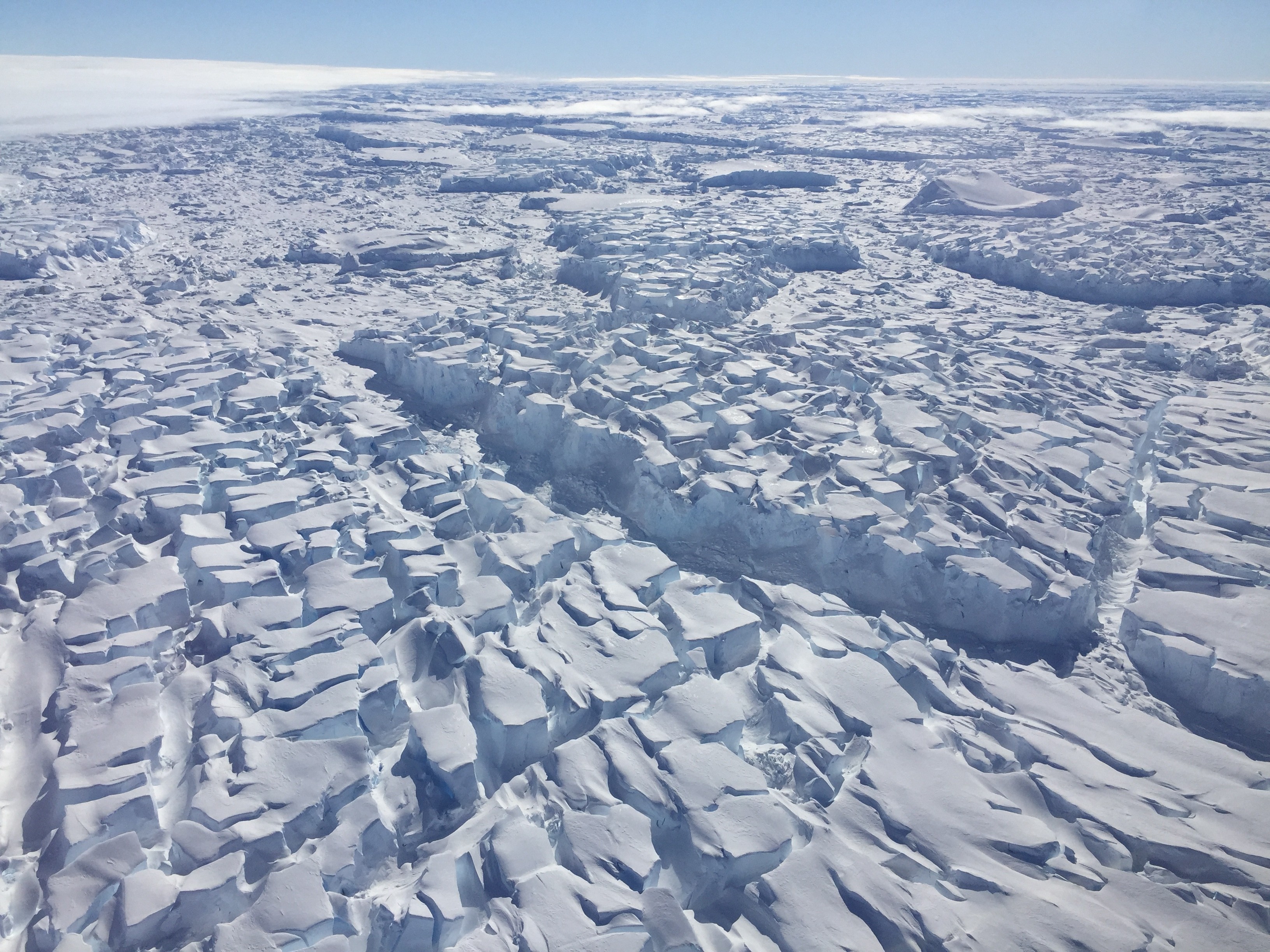
The glacier itself
Thwaites occupies about 192,000 square kilometres of the Walgreen Coast of Marie Byrd Land — roughly the size of Senegal, and larger than Florida — and it is only one outlet of the West Antarctic Ice Sheet, a reservoir some fourteen times its size. It was first mapped in 1947 and named for the American glaciologist Fredrik T. Thwaites, and for most of the twentieth century it was a remote, sluggish superlative: the widest glacier on Earth, in one of the least visited places on it. Its rapid melting has been tracked since the 1980s, and the tracking has never once produced a comforting trend. The glacier has lost more than 1,000 billion tonnes of ice since the year 2000, currently loses roughly 50 billion tonnes a year, and already accounts for about 4 percent of all the sea-level rise the planet experiences annually.
Its nickname — the "Doomsday Glacier" — is journalistic, not scientific, and many glaciologists dislike it. But the arithmetic behind the nickname is real. The ice Thwaites alone holds is equivalent to about 65 centimetres of global sea-level rise, and because of the shape of the bedrock beneath it — sloping downward inland, so that retreat feeds on itself — Thwaites also functions as a kind of plug for its neighbours. The full West Antarctic Ice Sheet holds about 3.3 metres. Nothing in the new study says that ice is coming out this century. Everything in it says the timetable for the first slices of it was misjudged.
The numbers, in context
The headline projection is 30.1 millimetres of global mean sea-level rise from Thwaites alone by 2100, with an uncertainty range of plus or minus 5.7 millimetres — about 1.2 inches, from one glacier, under a constant-climate scenario that assumes today's conditions simply persist. Compare that with the ISMIP6 ensemble, the international model-comparison project whose figures anchor most official planning: its average for Thwaites under comparable forcing was 15.2 millimetres. The new estimate is not a revision at the margins. It is a doubling, produced not by assuming a hotter world but by fixing the plumbing.
The sensitivity tests show how much of the answer lives in that one parameter. Shrink the grounding zone to one kilometre wide and the 2100 contribution falls to about 14 millimetres — essentially the old consensus. At three kilometres, it is about 19 millimetres. At the four-to-six-kilometre widths that matched the satellite record, it reaches the headline figure. The entire argument of the paper can be read off that ladder: the forecast was never mainly about the climate scenario. It was about a strip of ice a few kilometres wide that nobody had modelled as ocean.
And millimetres are not abstractions. Each centimetre of global sea-level rise exposes an estimated six million additional people to coastal flooding. The roughly fifteen extra millimetres this study adds for Thwaites — again, one glacier, no extra warming assumed — therefore translate, on that arithmetic, into flood exposure for millions of people who did not appear in the previous version of the future.
The ridge holding it back
Beneath the glacier's main trunk sits the feature on which much of the near-term story turns: the Mouginot Ridge, an undersea rise in the bedrock against which the ice is currently pinned, and which acts as a stabilising brake on retreat. In the best-matching simulations, the team found roughly a 60 percent chance that the trunk unpins from that ridge by 2100 — and in the widest-zone runs, the unpinning arrives as early as 2038. Unpinning would not be a collapse. It would be the removal of a brake: once the grounding zone steps back off the ridge into deeper bedrock, the geometry that slows retreat gives way to geometry that accelerates it, and the glacier begins drawing down the deeper ice behind the ridge at a faster rate.
That 2038 figure should be read carefully. It is the early edge of the widest-zone simulations, not a prediction with a date attached, and the study's own central finding — that the width of the zone is the master variable — means the honest statement is a range, not a year. But ranges have edges, and the near edge of this one falls within the planning horizon of infrastructure being designed right now.
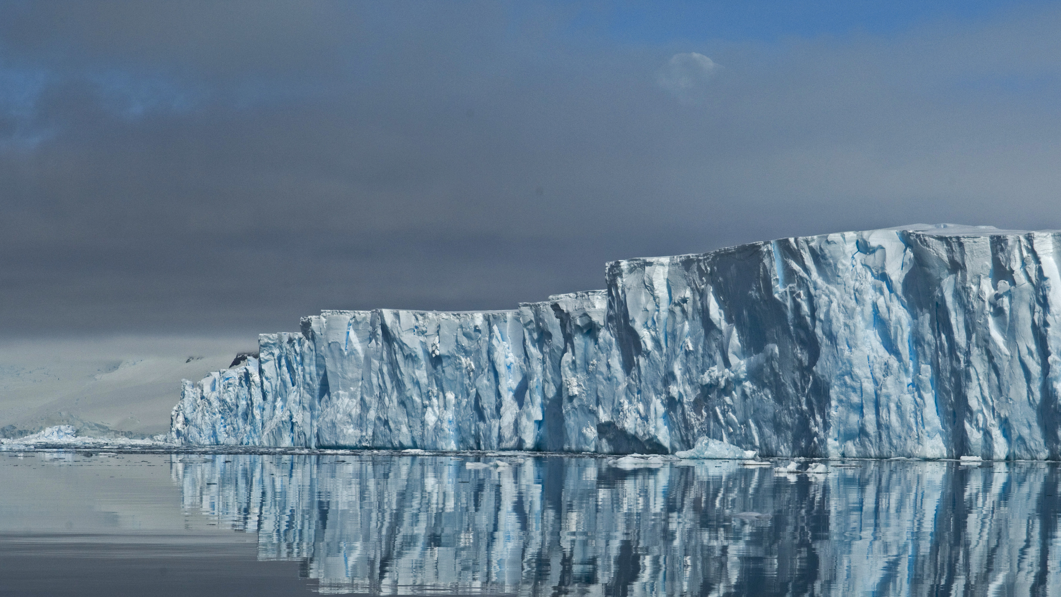
Who is exposed, and who pays
Sea-level rise is the most regressive of climate impacts, because the water does not read income statements. The first and worst exposure falls on low-lying coastal communities with the smallest protection budgets: delta populations, island states, subsiding port cities and the informal settlements that ring them, in rich countries as well as poor ones. Wealthy cities can, at a price, buy themselves decades — higher walls, bigger pumps, raised districts. The price is the point. Every upward revision of the forecast raises the cost of adaptation everywhere, while the places with the least fiscal room face the steepest relative bills and the earliest deadlines. The extra exposure implied by this study does not fall on the people who produced the emissions, in anything like proportion. It falls, as it always has, on the people who live closest to the water with the least money between them and it.
There is a second, quieter ledger: insurance. Flood risk is repriced annually, and private insurers retreat from markets where the numbers stop working long before the water actually arrives — through premiums, deductibles and quiet non-renewals. A doubling of a benchmark glacier's forecast does not stay inside glaciology. It propagates, within a few renewal cycles, into the cost of living anywhere the sea is close.
What cautious scientists say
The balance in this story is not decorative, and the study's own authors supply most of it. The paper does not predict a sudden collapse of Thwaites by 2100, and the International Thwaites Glacier Collaboration — the joint UK-US research programme that has studied the glacier most intensively — has judged complete collapse within the next few decades unlikely. Other experts quoted in coverage of the study have cautioned that more work is needed to pin down the volumes involved. Separate research, meanwhile, suggests the glacier's Eastern Ice Shelf could break up within the next two decades — a serious development, but a shelf event, not the loss of the glacier behind it.
The deepest caveat is methodological, and the authors state it themselves: the model prescribes the grounding-zone width rather than predicting it. The four-to-six-kilometre figure is the width that best reproduces the observed record — strong evidence, but an inference, not a measurement taken beneath the ice. Making the zone emerge dynamically from the physics, coupled to tides, ocean temperature and ice geometry, is the named next step, and until it is done the doubled figure carries the uncertainty its error bars advertise. Sceptics of the headline will also note, correctly, that a constant-climate scenario is a modelling device, not a forecast of the actual century. All of that is true. None of it restores the old number, which was produced by models that failed the retrodiction test the new ones passed.
A second study points the same way
One day after the Nature Communications paper appeared, a British Antarctic Survey-led study published in Geophysical Research Letters delivered a companion result from the opposite direction. Its team ran three ice-sheet models with ocean melting switched off entirely — an extreme, deliberately unrealistic cooling of the ocean's assault — for 150 simulated years. Neighbouring Pine Island Glacier, under that reprieve, thickened and recovered. Thwaites did not. It kept losing ice for the entire run, its decline slowing only as the glacier thinned. The implication is uncomfortable in a different register than the first study: some of Thwaites' future may already be committed by past warming, baked into its geometry, so that even an implausibly cooperative ocean would not stop the retreat — a finding that reframes the policy question from prevention alone to prevention plus preparation.
What happens next
The science now has a dated appointment with the ice. A field campaign planned for 2028 intends to place instruments beneath the grounding zone itself — the first direct measurements from inside the feature that this entire debate is about. Those instruments will either confirm the width the satellites imply or force another revision, and either outcome will be valuable. In parallel, the modelling groups will race to make grounding zones dynamic rather than prescribed, and to re-run the other great marine-terminating glaciers — in Antarctica and Greenland — with the zone switched on. Expect the next several years of sea-level projections to be a rolling series of upward nudges as that work lands, each one individually modest, collectively a different century than the one in the current planning documents.
For policy, the two October studies together argue against a false choice. The Nature Communications result — 30 millimetres assuming no additional warming — means emissions cuts still buy real safety, because a warmer ocean than today's would make every one of these numbers worse. The British Antarctic Survey result means cuts are no longer sufficient on their own: adaptation — defences, drainage, land-use decisions, honest insurance pricing — has to be planned alongside mitigation, funded as seriously, and aimed first at the low-lying communities with the least margin. The water, it turns out, was getting in underneath all along. The task now is to stop being surprised by it, in the models and on the coasts alike.
Related coverage: Island states win a UN declaration on sea-level rise and statehood · Climate change and the Himalayas' growing flood risk · Amazon deforestation falls to a record low — and why runoff is the next test
Sources
Poinelli, M., et al., Nature Communications, October 12, 2026 (grounding-zone discovery, ICEYE radar evidence, ISSM hindcasts 1996–2023, the 30.1 ± 5.7 mm projection and zone-width sensitivities, Mouginot Ridge unpinning probabilities; DOI 10.1038/s41467-026-77976-1); International Thwaites Glacier Collaboration (glacier scale, setting and imagery, and the collaboration's assessment that complete collapse within the next few decades is unlikely); Al Jazeera, October 17, 2026 (coverage carrying the findings and expert reaction to a wide audience); Gizmodo, October 2026 (reporting on the tidal-pumping mechanism and the doubled forecast); Interesting Engineering, October 2026 (reporting on the grounding-zone modelling and the 2100 figures); British Antarctic Survey coverage of the Geophysical Research Letters study, reported October 13, 2026 (ocean-melting-off simulations for Thwaites and Pine Island Glacier over 150 years); CNN (Poinelli's "different arrangement beneath Earth's major ocean-terminating glaciers" remark). Quotations are attributed to the scientists who made them; projections are model results under the scenarios stated in the article, not observations.