New Caledonia earthquake
A strong, shallow earthquake struck offshore New Caledonia on Friday, shaking the Loyalty Islands and setting the Pacific's tsunami-warning machinery in motion — and then, just as quickly, standing it down. The U.S. Geological Survey measured the quake at magnitude 6.6, with an origin time of 21:23 UTC on September 25: 2:23 p.m. Friday on the U.S. West Coast, 8:23 on Saturday morning in Noumea. Its epicenter lay 81 kilometers east-northeast of Tadine, the main town on Lifou island, at a depth of only 10 kilometers — shallow enough that the same quake beneath a city would have been a very different story.
Seven minutes after the origin time, the National Weather Service's Pacific Tsunami Warning Center in Honolulu issued its assessment: no tsunami threat. The USGS's automated impact estimator, PAGER, flashed green — the lowest of its four alert levels — projecting a low likelihood of casualties or economic damage, with maximum estimated shaking of intensity IV on the Modified Mercalli scale: light shaking, the kind that rattles windows and dishes. By late Friday Pacific time there were no reports of injuries, deaths, or damage — a silence that, in earthquake reporting, is the best possible outcome.
The ground was not finished. At 23:39 UTC — 4:39 p.m. Friday in California, 10:39 Saturday morning in Noumea — a magnitude 5.5 aftershock struck 61 kilometers east-northeast of Tadine, also at 10 kilometers depth. It too drew a green PAGER alert, and no tsunami threat was issued.
What we know so far
The first wire reports carried a bigger number. Reuters, citing the USGS, initially reported a magnitude 7.0 earthquake off Tadine — the kind of figure that triggers tsunami bulletins and newsroom scrambles across the Pacific. Seismologists then did what they always do with fast early estimates: they refined it. The USGS revised the magnitude down to 6.6, and the European-Mediterranean Seismological Centre independently confirmed 6.6 at 10 kilometers depth. For the record, the downgrade matters less than the discipline behind it — more on that below.
The geography is precise. The USGS placed the epicenter 81 kilometers east-northeast of Tadine (listed population 7,492), 146 kilometers east-southeast of We (10,375), 237 kilometers east-northeast of Mont-Dore, 242 kilometers east-northeast of Dumbea, and 248 kilometers east-northeast of Noumea (93,060). In other words: open ocean, with the nearest town a full 80 kilometers away. The aftershock sequence began quickly — the magnitude 5.5 event at 23:39 UTC sat 61 kilometers east-northeast of Tadine, closer in but smaller, and likewise generated no tsunami threat.
Why this matters
Strip away the jargon and this is a story about a margin — 81 kilometers of ocean between a genuinely dangerous earthquake and a catastrophe. A magnitude 6.6 at 10 kilometers depth is not a curiosity; it is a large earthquake, the kind that cracks masonry, topples chimneys, and kills people when it happens under a city. The only reason Friday's quake is a news story rather than a disaster story is where it happened: in the sea, far from anyone's bedroom wall.
That is exactly why it deserves attention rather than a shrug. The Loyalty Islands sit on one of the most restless stretches of the Pacific Ring of Fire, and the same patch of ocean produced a magnitude 7.7 earthquake in February 2021 — an event that did trigger tsunami warnings across the region before they were cancelled, with no damage in the end. Every one of these episodes is a live-fire exercise for the warning chain: the seismometers, the Pacific Tsunami Warning Center's analysts, the civil-defense channels in Noumea, and the news wires that must decide what to tell the public in the first chaotic hour.
This time the chain worked. Detection was fast, the all-clear came in seven minutes, and no one was hurt. But the first hour also carried a familiar hazard of its own: the initial magnitude 7.0 report traveled the world before the correction did. In an age when screenshots outrun seismology, how quickly and honestly agencies revise their numbers is part of the story — and this time, they did it right.
How we got here
New Caledonia exists because of plate tectonics, and it shakes because of it. The archipelago sits near the boundary where the Australian and Pacific plates grind against each other, part of the horseshoe of trenches, volcanic arcs, and fault systems known as the Ring of Fire. The Loyalty Islands — Lifou, Mare, and Ouvea — ride the eastern edge of this restless zone, and they have a long, well-documented history of strong offshore earthquakes.
The most recent reminder came in February 2021, when a magnitude 7.7 earthquake struck off New Caledonia. Tsunami warnings went out; coastal communities across the region braced; and then the warnings were cancelled with no significant damage. Friday's magnitude 6.6 belongs to the same family — same tectonic neighborhood, same shallow depth, same offshore geometry — but at roughly one-forty-fifth the energy. Understanding the family helps explain why the official response this time was calm rather than alarming.
Why the first reports said 7.0
Earthquake magnitudes are not measured like temperature. The first number comes from the first seismic waves to reach the nearest stations — a fast, rough estimate computed in minutes so that tsunami centers and emergency managers have something to work with. As waves arrive at more distant stations and analysts fold in more data, the estimate sharpens, and it often moves. A revision from 7.0 to 6.6 is utterly routine; it is the system working as designed, not evidence that anyone got it wrong.
The difference is not trivial, though. Magnitude is logarithmic: a 7.0 releases about four times the energy of a 6.6. That is why tsunami warning centers would rather act on a fast, slightly high estimate and stand down than wait for precision while a wave — if one existed — is already traveling. Friday's sequence shows both sides of that bargain: the wires briefly carried the scarier number, and the correction followed within the hour.
What a green alert really means
The USGS's PAGER system — Prompt Assessment of Global Earthquakes for Response — is an automated model that combines shaking estimates with population exposure to forecast casualties and economic losses. It issues four colors: green, yellow, orange, red. Green, which Friday's quake earned, means a low likelihood of either. The model's maximum estimated shaking was intensity IV on the Modified Mercalli scale — "light" shaking, felt indoors by many, with dishes and windows rattling, comparable to the vibration of a heavy truck passing.
Two caveats matter. First, PAGER is a probability, not a damage survey; it cannot see a cracked wall in Tadine. Ground truth comes from French civil-protection authorities and the High Commission in Noumea, and as of publication they had reported no damage. Second, green is a statement about odds across the exposed population — most of whom, in this case, were tens of kilometers of ocean away from the epicenter.
For context on what happens when the color is not green — and when the economics of recovery take over — see our coverage of the World Bank's $400 million earthquake-recovery commitment to Colombia.
Who felt it: Tadine, We, and Noumea
Tadine, the administrative center of Lifou, was the closest community of any size: 81 kilometers from the epicenter, home to roughly 7,500 people per the USGS's listed figures. At that distance, residents likely felt the light rolling of intensity IV shaking — noticeable, briefly unnerving, but well below the threshold of structural damage. We, on the same island chain, sat 146 kilometers away.
Noumea, the capital, was 248 kilometers distant — far enough that many residents may have felt nothing at all, or a faint sway high in a building. That distance gradient is the quiet hero of this story: shaking energy dissipates with distance, and every additional dozen kilometers of ocean between the fault and a foundation is protection no engineering can buy.
The economy under the shaking
New Caledonia's economy rests on what lies beneath it — literally. The territory holds some of the world's largest nickel reserves, and mining is the backbone of its economy and its politics. A major earthquake near the mines or the industrial zones around Noumea would not just be a human disaster; it would be a global commodities story, with nickel prices twitching on every aftershock. Friday's epicenter, far offshore in the Loyalty Islands, was nowhere near the mining heartland — but the episode is a reminder of concentration risk in a place where one industry underwrites so much.
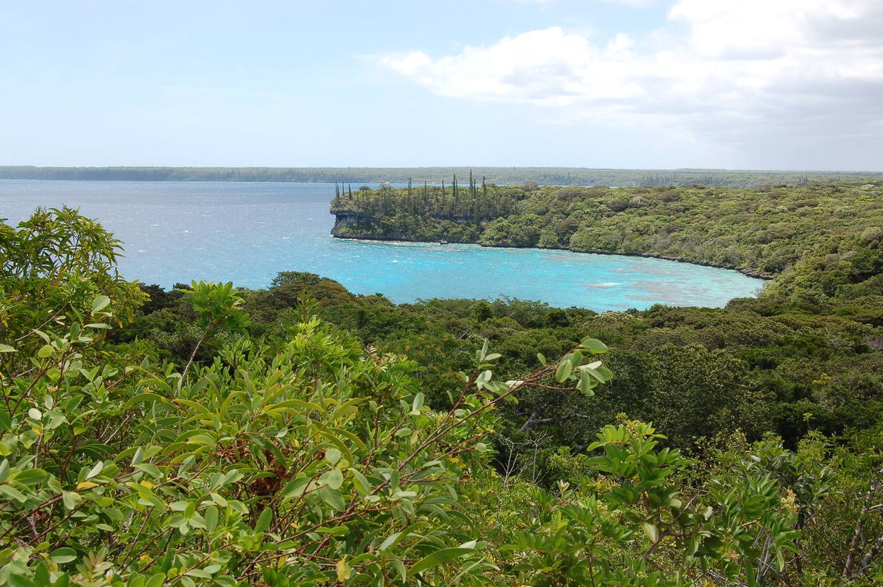
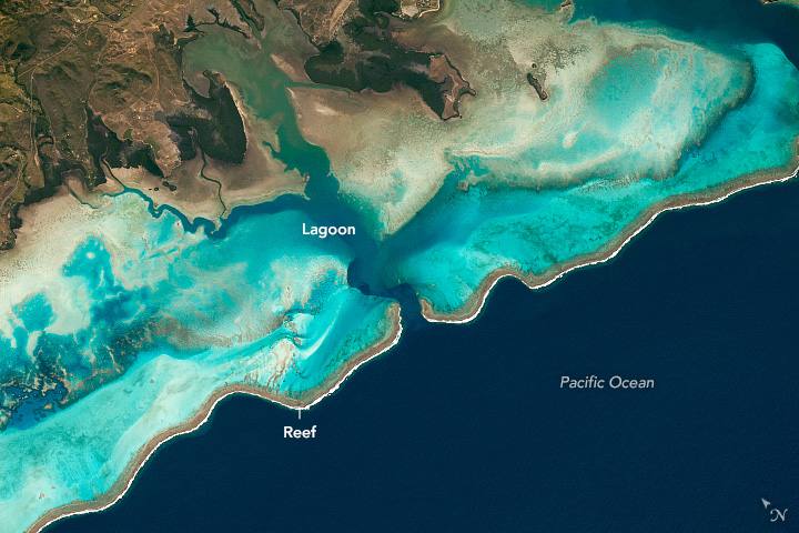
The sea itself is the other economy. Noumea is the territory's port, the lagoon enclosed by one of the world's great barrier reef systems draws divers and scientists, and Lifou — whose Santal Bay appears in our lead image — is a regular stop for Pacific cruise ships. An offshore epicenter in these waters is, among other things, a tourism story that didn't happen: no evacuations of beach resorts, no cruise itineraries rewritten, no reef damage reported.
The numbers, in context
Put Friday's quake beside its 2021 predecessor and the scale of the Pacific becomes visceral. The February 2021 magnitude 7.7 released roughly 45 times the energy of Friday's 6.6 — the difference between an event that triggers region-wide tsunami warnings and one that earns a seven-minute all-clear. Both were shallow; both were offshore; the difference was raw power and geometry.
Depth deserves its own note. Ten kilometers is shallow — the same magnitude at 100 kilometers down would be felt far less strongly at the surface, while a shallow 6.6 concentrates its energy where people live. That Friday's shallow quake still produced only light shaking is entirely a function of the 81 kilometers of ocean between the rupture and Tadine. Distance did the work that depth could not.
And the revision from 7.0 to 6.6, worth one more look: that 0.4 of magnitude represents roughly a fourfold difference in released energy. When the first number flashed across the wires, it described an earthquake four times more powerful than the one that actually happened. The correction was not a footnote; it was the story getting four times less dangerous in real time.
What happens next
The aftershock sequence has already begun — the magnitude 5.5 event just over two hours after the mainshock is textbook. Expect more: aftershocks typically decay in frequency over days and weeks, mostly in the magnitude 4 range, each one smaller and less widely felt than the last. There is always a small chance of a larger aftershock, which is why seismologists watch these sequences rather than declaring them over.
The tsunami posture is straightforward: the Pacific Tsunami Warning Center assessed no threat, and none has been issued for the aftershock either. The standing advice for anyone on these coasts remains what it always is — if shaking is strong and you are near the shore, move to high ground immediately and do not wait for an official bulletin. Bulletins are fast, but self-evacuation is faster.
The USGS and EMSC may refine the quake's parameters slightly in the coming days as more data arrives; that is normal. What will not change is the bottom line of September 25, 2026: a strong earthquake struck one of the Pacific's most active zones, the warning machinery did its job in minutes, the numbers were corrected honestly, and — by the grace of 81 kilometers of ocean — no one was hurt. In a week that has also seen a Category 5 hurricane bearing down on Mexico's Pacific coast, it is a reminder that the Pacific does not do quiet weeks — but sometimes, it does merciful ones.
Sources
- Reuters: "Earthquake of magnitude 7 strikes Tadine, New Caledonia region, USGS reports," September 25, 2026
- SRN News (Reuters): "Earthquake of magnitude 7 strikes Tadine, New Caledonia region, USGS reports" — with the downgrade to magnitude 6.6 and no tsunami threat, September 25, 2026
- The Watchers: "Strong and shallow M6.6 earthquake hits Loyalty Islands, New Caledonia," September 25, 2026
- watchers.live: "Shallow M5.5 earthquake hits offshore New Caledonia," September 26, 2026
- U.S. Geological Survey; European-Mediterranean Seismological Centre; NWS Pacific Tsunami Warning Center (official sources)
Reporting basis: magnitude, depth, location, origin times, PAGER green alert, and tsunami assessment are attributed to the USGS, EMSC, and the Pacific Tsunami Warning Center as reported by Reuters, SRN News, The Watchers, and watchers.live on September 25–26, 2026. Analysis and interpretation are Signal Post News's own. No damage or casualty reports had been issued as of publication.