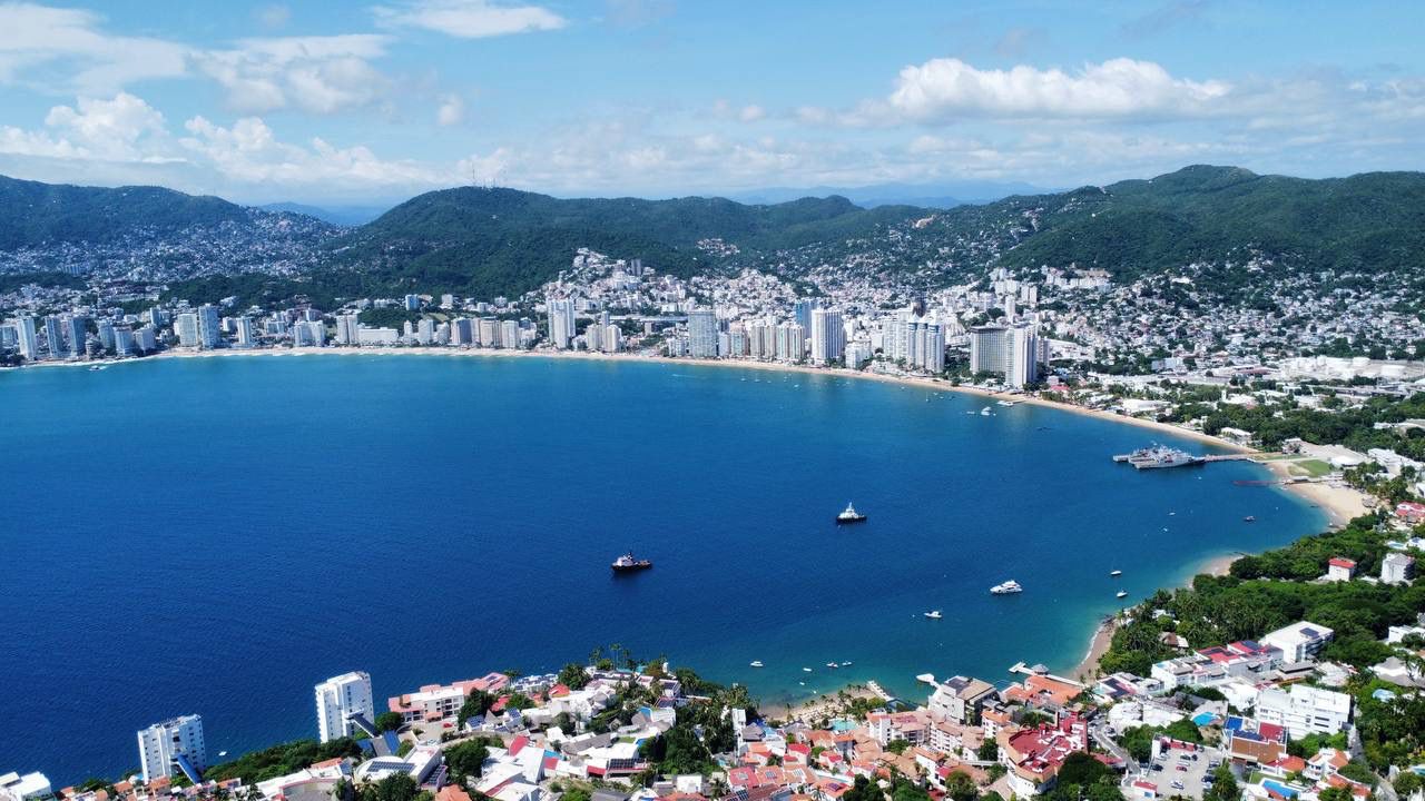
Hurricane Polo Category 5 status arrived with startling speed off Mexico’s southwestern coast on Tuesday, September 22. In the space of 24 hours, Polo jumped from a 50 mph tropical storm on Monday morning to a 160 mph Category 5 hurricane on Tuesday morning. The National Hurricane Center called the 110 mph increase “truly remarkable,” placing it among the fastest intensification episodes recorded in the Eastern Pacific.
The storm strengthened again Tuesday afternoon, reaching maximum sustained winds of 180 mph and a central pressure of 892 hPa. That wind speed tied two western Pacific super typhoons as the strongest storms on Earth so far in 2026. By Wednesday morning Polo had weakened slightly to a strong Category 4 with 155 mph winds, but the downgrade did not remove the danger. The latest forecast kept its hurricane-force core offshore while outer rainbands began affecting southwestern Mexico.
Polo’s expected path runs northwestward, roughly parallel to the coast, through the end of the week. That is the central piece of cautiously encouraging news in the latest Hurricane Polo update: the most destructive winds are forecast to remain over water. The central piece of bad news is that a near-shore track does not have to make landfall to produce lethal rain. Guerrero and Michoacán face life-threatening flooding and mudslides, and tropical-storm conditions were expected along parts of the coast Wednesday.
Hurricane Polo path tracker: offshore does not mean harmless
On Tuesday, Polo was reported about 220 miles, or 355 kilometers, south of Zihuatanejo and about 360 miles south-southeast of Manzanillo. The circulation was moving slowly before the forecast northwestward turn. A slow storm near a steep, populated coast creates a risk profile very different from a direct strike by the eye. Wind damage may be limited if the forecast holds, but bands of moisture can repeatedly move over the same terrain.
The current Hurricane Polo path tracker therefore has to be read in two layers. The first is the center line: dangerous hurricane-force winds are expected to stay offshore. The second is the impact field: rain, rough seas and tropical-storm conditions extend beyond the eye. Forecast tracks also contain uncertainty, and the National Hurricane Center has warned that it is too soon to determine the exact location and magnitude of all impacts.
Warnings covered the coast from Tecpan de Galeana in Guerrero to Punta San Telmo in Michoacán. Mexican civil-protection authorities told residents not to walk or drive through flooded streets and to remove beach furniture and equipment. Acapulco’s port closed to small vessels, including fishing boats, tourist excursions and yachts. Coastal classes were suspended in Guerrero and Michoacán.
The scale of preparation signals what officials fear even without a landfall. CONAGUA readied 21 emergency-care centers, 717 brigade units and 865 disaster-management teams. Temporary shelters with capacity for 200 people opened in Zihuatanejo. Heavy rain there had already caused flooding and property damage, including at least five flooded vehicles. No deaths had been reported at the time of publication.
Why Polo matters beyond this week
Polo is not only a dangerous storm near Mexico. It is a marker of an exceptional basin-wide season. It became the third Category 5 hurricane of the 2026 Eastern Pacific season, after Genevieve and Lowell. Reaching three by September 22 tied the 1994 record set by Emilia, Gilma and John.
That 2026 Pacific hurricane season record does not mean each storm had the same track, size or consequence. The Saffir-Simpson scale is based on maximum sustained wind and does not measure rainfall, storm surge, geographic reach or vulnerability. A compact Category 5 far offshore can be less destructive than a weaker, rain-heavy storm crossing densely settled mountains. Even so, three storms reaching the top category this early is an unmistakable signal of how much high-end intensity the basin has produced.
Polo also matters because the speed of its transformation compressed the decision window. At 50 mph, a tropical storm can appear manageable at a distance. One day later, a 160 mph hurricane represents an entirely different emergency. Port managers, fishing crews, schools, hotels, transport operators and local governments do not receive extra time simply because the atmospheric process is unusual. Rapid intensification turns forecast uncertainty into an operational hazard.
That is why Hurricane Polo rapid intensification belongs in the same policy conversation as warning systems and evacuation planning. Forecasting has improved, but a forecast only reduces harm if the warning reaches people, is trusted and can be acted on. A family without a vehicle, a fisher whose boat is the household’s main asset, or a worker who loses wages by leaving early experiences the same warning differently from a well-resourced visitor or business.
The numbers in context: 892 hPa and 110 mph in 24 hours
Polo’s 892 hPa central pressure made it the second-lowest-pressure Eastern Pacific hurricane in the record cited by forecasters, behind Hurricane Patricia’s 872 hPa in 2015. Lower pressure generally indicates a more intense cyclone, but pressure and maximum wind are not interchangeable. Storm structure, the size of the eye and the distribution of winds all influence how a pressure reading translates into hazards.
The 24-hour wind increase is equally striking. Polo gained 110 mph, from 50 to 160 mph. Patricia gained 120 mph in 24 hours in 2015, the basin benchmark. Hurricane Otis gained 105 mph in 21 hours before striking Acapulco in 2023. Polo sits between those historic comparisons depending on whether the measure is total wind increase, elapsed time or peak intensity.
These comparisons are useful because they show the scale of the atmospheric change, not because they predict identical outcomes. Patricia’s 872 hPa pressure does not mean Polo will follow Patricia’s path. Otis’s 105 mph surge does not mean Polo will repeat Otis’s landfall. The numbers establish that Polo entered a rare intensity class; the forecast track and rainfall pattern determine how that power meets people.
Hurricane Polo vs Hurricane Otis: the comparison Acapulco cannot avoid
The phrase Hurricane Polo vs Hurricane Otis is emotionally loaded along Mexico’s Pacific coast. Otis intensified almost without precedent before devastating Acapulco in 2023. Polo intensified even more in a 24-hour comparison, but the latest forecast places its core offshore. That difference is crucial. A direct passage of the eyewall over the city is not the current forecast and is considered very unlikely under the projected track.
Yet Otis remains relevant because it exposed Acapulco’s vulnerability. Hotels, housing, transport, communications and the informal economy all depend on the same coastal systems. A city still shaped by that disaster does not experience a new Category 5 offshore as an abstract meteorological event. Port closures, class suspensions and shelter preparation are rational responses to both the current forecast and recent institutional memory.
The appropriate comparison is therefore about preparedness and speed, not a prediction of repeated devastation. Polo demonstrates again that Eastern Pacific storms can move through intensity categories faster than public expectations. Otis demonstrated what happens when extreme intensification and urban exposure converge. The lesson is to act on rain and wind warnings while preserving the distinction between a possible impact and a forecast landfall.
Super El Niño is part of the background—not a complete explanation
The 2026 Eastern Pacific has been influenced by a record-strong El Niño, which favors unusually warm water and atmospheric patterns supportive of Pacific tropical cyclones. Polo intensified over very warm ocean water in a favorable environment. Warm water supplies heat and moisture; limited disruptive wind shear allows a storm’s circulation to remain vertically organized. Those are direct physical ingredients for intensification.
Climate change loads the background conditions by warming the ocean and atmosphere. A warmer ocean can provide more energy, and a warmer atmosphere can hold more water vapor, increasing the potential for heavy rainfall. Observational reporting has also documented more hurricanes rapidly intensifying as oceans warm. Those facts make Polo part of a serious climate-risk discussion.
But a single storm is not a controlled experiment. It is not scientifically sound to say climate change alone “caused” Polo or to assign its 180 mph peak to one factor without a dedicated attribution study. El Niño is a natural recurring pattern occurring on top of long-term human-driven warming; internal variability, storm-scale structure and short-term atmospheric conditions also matter. The careful conclusion is that the background environment favored extreme intensification and that warming raises the risk context—not that one storm proves every broader claim.
That distinction echoes our reporting on California’s El Niño emergency preparations. A powerful Pacific signal changes probabilities and planning needs; it does not provide a deterministic track for any one storm. Sound policy must prepare for the elevated downside without pretending uncertainty has disappeared.
Hurricane Polo flooding: Guerrero and Michoacán bear the main risk
The most serious supported onshore threat is rain-driven flooding and mudslides. Guerrero and Michoacán combine exposed coastal settlements with steep terrain where intense rainfall can move quickly into streets, rivers and unstable slopes. Water can isolate communities, block emergency access and damage homes even if the highest winds never reach land.
The phrase Hurricane Polo flooding Guerrero Michoacán captures a distributional problem as much as a weather forecast. Low-income coastal households often have fewer savings, less insurance, weaker construction and less flexibility to leave work or relocate. Damage to a vehicle may remove a family’s transport and income at once. A flooded ground-floor home can destroy documents, medicine, tools and school materials that conventional property totals fail to capture.
The same applies to a Zihuatanejo hurricane threat. Shelters can protect life, but they do not eliminate the costs of evacuation or the danger of returning to water-damaged homes. Advice not to drive through floods is critical because water depth and current are difficult to judge. It also assumes people receive the warning in time and have a safe alternative route or place to stay.
For emergency planners, the trade-off is clear. Keeping ports and schools open preserves income and routine in the short term, but closing them early reduces exposure when conditions can worsen quickly. The offshore forecast makes those decisions harder, not easier: officials must weigh visible disruption against an impact whose exact location remains uncertain.
Who loses if the rain persists
Coastal households face the most immediate risk, especially renters, informal workers and families in flood-prone or hillside neighborhoods. Wind is only one pathway to loss. Water damage, road closures, lost work and interrupted schooling can extend well beyond the storm’s closest approach.
Acapulco’s tourism economy faces cancellations and another confidence shock. The closure of the port to small vessels directly affects excursion operators, crews and waterfront businesses. Hotels may avoid major structural damage if the wind core stays offshore, but bookings, transport and beach operations can still be disrupted. No credible loss estimate was available, and assigning one before impacts are measured would be speculation.
Fisheries lose access to the water precisely when many crews depend on daily activity. Pulling boats ashore protects lives and equipment, yet every closed day means foregone income. Smaller operators have less ability to spread risk across locations or seasons. Rough seas may also delay the return even after skies improve.
Insurers and public agencies could face claims and repair costs from flooding, vehicles and property damage. The distribution will depend on coverage. Households without insurance may absorb losses directly or rely on limited public aid, while insured losses become a test of claims capacity and policy exclusions. Again, the absence of a reliable estimate is itself important: exposure is clear, but the final bill depends on where the rain falls and how long it lasts.
Benefits and trade-offs—without pretending a Category 5 is good news
There is no meaningful “winner” from a 180 mph hurricane near populated coasts. The most supportable benefit is operational: an offshore parallel track can spare communities the catastrophic wind damage associated with a direct eyewall strike and gives officials time to stage teams, open shelters and close exposed operations. That is risk avoided, not a gain created by the storm.
Rain can sometimes support water supplies, but Polo’s confirmed threat is dangerous flooding and mudslides. Without verified reservoir, drought or rainfall-distribution data, claims of agricultural or water-system benefits would be premature. The same caution applies to surf or tourism narratives: rough seas that attract attention also endanger swimmers, crews and coastal infrastructure.
Three scenarios from here
Best case: the parallel offshore track holds. Polo continues northwestward with its hurricane-force core over water, weakens gradually and delivers only limited wind damage on land. Rain still causes localized flooding, but warnings, closures and staged response teams keep losses contained. Evidence for this scenario would include a sustained offshore motion, shrinking wind field and rainbands moving through rather than stalling.
Main risk: flooding and mudslides become the defining impact. The center never crosses the coast, yet repeated heavy rain overwhelms drainage, floods roads and destabilizes slopes in Guerrero and Michoacán. This is the most serious threat supported by the forecast. The operational indicators are not the hurricane category alone but rainband persistence, local river and street flooding, slope failures and access to vulnerable communities.
Very unlikely but high consequence: the track shifts toward Acapulco. A direct Acapulco landfall is not the current forecast. If the track were to change materially, the consequences would escalate sharply because extreme wind would join the existing flood threat in a city with recent hurricane damage. This should be treated as a conditional planning case, not a prediction. Repeating it without that qualification would confuse preparedness with alarmism.
Forecast confidence should be updated through official advisories rather than a static social-media map. The National Hurricane Center’s archive shows the evolution from Polo’s Tuesday Category 5 peak to Wednesday’s slightly weaker—but still extremely dangerous—storm. Local instructions from Mexican authorities determine what residents should do in each community.
What Polo says about the new warning problem
The deepest lesson is not that every fast-strengthening storm will strike a city. It is that the time between “watch” and “historic intensity” can be shorter than the time institutions need to move people and assets. A 110 mph increase in a day makes preparedness a standing capacity rather than a last-minute reaction.
Japan’s response to another Pacific storm offers a useful comparison. Our report on Typhoon Dujuan evacuations examined how warnings, transport systems and public trust determine whether a forecast becomes protective action. Mexico’s geography and resources differ, but the principle is the same: forecasts save lives only when institutions can translate them into closures, shelters, transport and credible local communication.
Polo’s category may fall as the week continues, yet the public-risk clock does not move neatly with the wind scale. Saturated soil can fail after peak winds have passed. Flooded roads can remain dangerous under clearer skies. Port and school reopenings must therefore depend on local conditions, not the visual impression that the storm is farther away.
Reporting basis: what is confirmed and what remains uncertain
Confirmed: Polo reached Category 5 on Tuesday, intensified by 110 mph in 24 hours, peaked at 180 mph and 892 hPa, and weakened to 155 mph by Wednesday morning. It became the season’s third Category 5. Warnings, school suspensions, port restrictions, shelters and emergency deployments were in place, and flooding and property damage had been reported in Zihuatanejo. No deaths had been reported.
Developing: the precise distribution and duration of rainfall, the extent of flooding and property damage, and Polo’s exact offshore path through the end of the week. Forecasts change as aircraft, satellite and surface observations arrive. This article therefore separates the latest official track from conditional scenarios.
Signal Post News analysis: the discussion of unequal household exposure, tourism, fisheries, insurance, warning capacity and climate attribution draws implications from the confirmed facts without assigning unverified losses or claiming a direct climate cause for this single storm.
Sources and reporting basis: National Hurricane Center advisory archive; NHC Wednesday advisory; CNN weather reporting syndicated by KION; Associated Press reporting; and EarthSky storm analysis. Reuters reporting was used to cross-check location, track and flood-risk language. Conditions remain developing; readers should rely on official local instructions.