tropical storm southern california
Weather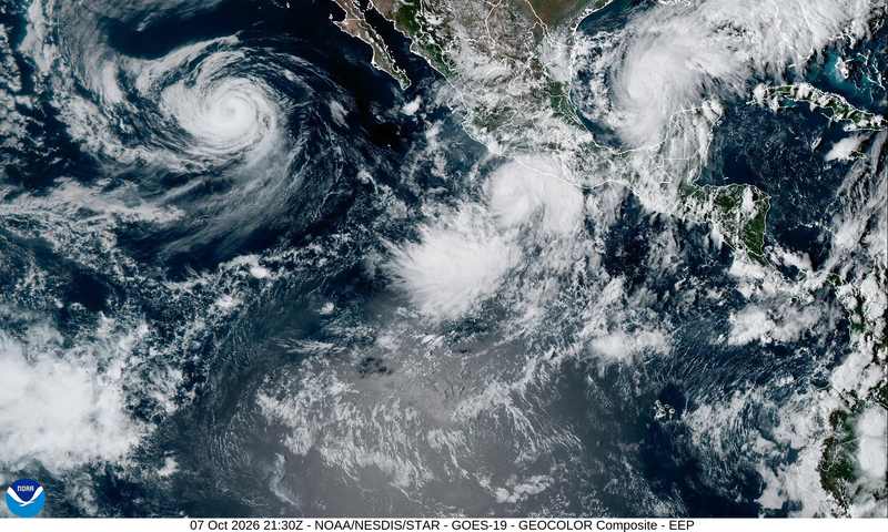
The tropical storm Southern California is watching began Wednesday as Tropical Depression Twenty-E, a 35-mph system spinning off southern Mexico. The National Hurricane Center placed its center about 285 miles south-southeast of Lázaro Cárdenas and about 405 miles southeast of Manzanillo. The official forecast takes the depression northward, close to Mexico's coast and toward the southern end of Baja California, with steady strengthening and hurricane intensity expected by October 9.
That is not the same thing as a hurricane forecast for a U.S. landfall. No hurricane or tropical storm watches have been issued for the U.S. coast, and the northward path that has Southern California's attention remains a model scenario rather than an official U.S. landfall forecast. But dismissing the setup would also be a mistake. The ocean is unusually warm, upper-level winds are weak, and the region is already receiving hazardous surf from a separate hurricane.
Why this matters
October tropical systems aimed toward California are rare enough that forecasters have little room for casual assumptions. Most eastern Pacific cyclones turn west over open water or run into Mexico. Twenty-E is being steered north by a ridge over Mexico, bringing the Baja California hurricane track into focus and raising the possibility that moisture, wind and surf reach farther north.
The larger setup is historically unusual because California is being pressed from three directions at once. Offshore, a tropical depression sits over water capable of supporting rapid strengthening. On land, a southern California heat wave has broken long-standing October records. Across the tropical Pacific, the El Niño 3.4 region has reached an average daily ocean temperature of 86°F, or 30°C, with anomalies reported above every previous El Niño on record.
Those ingredients do not mechanically guarantee a California storm. They do mean that the normal late-season escape routes — cooler water, stronger shear and a quick westward turn — cannot be taken for granted. The central question is not whether Southern California is about to take a direct hurricane hit; current official guidance does not say that. It is how much tropical energy survives the trip north, and how it interacts with an already overheated coast.
What the forecast actually says
The National Hurricane Center's October 7 position report put Tropical Depression Twenty-E about 285 miles south-southeast of Lázaro Cárdenas and about 405 miles southeast of Manzanillo, with sustained winds of 35 mph. Its forecast calls for a northward motion skirting close to Mexico's coast rather than an immediate turn out to sea.
Senior hurricane specialist Richard Pasch said the environment favors steady strengthening: low wind shear, abundant atmospheric moisture and very warm sea-surface temperatures. The NHC expects the system to become a hurricane by October 9. Its Tropical Weather Discussion adds important mechanics: Twenty-E is moving over water near 29°C, with weak upper-level winds and little vertical shear, and is likely to strengthen into a tropical storm on Friday.
National Hurricane Center Twenty-E track: Mexico first, Baja next
A ridge of high pressure over Mexico is expected to steer the depression northward. That makes the official near-term concern the Mexican coast and the southern tip of Baja California. The hurricane forecast California residents are seeing in model maps must be read more carefully: the official track points toward Mexico and Baja, not a confirmed U.S. landfall.
SoCal coastal flooding is a model risk, not a watch
Daniel Swain, a climate scientist with the University of California Agriculture and Natural Resources, said on October 7 that some weather models show a fairly strong low-pressure system capable of generating strong onshore winds and more significant coastal flooding for Southern California. That scenario deserves attention because onshore wind can push elevated water and large surf toward beaches and low-lying coastal neighborhoods. It remains a scenario. No U.S. tropical storm or hurricane watch has been issued.

Hurricane Rachel swells are the immediate coastal hazard
A second system is already shaping conditions. Hurricane Rachel, with 75-knot winds and centered near 20.5°N, 119.5°W, is sending swells into the Baja California peninsula and parts of southern California. The NHC warns that life-threatening surf and rip-current conditions can persist for the next several days. That is the actionable coastal risk now, independent of whether Twenty-E follows the more northerly model solutions later.
Southern California's record October heat: the setup
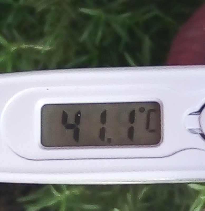
October 6 produced a startling set of all-time maximum highs. Escondido reached 105°F, breaking a 99°F record associated with both 1953 and 1893. Vista hit 101°F against an old record of 99°F from 1971 and 1957. Ramona reached 101°F, topping a 99°F benchmark from 2024 and 1974. Anaheim reached 100°F, above the 99°F mark from 2005 and 1989.
A 105°F reading in Escondido in October is not normal weather noise; it cleared a record that had endured across generations. The California October heat records matter to the tropical forecast because they leave the coastal atmosphere and landscape primed for abrupt changes in humidity, wind and rainfall. Heat also complicates fire response, as shown in our coverage of the Bouquet Fire during Southern California's heat wave.
The strongest El Niño on record is loading the dice
The El Niño 2026 record is not a slogan attached to a warm week. The University of Maine Climate Reanalyzer put the average daily ocean temperature in the El Niño 3.4 region at 86°F, or 30°C, this week. Zeke Hausfather of Berkeley Earth said the water-temperature anomalies are warmer than during any previous El Niño on record, above both 2015 and 1877.
El Niño means unusually warm water across the central and eastern tropical Pacific. For late-season eastern Pacific hurricanes, warm water is fuel: it supports deep convection and helps a developing circulation strengthen when moisture is abundant and wind shear is light. That is precisely the environment NHC specialists describe around Twenty-E.
El Niño also changes the broader atmospheric pattern that directs tropical moisture. It can make northward transport more plausible, but it does not dictate the route of a single storm. A ridge, a trough, land interaction and upper-level winds still decide what Twenty-E actually does. The responsible inference is that the ocean has loaded the dice toward a more energetic eastern Pacific, not that it has fixed the outcome for Southern California.
Who wins, who loses
Surfers gain spectacle — and inherit the danger
Hurricane Rachel swells can produce the kind of powerful, organized surf experienced surfers pursue. The same energy produces rip currents and shore break capable of overwhelming swimmers and damaging beach infrastructure. “Epic” waves and life-threatening conditions can exist at the same time; the NHC warning should set the boundary for anyone tempted by the spectacle.
Coastal homeowners and beach cities face the downside
If strong onshore wind arrives on top of large swell, coastal homeowners and beach cities face erosion, overtopping and flooding. The Swain scenario would place the burden on low-lying neighborhoods, lifeguard services, road crews and local emergency managers. Even without a direct tropical landfall, water driven shoreward can become the event that matters most.
Rain would help water supply but punish burn scars
Water managers could welcome meaningful rain after fire season and extreme heat. The other side of that benefit is the response of recently burned terrain: hard, damaged slopes shed water quickly, creating mudslide and debris-flow risk. The same rainfall total can be useful over a reservoir watershed and dangerous over a burn scar.
The preparedness debate therefore needs a middle lane. Panic is unjustified because the official forecast does not show a U.S. hurricane landfall and no U.S. watches are in force. Shrugging is equally weak because dangerous Rachel surf is already forecast and Twenty-E's environment favors strengthening. The proportionate response is to follow official advisories, respect surf restrictions and use the next forecast cycles to narrow the range of outcomes.
What happens next: three scenarios
Scenario one: the official Baja California hurricane track holds
Twenty-E follows the official track close to Mexico and toward southern Baja California. Southern California receives fringe moisture, higher humidity and additional surf, but the core remains south. This is the scenario most closely aligned with the published NHC track described on October 7.
Scenario two: the northward push strengthens
A stronger low-pressure system turns farther north and produces the onshore-wind pattern Swain highlighted. In that case, SoCal coastal flooding and erosion become more significant even if the tropical core never reaches the U.S. coast. The key would be the pressure gradient and wind direction, not simply the storm's label on a map.
Scenario three: shear or land interaction weakens it early
The depression moves too close to Mexico or encounters less favorable upper-level winds, interrupting the strengthening cycle. A weaker system could still send moisture north, but the wind and coastal-flooding threat would diminish. This remains a plausible counterweight to the warmer-water signal.
The checkpoints are straightforward: whether the system reaches tropical-storm strength on Friday, whether the NHC still expects hurricane intensity by October 9, whether the track shifts closer to or farther from Baja California, and whether any watches or warnings expand. For Southern California, the most important local indicators will be forecast onshore wind, surf timing and any coastal-flood guidance.
Twenty-E is not yet a California hurricane forecast. It is an unusually well-fueled October cyclone whose northward route is worth taking seriously while the official track still centers Mexico and Baja. In the next two days, the atmosphere will answer the question that models cannot settle in advance: whether Southern California gets only the edges of a busy eastern Pacific, or a much more direct encounter with its wind, water and heat.
Sources and reporting basis
- USA Today: Hurricane Rachel forecast and Southern California conditions
- National Hurricane Center Tropical Weather Discussion
Forecast analysis and statements are attributed to Richard Pasch, senior hurricane specialist at the National Hurricane Center; Daniel Swain, climate scientist with University of California Agriculture and Natural Resources; and Zeke Hausfather of Berkeley Earth. Ocean-temperature data are attributed to the University of Maine Climate Reanalyzer.
Signal Post News Weather Desk