Storm Austen power cuts: the season's first named storm knocked out electricity to nearly 300,000 homes in France and tens of thousands in southern Britain on Friday, stopped trains in Normandy, diverted flights in Paris and Amsterdam, closed 87 schools in Cornwall and tore part of Brighton's derelict West Pier into the sea — hours before forecasters named a second storm, Boelo, and put northern Britain under an amber warning for the weekend.
Normandy's Trains Stopped, Paris Flights Were Diverted and a Piece of Brighton Fell Into the Sea — and the Season Is Only Days Old
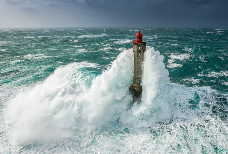
PARIS — Storm Austen power cuts defined Friday across north-western Europe. According to Reuters, the storm cut power to nearly 300,000 French homes and disrupted train and plane services through the day, and knocked out electricity for some 12,000 homes in Britain on the initial count. A low-pressure front brought winds of 111 mph (179 kph) and driving rain across Europe overnight, Reuters reported, leaving trees and debris littered across roads by morning. No deaths were reported in any source consulted as of Friday evening.
Track it live: live severe-weather tracker — storm systems, warnings and severe weather as they develop, on the Signal Post News tracker pages.
What happened in France
The French toll was counted by the grid operator. Enedis, via Reuters, said nearly 300,000 of its clients had no electricity, with most of the disruption in Brittany on the western coast and Normandy in the north — the two regions that faced the Atlantic head-on as the front came ashore overnight. Those are homes and businesses, in Enedis's accounting, and the figure is a snapshot of a moving situation: crews restore streets and villages through the day even as fresh faults are reported, so the number at any given hour describes the storm's footprint at that hour, not a final total.
Transport stopped where the wind was strongest. French Transport Minister Philippe Tabarot said on X, via Reuters, that all rail traffic was suspended in Normandy and that major disruptions were expected on Paris commuter rail. In the air, flights were diverted from Paris Charles de Gaulle to Orly, with more diversions anticipated, Reuters reported. Météo-France issued orange alerts for much of the north-west, with heavy wind and thunderstorms continuing into late Friday — a warning level that tells residents to be vigilant, limit travel and expect disruption, and which remained in force while the front crossed the country.
Southern Britain: gusts, darkness and a falling pier
Britain's south coast took a parallel beating. Reporting by The Times, The Sun and the BBC on Friday described tens of thousands of homes in the South West without power. The outage figures, read in sequence, tell the story of a grid being hit and then repaired in real time rather than contradicting one another: Britain's National Grid said early on Friday, via Reuters, that its engineers had to restore power to more than 12,000 homes; by Friday afternoon National Grid put 31,000 South West homes without power; and on Friday night PA reported that National Grid engineers had restored power to more than 60,000 homes since Storm Austen began. Outage totals in a storm like this change hour by hour, and each of those numbers was accurate at the moment its source published it.
The wind readings explain the damage. Gusts of 76 mph were recorded at St Mary's airport on the Isles of Scilly, 84 mph in Jersey, 111 mph in Padstow, Cornwall, and 97 mph in St Ives, according to Friday's reporting. A gust of 111 mph is the kind of number more often associated with high ground in midwinter than with a Friday in October on a Cornish headland — and Padstow's reading matched the 111 mph peak Reuters reported for the front as it crossed Europe overnight.
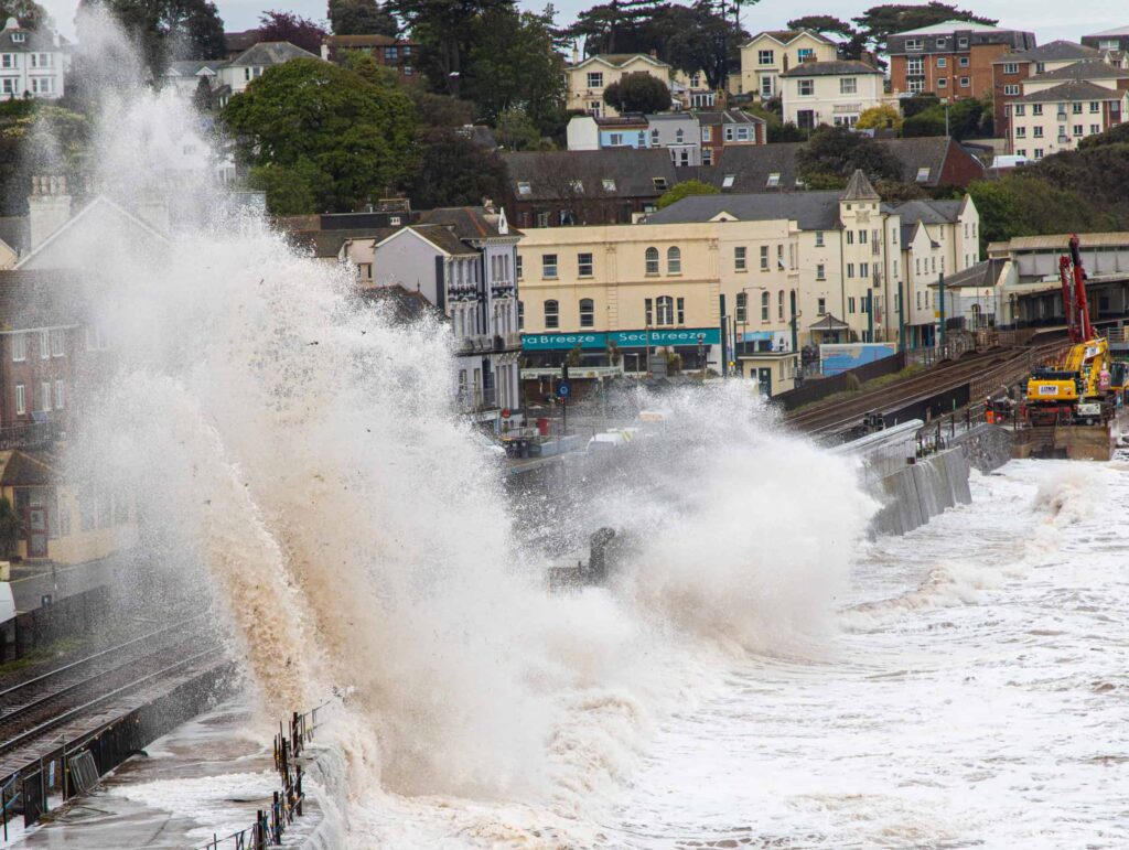
Brighton loses another piece of the West Pier
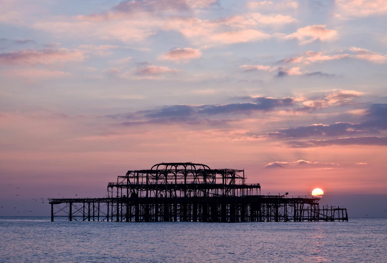
The day's most photographed casualty was a ruin. Part of Brighton's derelict West Pier fell into the sea at about 9:30 a.m. on Friday as huge waves hit the structure, according to BBC footage of the collapse. The pier has been closed since 1975 and was gutted by fires in 2003; what remains is a skeletal iron framework that has stood offshore for half a century as one of the most recognisable silhouettes on the south coast, shedding pieces to storms year by year. West Pier Trust historian Professor Fred Grey, quoted via The Sun, has long described the structure's slow loss to the sea; Friday's collapse is the latest instalment of that erosion, delivered in a single morning by a single storm.
Schools shut, runways quiet
The disruption ran through the ordinary machinery of a Friday. In Cornwall, 87 schools opened late or stayed closed. Southampton Airport cancelled the majority of its Friday-morning flights. Guernsey's airline Aurigny cancelled all of its services. And at a civil-preparedness event on Friday, Prime Minister Andy Burnham warned that the UK could face "a winter of greater flooding" and said unexpected events were becoming more common — a political framing of the same fact the outage maps were making on their own: the season's first storm had arrived early, hit hard, and was not coming alone.
The Dutch knock-on: KLM cancels, Schiphol holds
Austen's reach extended past the Channel. KLM cancelled 20 flights on Friday due to strong winds in the Netherlands caused by Storm Austen, Reuters reported, with a further 22 cancellations expected on Saturday. The Dutch weather service KNMI warned of gusts of 75 to 90 km/h through the weekend. Schiphol Airport, for its part, told the ANP news agency it was experiencing little disruption, and no other airlines had cancelled flights for the same reason — a useful calibration of Friday's Dutch impact: real, concentrated on one carrier's schedule, but not an airport-wide shutdown. The pattern repeated the day's geography in miniature: the closer to the Atlantic coasts, the worse the damage; the further inland, the more the storm became a scheduling problem rather than a physical one.
Why this matters
The first reason is the calendar. Austen is the first named storm of the season and Boelo is the second — and they have arrived back to back, within the same weekend, at the very start of the storm season. The naming system exists to give the public a single, memorable label for dangerous weather; two names consumed in the season's opening days is itself a signal about the autumn taking shape, the point Burnham was making in political language when he warned of a winter of greater flooding and of unexpected events becoming more common.
The second reason is the stress test. In roughly 24 hours, one weather system examined the resilience of two countries at once: France's electricity distribution in Brittany and Normandy, its rail network and its biggest airport; Britain's South West grid, its coastal schools, a Channel Islands airline and a regional airport; and the Netherlands' flag carrier at one of Europe's largest hubs. It did so on a half-term travel weekend, when roads, trains and flights carry families in numbers a normal Friday does not. Infrastructure rarely fails everywhere at once, and it did not fail everywhere on Friday — Schiphol's calm and the speed of National Grid's restorations are part of the record too. But the breadth of systems touched, in a single day, by a single storm, is the measure of how much of modern life a 111 mph gust can reach.
The third reason is sequencing. Restoration crews in the South West and northern France will still be working — restringing lines, clearing trees, repairing the faults a storm leaves behind — when Boelo's winds arrive in the north on Saturday. A second storm does not have to be stronger than the first to do outsized damage: it hits trees already loosened, ground already saturated, networks already patched, and people already tired. Austen's rain warning for southern and eastern Scotland on Friday carried 20–40 mm, with 60–80 mm possible locally, according to the Met Office — water that will still be in Scottish rivers and soil when Boelo adds its own rain to it.
How two countries came to share one storm season
Storm naming in north-western Europe is a cooperative exercise. The UK Met Office, Ireland's Met Éireann and the Netherlands' KNMI name storms as a group, working through an agreed alphabetical list for the season, while France's Météo-France names storms affecting its own territory within a south-western European grouping. That is how one low-pressure system can arrive wearing a French name — Austen is the name carried in French and British reporting of Friday's system — while the next system on the same list, Boelo, is named for the winds it will bring to Britain and Ireland. A storm earns a name when forecasters judge it has the potential to cause significant impact, which is why the names themselves are a rough public ledger of a season's severity: quiet seasons leave most of the alphabet unused.
Comparisons with past autumns should be made carefully, and this article makes none with invented figures. What can be said from Friday's record alone is that the ingredients were the familiar ones, in an unfamiliar concentration: an Atlantic low deepening as it crossed, gusts at exposed headlands reaching the levels Padstow and St Ives recorded, and rain falling ahead of the wind on ground that must absorb a second storm within 48 hours. Readers who followed last month's severe weather in the United States — our reporting on the Las Vegas flash flood and Tropical Storm Rachel's record rain and the Arizona tornado watch, the state's first in 16 years — will recognise the same pattern from the other side of the Atlantic: early-season systems arriving with mid-season force.
Who is exposed next: the amber north
Boelo, the second named storm of the season, brings an amber wind warning across Scotland, the north of England down to Carlisle and the north-east of Northern Ireland on Saturday through Sunday night, PA reported on Friday night, with gusts potentially exceeding 80 mph. Amber is the middle tier of the Met Office's warning scale — above yellow, below red — and it means there is an increased likelihood of impacts from severe weather, including a potential risk to life and property, and that people should prepare for disruption rather than merely note the forecast.
The forecasters were specific about where the disruption will land. Met Office meteorologist Tom Morgan, via PA, said widespread travel disruption to ferries and trains is expected across Scotland, possibly northern Northern Ireland and the far north of England, over the next 24 to 36 hours. Met Office Deputy Chief Forecaster Chris Bulmer said gusts of 70–80 mph in exposed coastal areas and high ground are possible, 50–60 mph more widely, accompanied by heavy rain. Those are forecasts, not observations — the distinction this article has kept throughout: Austen's 111 mph at Padstow is a measurement; Boelo's 80 mph is a warning, and the weekend will decide how close the two numbers come to each other.
What happens next
The timeline is already written in the warnings. Boelo's amber warning runs from Saturday through Sunday night across Scotland, the north of England down to Carlisle and the north-east of Northern Ireland. KLM's expected further 22 cancellations fall on Saturday. And beyond Boelo, Met Office reporting points to a further, as yet unnamed Atlantic low possible on Monday — which would make three significant systems in four days, and would test whether the naming list loses a third letter before the season is a week old.
What to watch, in order: the restoration numbers from Enedis and National Grid, which will show how much of Friday's damage was repaired before the second storm arrived; ferry and rail cancellations across Scotland and the Irish Sea, the impacts Morgan named first; flood warnings, as Austen's rain and Boelo's rain combine on saturated ground — the risk Burnham flagged; and any move of Boelo's warning up the scale, or its extension further south. Signal Post News will update this story as the weekend's figures replace the forecasts.
Related coverage: severe weather is tracked continuously on our live severe-weather tracker, and our recent storm reporting includes the Las Vegas flash flood that broke rainfall records and Arizona's first tornado watch in 16 years.
Sources
Reuters, "Storm causes power outages and traffic disruptions in France and Britain," October 23, 2026 — the nearly 300,000 French homes cut off, Enedis's Brittany and Normandy figures, the initial 12,000 British homes, Transport Minister Philippe Tabarot's rail statement, the Paris flight diversions, Météo-France's orange alerts and the 111 mph winds. Reuters, "KLM cancels dozens of flights due to strong winds," October 23, 2026 — KLM's 20 Friday cancellations and 22 expected Saturday, KNMI's 75–90 km/h gust warning and Schiphol's statement to ANP. PA Media via the Glasgow Times, "Storm Boelo may cause widespread travel disruption," October 23, 2026 — the amber warning area and timing, Tom Morgan's ferry and rail disruption warning, Chris Bulmer's gust and rainfall figures, and National Grid's restoration of power to more than 60,000 homes. The Times, "Storm Austen: thousands of homes in southwest left without power," October 23, 2026 — the South West outages and National Grid's 31,000 figure. BBC News reporting via The Independent, "Brighton's West Pier partially collapses," October 23, 2026 — the 9:30 a.m. partial collapse of the West Pier. Met Office statements via The Sun — the recorded gusts at St Mary's, Jersey, Padstow and St Ives, the 87 Cornwall schools, the Southampton Airport and Aurigny cancellations, Professor Fred Grey's West Pier history and Prime Minister Andy Burnham's flooding warning. Outage figures are attributed to their sources and times as published; forecast figures for Storm Boelo are Met Office forecasts via PA, not observations.