Hurricane Rachel Southern California
Weather / California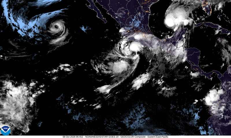
Hurricane Rachel Southern California impacts are coming into focus after a remarkable shift in the Category 1 storm's path. Rachel, with 80-mph winds and a center roughly 800 miles west of southern Baja California on Wednesday afternoon, is forecast to slow and then make what the National Hurricane Center calls a “sharp turn to the northeast,” accelerating back toward Baja California and Southern California through the October 10–11 weekend.
The cyclone should weaken over cooler water and may arrive as a post-tropical system rather than a hurricane. That technical downgrade would not erase its moisture, wind or ocean energy. Life-threatening surf can reach the coast before the center, while tropical rain falling on steep terrain, burn scars and overloaded urban drains can produce dangerous local flooding without a direct landfall.
Why this matters
Eastern Pacific hurricanes usually steer west, away from California. A northeast turn toward San Diego and Orange County is rare enough that meteorologist Collin Gross noted it is “not very often” that several Southwestern states sit inside one National Hurricane Center forecast cone.
The timing is as important as the direction. Rachel arrives as Southern California exits a punishing run of triple-digit October heat, flipping the region from fire-weather stress to tropical moisture in a matter of days. Climate scientist Daniel Swain said outcomes for San Diego still span from “dry” to a “rare October rain and windstorm.” That wide spread is not a reason to ignore the forecast; it is the central risk-management problem.
Burn-scar soils can repel water, sending runoff quickly into mountain channels and canyon roads. Meanwhile, swell outruns the cyclone and can catch beachgoers beneath clear skies. The most immediate danger may therefore be at the water's edge before many residents see a cloud from Rachel.
How the turn happened
Rachel spent days doing what most Eastern Pacific hurricanes do: drifting west into open water, with peak seas near 35 feet and little threat of landfall. An approaching upper-level trough is now expected to capture the storm and pull it northeast, an unusual but not unprecedented setup.
As of Wednesday afternoon, Rachel remained a Category 1 hurricane with 80-mph sustained winds. Hurricane Marie offers a coastal warning from history: it severely eroded Southern California beaches over Labor Day weekend without making landfall. In late September, Hurricane Polo pushed 4-to-7-foot surf into the region. Rachel may follow the same playbook, with ocean impacts arriving before — or without — a direct hit from the center.
What Southern California should expect
San Diego County
San Diego sits closest to the forecast track and could see the strongest winds, heaviest rain bands and highest surf if the current path holds. The National Hurricane Center currently places the odds of tropical-storm-force winds below 10%, but that probability could rise if Rachel's path shifts north.
Orange and Los Angeles counties
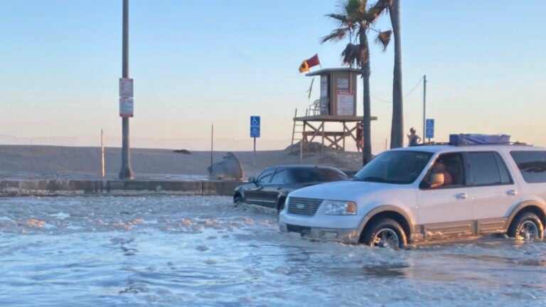
Orange and San Diego counties face the greatest surf risk, with 3-to-6-foot surf and higher sets, plus dangerous rip currents. Los Angeles County beaches face elevated surf, minor coastal flooding and the greatest impacts along the Malibu coastline. Tides near 7.5 feet by Sunday would leave vulnerable beaches open to considerable or significant wave runup.
A National Weather Service coastal flood advisory runs from 6 a.m. Wednesday through 11 p.m. Friday, with impacts highlighted for Long Beach's Alamitos Peninsula, Catalina Island, Malibu and Zuma Beach. Even after that advisory expires, Rachel's later southerly swell may create a new period of hazardous conditions.
Rain and flash floods
Showers could begin Saturday night, followed by broader rain and isolated strong-to-severe thunderstorms from Sunday afternoon into Monday night. The heaviest rainfall is favored south and east of Los Angeles. Most forecasts call for roughly a quarter to half inch, with up to an inch on lower coastal slopes and mountains; the wider model envelope runs from a tenth of an inch to about 2 inches.
The National Weather Service highlights a marginal excessive-rainfall risk from Malibu through Los Angeles into San Diego County on Sunday, plus a slight flash-flood risk inland across the San Bernardino Mountains, Palm Springs, Las Vegas and Phoenix. Mountains, burn scars, canyons and urban areas with poor drainage are the places where a modest regional total can become a dangerous local surge.
Meteorologist Ben Brissey said the remnants are increasingly likely to deliver a potentially needed soaking. Meteorologist Jason D. Farhang warned that the rapid transition from extreme heat could come with waves of 10 to 12 feet and perhaps a rogue 15-footer from San Luis Obispo through Orange County to Ensenada. His coastal-flood window runs from Sunday at 11 a.m. through Wednesday at 6 p.m.
The ocean threat arrives first
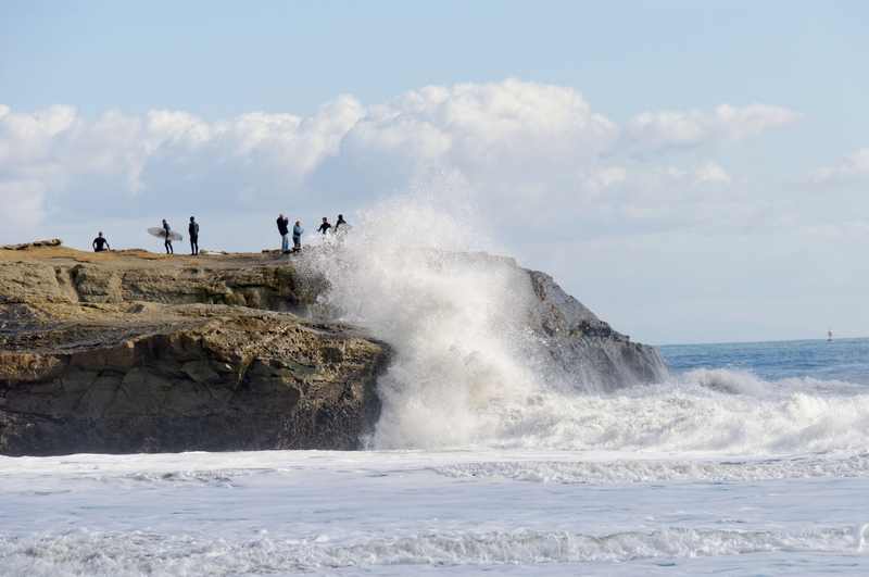
The strongest ocean impacts may arrive before the storm center, so beachgoers should stay cautious even if skies remain clear. Forecasters expect moderate to significant beach erosion, a higher risk of ocean drowning and powerful rip currents. Waves can wash people from beaches and rocks and capsize small boats close to shore.
Southerly swell is especially deceptive because it reaches beaches that do not usually receive direct wave energy from that direction. Inexperienced swimmers may find familiar water behaving differently. Lifeguard restrictions and beach closures should be treated as hazard controls, not suggestions.
The heat-to-deluge whiplash
Southern California is moving from triple-digit days and October heat records toward highs mostly in the 70s by Monday — 5 to 15 degrees below normal and a swing of more than 30 degrees in roughly 72 hours. That compression matters for emergency planning: power systems and fire crews move from cooling demand and heat-driven fire risk to drainage, surf and flood response in the same week.
October tropical remnants reaching San Diego County are a once-in-decades-scale event. The combination of record heat and tropical moisture is an even sharper one-two punch. Our reporting on the Bouquet Fire during the heat wave shows what the first half of that whiplash looked like; Rachel may define the second.
A crowded tropics
Rachel is not alone. Tropical Depression Twenty-E formed October 7, becoming the 22nd storm of the eastern and central Pacific season since May 15 as a strengthening El Niño keeps ocean heat unusually high. Rachel's moisture is expected to merge into a separate, non-tropical low-pressure system off the coast and then move northeast, spreading rain into Arizona and Nevada over the weekend and toward Utah by the morning of October 12.
Swain has identified that non-tropical low as the sleeper threat. Strong onshore winds near San Diego could push water toward the coast and compound flooding even as Rachel's tropical circulation weakens. Storm labels matter less at that stage than wind direction, moisture transport and timing against high tide.
The broader Atlantic basin is busy, too. Our coverage of Hurricane Isaias and its U.S. impacts underscores a common hurricane-season lesson: disruptions can spread far beyond the forecast center line.
Who wins, who loses
Potential winners: inland farms and water districts if the rain arrives gradually; fire agencies that get a humidity reprieve after dangerous heat; and skilled surfers who respect closures, local knowledge and the power of the swell.
Likely losers: beachfront businesses facing erosion and weekend closures; travelers moving through LAX and SAN during thunderstorms; burn-scar communities under flash-flood alerts; and ports or small-craft operators exposed to rapidly changing winds and seas.
The communication trade-off is real. Overhyping a hurricane that arrives as post-tropical rain risks a credibility gap before the next storm. Underplaying Rachel because its center may weaken risks drownings in dangerous surf that does not require landfall. The fair message is conditional and specific: the track remains uncertain, while the ocean hazard is already credible.
What happens next
North-track scenario
If the forecast cone shifts toward Orange County, tropical-storm-force winds become more plausible, with 1-to-2-inch rainfall pockets and significant coastal flooding. San Diego and Orange County would carry the highest combined wind, rain and surf risk.
South-track scenario
If the path stays south — the outcome favored by Google Weather Lab, with landfall south of Ensenada — Southern California gets a glancing moisture plume: showers, moderate surf and more limited flooding.
Uncertainty should narrow once the turn begins late this week. Residents do not need to prepare for a Category 1 landfall; they should review emergency plans, clear drains, avoid risky surf and watch for official watches, warnings and beach restrictions as the weekend approaches.
Sources
- National Hurricane Center Tropical Weather Discussion and advisories
- USA Today: Tropical storm will turn toward Southern California, forecasters say
- USA Today: Hurricane Rachel may weaken, but California flooding threats could grow
- New York Post: Hurricane Rachel set to bring tropical rain to Southern California
- The Inertia: Hurricane Rachel rain, wind and storm-surge outlook
- Surfer: Hurricane Rachel path toward Southern California
- The Desert Sun: Hurricane swell brings hazardous beach conditions
- MyNewsLA: Southland heat wave and relief on the horizon