World · Weather
World / Weather — The Cyclone Murasu landfall is now a matter of hours. A severe cyclonic storm over the west-central Bay of Bengal is forecast to cross the south Andhra Pradesh coast between Nellore and Narsapur, to the south of Ongole, between 11:30 p.m. tonight and 4 a.m. on Tuesday, with sustained winds of 100–110 kmph gusting to 120 kmph, according to the India Meteorological Department (IMD).
Track it live: Live storm and hurricane tracker

ONGOLE, Andhra Pradesh — By tonight, the question hanging over a long stretch of India’s east coast will no longer be whether Cyclone Murasu makes landfall, but exactly where, and how much water it pushes ashore when it does. The Cyclone Murasu landfall window given by the India Meteorological Department is unusually precise: the severe cyclonic storm is expected to cross the south Andhra Pradesh coast between Nellore and Narsapur, to the south of Ongole, during the hours between 2330 IST on Monday, November 2, and 0400 IST on Tuesday, November 3, 2026 — late tonight into the first hours of Tuesday morning, local time.
The storm arrives with the region already braced. A red alert is in force for coastal Andhra Pradesh and north Tamil Nadu. At least 21 flights have been cancelled across the region as a precaution, schools have shut across three states, rail services have been disrupted, evacuations have begun from vulnerable coastal areas of Andhra Pradesh, and two ports have raised the Great Danger Signal No. X, among the highest warnings in India’s port signal system. As of publication, no deaths and no damage toll from Murasu have been reported — the storm has not yet come ashore, and this article will not guess at numbers that do not yet exist.
What we know
- The storm: Severe Cyclonic Storm Murasu over the west-central Bay of Bengal, moving west-northwest at 22 kmph over the previous six hours, according to the IMD bulletin posted on X by @Indiametdept on Monday, November 2, 2026.
- The position: At 0830 IST on Monday it was centred near 14.1°N, 81.4°E — about 160 km east-southeast of Nellore, 180 km northeast of Chennai, 180 km east-southeast of Kavali, 210 km southeast of Ongole and 240 km south of Machilipatnam.
- The landfall: Forecast to cross the south Andhra Pradesh coast as a severe cyclonic storm, between Nellore and Narsapur and to the south of Ongole, between 2330 IST on November 2 and 0400 IST on November 3, with sustained winds of 100–110 kmph gusting to 120 kmph.
- The surge: A storm surge of about 1.0–1.5 metres above astronomical tide is likely to inundate low-lying coastal areas at the time of landfall, according to the IMD coastal bulletin of November 2.
- The warnings: Great Danger Signal No. X raised at Nizampatnam and Vadarevu ports; red alert in force for coastal Andhra Pradesh and north Tamil Nadu.
- The rain: Extremely heavy rainfall is forecast for coastal Andhra Pradesh and Yanam on November 2–3, and for Telangana on November 3.
- The disruption: At least 21 flights cancelled across the region, including 11 at Chennai airport; schools shut across Andhra Pradesh, Tamil Nadu and Odisha; rail services disrupted; evacuations begun from vulnerable coastal areas of Andhra Pradesh, as reported by Travel and Leisure Asia and ETV Bharat on November 2.
- The casualties: None reported so far. No deaths or damage toll has been attributed to Murasu at the time of publication.
The IMD position — and the hours between now and landfall
The IMD’s Monday-morning fix put Murasu over the west-central Bay of Bengal at 14.1°N, 81.4°E, having moved west-northwestwards at 22 kmph over the previous six hours: 160 km east-southeast of Nellore, 180 km east-southeast of Kavali, 210 km southeast of Ongole, 240 km south of Machilipatnam — and, notably, 180 km northeast of Chennai, close enough that one of India’s busiest air hubs sits inside the storm’s weather even though the centre is aimed at Andhra Pradesh.
Read hour by hour, the timeline runs like this. Through Monday afternoon and evening, the outer rain bands reach the coast first: the extremely heavy rainfall forecast for coastal Andhra Pradesh and Yanam begins before the centre does, under a red alert covering coastal Andhra Pradesh and north Tamil Nadu. Sea conditions deteriorate through the day — which is why Great Danger Signal No. X at Nizampatnam and Vadarevu matters: it tells shipping and fishing fleets, in the plainest language the port system has, that a severe storm is expected to cross near those ports and that vessels should be in shelter.
The landfall window: 11:30 p.m. to 4 a.m.
The crossing itself is forecast for the darkest part of the night — between 2330 IST on Monday and 0400 IST on Tuesday — along the stretch between Nellore and Narsapur, south of Ongole. Night landfalls are the hardest kind: surge and flooding arrive when visibility is worst, and the first damage assessment has to wait for daylight. What the IMD is confident about is the intensity at crossing: sustained winds of 100–110 kmph, gusting to 120 kmph. On the scale most international readers know, 100–120 kmph is roughly Category 1 hurricane strength — not the top of any scale, but more than enough when it arrives with a surge and a night of extreme rain.
After crossing, the system is expected to weaken as it moves inland, carrying its rain shield northwest: the IMD forecasts extremely heavy rainfall for Telangana on November 3, which means the flood risk does not end at the coastline — it migrates inland with the remnant storm on Tuesday.
Flights cancelled, schools shut, evacuations under way
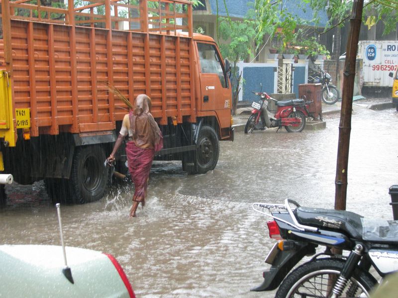
The disruption began a full day before landfall, and it maps the storm’s footprint. At least 21 flights have been cancelled across the region as a precaution, including 11 at Chennai airport, as reported by Travel and Leisure Asia and ETV Bharat on November 2. Chennai matters out of proportion to its distance from the crossing point: it is the aviation hub for this entire coast, so cancellations there ripple into connections across southern India. Travellers booked through Chennai or the smaller Andhra-coast airports on Monday night and Tuesday should expect further changes as airlines react to the IMD’s updates.
On the ground, schools have shut across Andhra Pradesh, Tamil Nadu and Odisha — a three-state closure reflecting both the forecast rain footprint and the precautionary approach governments now take with Bay of Bengal storms. Rail services have been disrupted. And in Andhra Pradesh, the most consequential step began on Monday: evacuations from vulnerable coastal areas, moving people out of low-lying settlements in the landfall corridor before the surge window opens tonight — the evacuation-first doctrine that has transformed Bay of Bengal cyclone outcomes over the past two decades.
Why this matters
Start with the calendar. Murasu is the second severe storm in days to aim at essentially the same coastline: it arrives only days after Cyclone Arnab battered the same Andhra coast, as Dainik News Live has noted — the storm whose approach we tracked in our coverage of the Cyclone Arnab landfall forecast for the Andhra coast. Two severe storms in quick succession are different arithmetic from one: soils are already saturated, rivers and drainage are already full, crews have already worked one emergency, and households that spent money and leave on the first storm have fewer reserves for the second.
Second, the season. Murasu is a textbook product of the Bay of Bengal’s post-monsoon cyclone season, the October–November window when the bay’s waters are at their warmest and the retreating monsoon leaves the low wind shear that lets storms organise and intensify. The bay produces a minority of the world’s tropical cyclones but, historically, the large majority of the world’s cyclone deaths — a statistic written by geography: the coastline is low, flat and densely settled, the sea floor shelves gently and piles water ashore, and the plains behind the beaches hold millions of people within a few metres of sea level.
That is why the most important number in the IMD’s bulletin is not the wind. It is the surge: 1.0–1.5 metres above astronomical tide, forecast to inundate low-lying coastal areas at landfall. In Bay of Bengal storms, water — surge first, then rain-fed flooding — has always been the main killer, not wind. A 120 kmph gust will strip roofs, fell trees and bring down power lines. A metre and a half of seawater arriving at night across a flat coastal plain, on top of extremely heavy rain falling on ground already soaked by Arnab, is what turns a severe storm into a humanitarian problem. The evacuations, the port danger signals and the red alert are all, in effect, responses to the water forecast rather than the wind forecast.
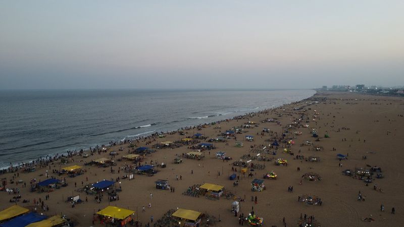
Third, the corridor. The forecast landfall stretch — Nellore to Narsapur, south of Ongole, with Machilipatnam to the north and Chennai to the south — is not empty coastline. The Nellore–Ongole–Machilipatnam corridor holds millions of people in port towns, fishing settlements, aquaculture ponds, salt pans and growing coastal cities, tied together by the coastal highway and rail line that are among the first assets a surge cuts. Add Chennai’s role as the region’s air hub, and a storm crossing south of Ongole becomes a story for the whole southeast coast.
Context and background: a drum, a season, and a familiar coast
Even the name carries a local signature. Murasu was contributed by India to the regional cyclone naming roster, and it means “drum” in Tamil — a name chosen years in advance, from a list, long before anyone knew which storm would carry it. The naming system exists for exactly the purpose it is serving tonight: one short, unambiguous word that forecasters, officials and the public across several countries and languages can use for the same storm without confusion.
The wider context is a coastline that has had an intense few weeks. Arnab’s landfall on this same Andhra coast is days old. Earlier this autumn, a Bay of Bengal system brought heavy weather to the Andhra and Odisha coasts in September — the pattern we covered in our reporting on the Bay of Bengal deep depression that made landfall on the Andhra–Odisha coast — and the 2026 monsoon itself was already an outlier, as our analysis of India’s 2026 monsoon, the weakest since 2015, set out.
Who is most exposed — and who bears the cost
The exposure map tonight is layered. First are the fishing communities and residents of low-lying settlements inside the surge zone between Nellore and Narsapur — the people the evacuations are designed to reach, for whom a 1.0–1.5 metre surge threatens home and livelihood directly. Fishermen who lose days at sea to danger signals lose income with no wage to fall back on; aquaculture and salt-pan workers face ponds and pans a single surge can damage for a season. Second are the inland poor of the rain footprint: when extremely heavy rain falls on saturated ground in coastal Andhra and then, on Tuesday, in Telangana, the worst-drained settlements flood first and drain last. Third are the travellers, patients, students and workers for whom cancelled flights, disrupted trains and closed schools are the storm’s most immediate costs. Murasu’s bill, like every Bay of Bengal cyclone’s, will be paid disproportionately by the coastal households least able to pay it — which is why the warning and evacuation machinery matters more than the wind category.
What happens next
The next twelve hours decide this story. Watch, first, for the IMD’s evening and night bulletins: any shift in the crossing point along the Nellore–Narsapur stretch changes which districts take the worst of the surge. Second, watch the landfall itself, in the 2330 IST to 0400 IST window south of Ongole, and the first surge and rainfall reports from Nellore, Kavali, Ongole and Machilipatnam as dawn breaks on Tuesday. Third, watch the inland turn: as Murasu weakens over land, its rain moves toward Telangana, where extremely heavy rainfall is forecast on November 3, and the emergency changes character from surge rescue to flood management. Fourth, watch the recovery ledger — power restoration, flights, rail and school decisions — and the first official damage assessments once daylight allows survey teams to work.
Signal Post News will update this story as the IMD issues new bulletins and as the first confirmed reports come in from the landfall zone. For now, the verified position is this: a severe cyclonic storm with gusts to 120 kmph and a surge of up to a metre and a half is hours from the Andhra coast, the warnings are at their highest levels, the evacuations have begun — and no casualties have been reported. If you are in the landfall corridor tonight, what are conditions like where you are? Tell us in the comments — and like and follow Signal Post News for live updates as Murasu comes ashore.
Sources
India Meteorological Department (IMD) — mausam.imd.gov.in and the IMD bulletin posted on X by @Indiametdept, November 2, 2026: Severe Cyclonic Storm Murasu centred at 0830 IST near 14.1°N, 81.4°E, moving west-northwest at 22 kmph; forecast landfall between Nellore and Narsapur, south of Ongole, between 2330 IST November 2 and 0400 IST November 3, with sustained winds of 100–110 kmph gusting to 120 kmph; IMD coastal bulletin, November 2, 2026: storm surge of about 1.0–1.5 metres above astronomical tide, Great Danger Signal No. X at Nizampatnam and Vadarevu, red alert and extremely heavy rainfall forecasts. Travel and Leisure Asia — Cyclone Murasu travel alert, November 2, 2026: at least 21 flights cancelled across the region, including 11 at Chennai airport, with school closures and travel disruption (also reported by ETV Bharat, November 2). Adda247 — IMD Cyclone Murasu update summary, November 2, 2026. Dainik News Live — November 2026: Murasu follows Cyclone Arnab on the same Andhra coast; the name Murasu, contributed by India, means “drum” in Tamil.