Weather / California — The ocean arriving this week is not a storm. There is no hurricane behind it. It is the tide itself, swollen by months of abnormally hot water and an El Niño Kelvin wave, forecast to reach 8.5 feet at Newport Beach on Tuesday — on a coastline whose sand, bluffs and boardwalks have already been spent by a season of hurricane swells.
SOUTHERN CALIFORNIA — The National Weather Service has issued a coastal flood warning for the San Diego and Orange County coasts from Sunday morning through Thursday afternoon, warning of “significant coastal flooding” that could reach low-lying homes, businesses and critical infrastructure, as exceptionally high king tides arrive along a shoreline already battered by erosion. Forecasters said the tides could break modern-day records in the two counties: adjusted for the unusually hot ocean water off California, they could reach 7.5 to 8 feet, or higher. The Los Angeles Times reported the warning in full on Saturday, and California’s Office of Emergency Services said a coastal flood advisory will cover the wider state coast from October 25 to October 29, with the warnings concentrated in Orange and San Diego counties.
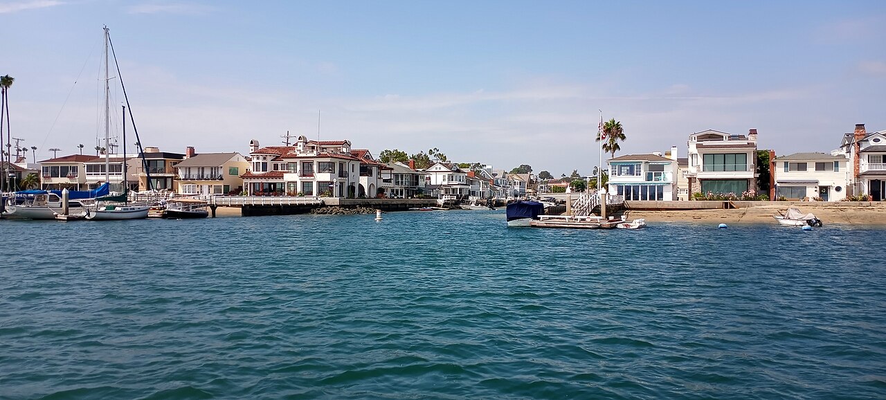
The numbers that matter most are local, and Newport Beach has published its own. The city expects its highest tides at 8.3 feet on Monday at 9:15 a.m., 8.5 feet on Tuesday at 9:50 a.m. and 8.4 feet on Wednesday at 10:28 a.m. — figures 1.8 feet higher than predictions that do not account for the warmer ocean water. Newport has declared a local emergency, activated its emergency operations center, and is reinforcing protective sand berms while preparing pumps and tide valves in flood-prone areas. The National Weather Service office in Los Angeles separately warned that minor to moderate coastal flooding is likely from Sunday through Thursday, with high tides of 7.5 to 8 feet running as much as 1.5 feet above projections and moderate to significant beach erosion likely.
A luxury resort empties its first floor; a bluff gets a $4 million brace
The preparations are easiest to see at the water’s edge. In Laguna Beach, the Surf & Sand Resort is placing no guests on its first floor as surf pounds the beachfront property — a precaution an employee described to the California Post as taken out of an abundance of caution, adding that the building itself had not been damaged and had withstood major storms in the past. A newly circulated Instagram video purporting to show a section of the resort’s oceanfront seawall collapsing has added to local concern; the extent of any structural damage has not been independently confirmed, and it should be treated as unverified until it is. Laguna Beach surfer Blair Conklin, who has been documenting the season’s damage, put the underlying problem plainly: offshore reefs that once broke incoming waves are now deep enough that waves pass over them and double up on the structures inside — “and there’s no sand buffer.”
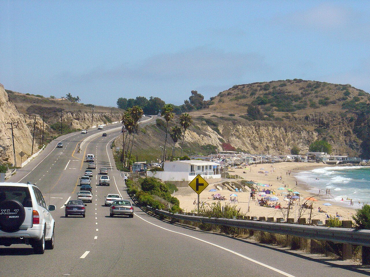
North of Laguna, crews are mounting what the California Post reported as a $4 million emergency operation to reinforce a fractured 360-foot bluff near El Moro and Crystal Cove, using heavy equipment, rocks and sand-filled plastic bags ahead of the tides. The Los Angeles Times reported the highway side of the same work: near Crystal Cove, where a crack has developed in the slope beneath Coast Highway, Caltrans is placing 4-foot-tall, sand-filled barriers below the roadway, the two lanes closest to the cliff remain closed, and traffic is routed onto the remaining two lanes. In Capistrano Beach, several homes along Beach Road have reportedly suffered structural damage, with six or seven red-tagged as uninhabitable and undergoing demolition, according to the California Post — a count that, like the resort video, is reported rather than independently tallied here.
Why the tide is taller than the tide table says
A king tide is an ordinary astronomical event — the highest tides of the year, when the sun and moon align. What is not ordinary this year is everything stacked underneath it. The weather service says actual tides in Southern California are running 1.25 to 1.75 feet above what astronomy alone would produce, because the ocean itself is hot: water expands as it warms, and near-shore waters have stayed abnormally warm for months under a marine heat wave. At Scripps Pier in La Jolla, surface water reached about 77 degrees this year against an average maximum near 70, and was still about 73 degrees on Thursday against a seasonal average of 66. Reinhard Flick of the Scripps Institution of Oceanography told the Times that water levels have been at least “half a foot above the prediction for months” — “as far as I know, this is unprecedented, especially for this length of time.” Layered on top is an oceanic Kelvin wave associated with El Niño, a slow slosh of elevated water across the Pacific that forecasters describe as boosting background tides for weeks at a time, on a coast where sea level has already risen about a foot over the past 125 years.
The geography of the alert reflects that physics. The warning — the serious tier — covers San Diego and Orange counties from Sunday at 5 a.m. to Thursday at 1 p.m. A coastal flood advisory covers the same period in Los Angeles, Ventura, Santa Barbara and San Luis Obispo counties, where significant-to-moderate beach erosion is likely and isolated damage to structures from seawater is possible. A separate advisory for the San Francisco Bay and Monterey Bay areas begins Saturday and runs through Thursday afternoon, warning of up to 1.9 feet of inundation above ground level near shorelines and tidal waterways. “Take the necessary actions to protect flood-prone property,” the weather service said. NOAA oceanographer Doug George was blunter: “The warning and advisories are real. People should take them seriously because conditions are favorable for flooding.”
Why this matters
This week’s flood risk is dangerous precisely because of what is missing: weather. The earlier rounds that damaged this coast were driven by identifiable storms — the swells of Hurricanes Marie, Polo and Rachel that swamped Pacific Coast Highway at Laguna Beach in early October and flooded the Balboa Peninsula and Long Beach days later. Those events at least ended when the swell did. A tide does not end; it returns on a timetable printed years in advance, twice a day, and this week’s timetable sits on top of a baseline that heat has quietly raised by more than a foot. Philip Gonsalves, a meteorologist with the weather service’s San Diego office, expects this round to be “on a similar scale” to the hurricane-swell flooding, “with different contributing factors producing a similar outcome.” Todd Hall, the warning coordination meteorologist in Oxnard, added the sentence that explains the whole week: “Any additional flooding exacerbates the issue because the damage is already there.”
That is the compounding logic now governing this coastline. The sand that would have absorbed this week’s water was stripped away by the hurricane season. The boardwalk on the Long Beach Peninsula, already torn up, is being repaired into the path of the next inundation. The bluff at El Moro was intact before the swells undercut it; now it needs barriers before a tide, not a storm, arrives. Newport Beach’s response shows a city pricing that logic in real time: about 30 to 40 trucks hauling sand from above Prado Dam toward the Wedge with a goal of 2,000 cubic yards by Saturday, thousands of sandbags installed on Balboa Island, and a longer project to move roughly 100,000 cubic yards of sand from the Santa Ana River mouth onto eroded beaches between 36th and 62nd streets. Long Beach is dredging Alamitos Bay and pumping sand onto its Peninsula. These are not storm repairs any more; they are a standing logistics operation against a higher baseline, run by cities that have now declared local emergencies twice in a single month.
The week ahead — and the winter behind it
The practical disruptions begin before the water peaks. Metrolink has suspended commuter rail service in southern Orange County and San Diego County for the coming workweek because of the tide forecast — the coastal rail line runs at sea level through exactly the corridor under warning. In the Bay Area, crews are closing a section of Highway 37 for 55 hours this weekend for emergency work to raise flood-prone stretches of the Marin–Sonoma route by 3 feet before winter. The peak mornings are Monday through Wednesday, and the mornings are when residents in low-lying areas should expect water in streets, parking lots, harbourside walkways and, in the warning area, at the thresholds of homes and businesses.
And this is, by the forecasters’ own account, the first in a series. Daniel Swain, a climate scientist with UC Agriculture and Natural Resources, told the Times: “It’s likely to get worse before it gets better.” Tides are expected to climb even higher around Thanksgiving, Christmas and Martin Luther King Jr. Day, with the California Coastal Commission listing further king-tide windows on November 24–26, December 23–25 and January 21–22 — and the coast could be hit hardest if a king tide coincides with a genuine winter storm, the combination this week mercifully lacks. That is the context in which to read this autumn on this coast, from the record El Niño the UN’s weather agency has been tracking to a single closed lane above Crystal Cove: the emergency is no longer any one event. It is the schedule.
Sources: Los Angeles Times — 8-foot king tides to swamp California coast for 6 days (Oct 24, 2026; reporting the National Weather Service warning, Newport Beach, Scripps Institution and Caltrans; read in full via republication this run — drain to link the canonical latimes.com URL) · California Post / New York Post — 5-star hotel in the crosshairs as coastal flooding pushes SoCal to its limits (Oct 24, 2026; Surf & Sand Resort, El Moro bluff operation, Capistrano Beach) · SURFER — King Tides Pummel California Coast as Super El Niño Surges (Oct 24, 2026) · FOXLA — Newport Beach declares local emergency ahead of storm, King Tides · MyNewsLA / City News Service — Newport Beach Declares Local Emergency Ahead of King Tides (Oct 19, 2026)