Weather · Florida · Space Coast
The National Weather Service called it a “particularly dangerous situation” and rated the damage threat catastrophic. By sunrise, cars were underwater in Palm Bay, U.S. 192 was closed in Melbourne, and a county built around launches and lagoons was being told to stay home.
Track it live: Live severe-weather and storm tracking
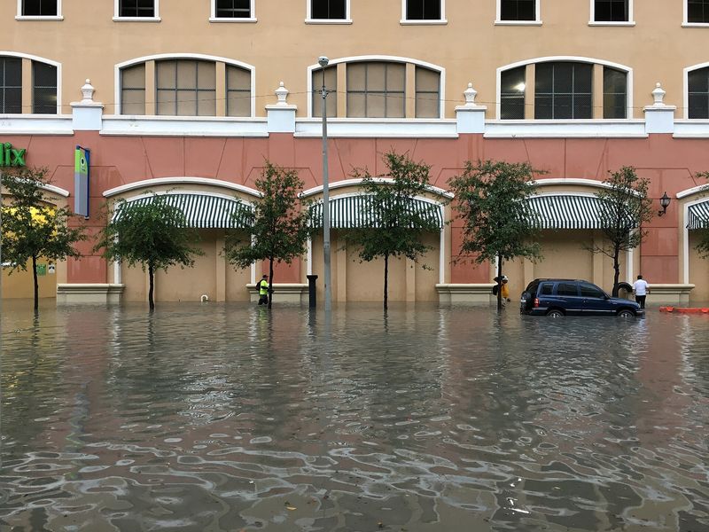
MELBOURNE, Florida, November 2, 2026 — Brevard County flooding schools closed: every public school in Brevard County shut on Monday after a night of training thunderstorms dropped close to a foot of rain on Florida’s Space Coast, and the National Weather Service in Melbourne escalated its warnings to the rarest level it issues — a flash flood emergency — for Palm Bay and West Melbourne.
The emergency, issued at 7:56 a.m. Eastern on Monday, said between 8 and 12 inches of rain had already fallen, based on radar and automated gauges, with more possible, and rated the flash flood damage threat “catastrophic.” “This is a PARTICULARLY DANGEROUS SITUATION. SEEK HIGHER GROUND NOW!” the warning said, telling people not to travel unless they were fleeing an area subject to flooding or under an evacuation order. No evacuation orders had been issued as of Monday morning, Florida Today reported, and no deaths or injuries had been reported in the coverage available as this article was published.
Brevard Public Schools shuttered all of its schools for the day. Florida Tech cancelled classes, all four Eastern Florida State College campuses closed, and Kennedy Space Center officials advised staff to work from home because of the flooded roads. Health First closed its physician offices, labs and imaging centres on Monday morning and cancelled elective surgeries through 11 a.m., while its hospitals stayed open. The school district’s spokesperson, Janet Murnaghan, said the closure was made for the safety of students, teachers and bus drivers on roads that could not be trusted.
A warning ladder climbed before dawn
The emergency was the top of a ladder the Weather Service climbed all night. A first flash flood warning for southern Brevard County at 4:44 a.m. said 6 to 8 inches of rain had fallen, with 2 to 4 more possible, and called the flooding life-threatening across Palm Bay, Melbourne, West Melbourne, Rockledge, Satellite Beach, Indialantic, Malabar, Merritt Island and Viera. A second warning at 4:58 a.m. covered the north of the county — Titusville, Mims and Port Saint John — after 2 to 4 inches there. By 6:30 a.m., forecasters said a stalled boundary was still producing “training bands of showers and storms,” the pattern in which rain cells pass over the same ground again and again like carriages on a track.
The 24-hour totals explain the escalation. The Weather Service’s unofficial figures, reported by Florida Today, put 11.9 inches of rain on West Melbourne, with 7.5 to 9 inches across much of the rest of the county. In Palm Bay, Lt. Vincent Galioto of the police department told Florida Today: “We’re seeing streets underwater everywhere.” Water had overtaken cars parked in roadways, crept up driveways and covered stop signs halfway in some neighbourhoods, and the department said it had small boats and pickup trucks ready to assist with rescues. Catherine McDonald, a northwest Palm Bay resident of 13 years, woke at 5 a.m. to find floodwater overtaking her front yard and cars outside nearly covered: “I’ve never seen anything like this.”
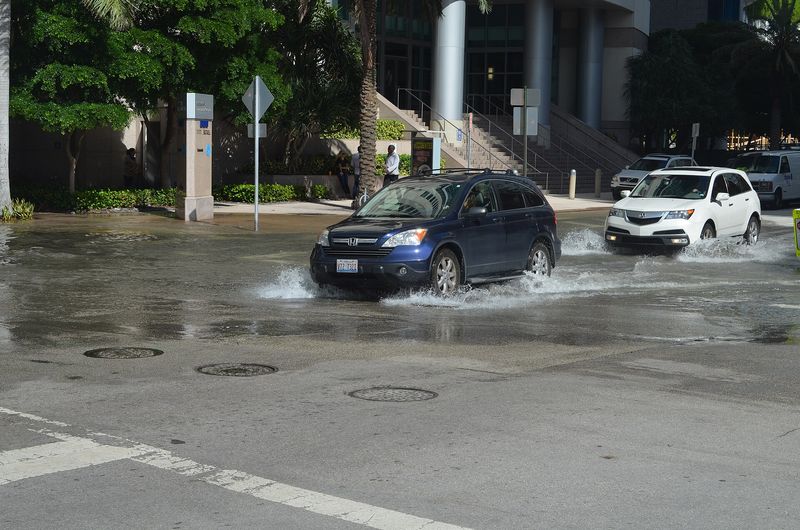
Road closures multiplied through the morning. Flooding closed all lanes of U.S. 192 at Vine Street in Brevard County, Melbourne police closed Babcock Street at University Boulevard, all of Dairy Road and Lake Washington Road, and Sarno Road near Eau Gallie Boulevard was shut earlier; Brevard Emergency Management said portions of Interstate 95 might have standing water. Sheriff Wayne Ivey, who said the rain had “already flooded out 192 in Melbourne,” asked residents to stay home and off the roadways unless travel was necessary: on a flooded road, he warned, “you may not be able to tell if there is a problem with the road.”
Why the water had nowhere to go
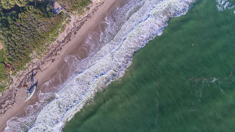
Monday’s flood was not only about how much rain fell. It was about the condition of the ground and the waterways it fell on. Brevard’s canals, ditches and stormwater systems drain toward the Indian River Lagoon, and the lagoon system was already swollen: last week, king tides — the highest tides of the season, sharpened by a closer-than-usual full moon — swamped Space Coast beaches and mainland areas near the lagoon and its canals. With lagoon, river and groundwater levels already elevated, heavy rain has a harder time draining away, Florida Today’s reporting noted, and Monday’s high tide, at around 2 p.m. Eastern, could itself temporarily reduce the drainage systems’ ability to discharge runoff.
The system strain showed in an unusual place: wastewater. Brevard Emergency Management asked residents at 8:15 a.m. to limit water use — shorter showers, dishwashers only when full — because the rain was stressing the wastewater system, and Cocoa Beach warned residents that its lift stations were operating at capacity and asked the city to conserve water to avoid overwhelming it. When a flood starts dictating how a city uses its showers and dishwashers, the water is no longer only on the roads.
Nor was Brevard alone. A flood watch for east central Florida — Brevard, Volusia, Orange, Seminole, Osceola, Lake, Indian River, St. Lucie, Martin and Okeechobee counties — ran until 7 p.m. Eastern on Monday, and the Weather Service in Miami had a flood watch for all of South Florida through Monday evening, with the Palm Beach Post’s live coverage reporting one to three more inches expected and isolated totals far higher possible. In the interior, the St. Johns River near DeLand stood at its 4-foot flood stage early Monday and was expected to crest slightly higher in the evening. The Tampa Bay office, meanwhile, issued its own flash flood warning for parts of Hardee, DeSoto and Highlands counties, where 5 to 8 inches had fallen.
Why this matters
The first reason is what a flash flood emergency actually certifies. The Weather Service reserves the wording for flooding that is an imminent, severe threat to life — a step above an ordinary warning, used sparingly. Monday’s Brevard emergency carried the “catastrophic” damage-threat tag, the highest the service assigns. That vocabulary matters because it is the moment a heavy-rain event stops being weather and becomes a public-safety operation: schools closed countywide, a space centre sent its workforce home, a hospital group cancelled surgeries, and police departments readied boats. None of that required a named storm, a landfall, or a hurricane cone. A stalled boundary and training thunderstorms over saturated ground did it on an ordinary November Monday.
The second reason is the comparison residents themselves reached for. Florida Today reported that Monday’s steady, persistent rain reminded Space Coast residents of Tropical Storm Fay in 2008, which stalled over Central Florida and dropped 27.65 inches, making it one of the wettest tropical storms to hit Florida. West Melbourne’s 11.9 inches is well short of Fay’s total — but Fay is the right frame for the mechanism, not just the amount: in both cases the disaster came from a system that would not move, raining on the same streets for hours. Brevard’s drainage, canals and lagoon outfalls are built to move water away between bursts; training bands deny them the interval.
The third reason is forward-looking, and forecasters are stating it carefully. Meteorologists do not directly attribute Monday’s flooding to the developing El Niño, Florida Today reported — but a strong, potentially “super” El Niño is forecast to bring Florida more frequent, stronger storms this fall and winter, with heavier rainfall and a higher flood risk statewide. Monday is therefore best read as a stress test taken early: a county whose lagoon was already high from king tides, whose soils were saturated, and whose wastewater system reached capacity under a single night’s rain, heading into a season forecast to send it more of the same. The results of that test — a closed school system, a closed highway, a “catastrophic” tag — are now on record before the season has properly begun.
What happens next
The immediate question is Monday evening. Forecasters expected the heaviest rain to ease around midday, but the east central Florida flood watch ran to 7 p.m., rain bands were still crossing the county, and the St. Johns River was not expected to crest until the evening — river flooding, unlike street flooding, peaks after the rain stops. Officials’ advice stayed blunt all morning: stay home where possible, never drive through flooded roads, and seek higher ground if water rises. Brevard Public Schools and the colleges will have to judge Tuesday against roads that may still be closed and neighbourhoods still draining; Health First planned to reopen its offices in the afternoon if conditions allowed.
Beyond Monday, the accounting begins: damage assessments in the Palm Bay neighbourhoods where cars stood underwater, the state of the canals and lift stations that ran at capacity, and whether the 11.9-inch West Melbourne figure is confirmed in the Weather Service’s final storm reports. What is already settled is the shape of the event — almost a foot of rain, on ground and water that were already full, in a county that had to close everything at once. Florida’s wet season may be ending on the calendar. On the Space Coast, it did not get the message.
Related coverage: Hurricane Isaias’s aftermath in Florida: deaths, outages and recovery · Cyclone Murasu’s landfall in Andhra Pradesh
Sources: National Weather Service, Melbourne office — flash flood emergency issued 7:56 a.m. ET, November 2, 2026, and flash flood warnings issued 4:44 a.m. and 4:58 a.m. ET, flood watch for east central Florida to 7 p.m. ET, and St. Johns River flood warning near DeLand, as published via api.weather.gov and quoted November 2, 2026. Florida Today, “Heavy rains trigger flooding across Brevard County, close schools” and “Almost foot of rain falls in some Florida locations,” November 2, 2026 (school, college, Health First and Kennedy Space Center closures; Sheriff Wayne Ivey; Palm Bay police Lt. Vincent Galioto; resident Catherine McDonald; NWS meteorologist Scott Kelly; king-tide and El Niño context; Tropical Storm Fay comparison). Palm Beach Post, live updates, November 2, 2026 (U.S. 192 closure; Cocoa Beach water conservation; South Florida flood watch). FOX 35 Orlando, November 2, 2026 (Brevard Public Schools closure). Rainfall totals are the Weather Service’s unofficial 24-hour figures as reported by Florida Today; the 8-to-12-inch figure is the Weather Service’s own estimate in the flash flood emergency. No deaths or injuries, and no evacuation orders, had been reported in these sources as of publication.