A slow nor'easter parked a few hundred miles off the Southeast coast is bringing days of coastal flooding to the East Coast this week — warnings and advisories from Long Island to North Carolina, 1 to 4 feet of inundation possible in coastal North Carolina and Virginia, gusts to 45 mph, and a National Hurricane Center watching brief: the system has about a 40 percent chance of picking up subtropical characteristics, and possibly the name Josephine, later in the week.
Track it live: Live hurricane and storm tracker
The setup: offshore, slow, and possibly subtropical
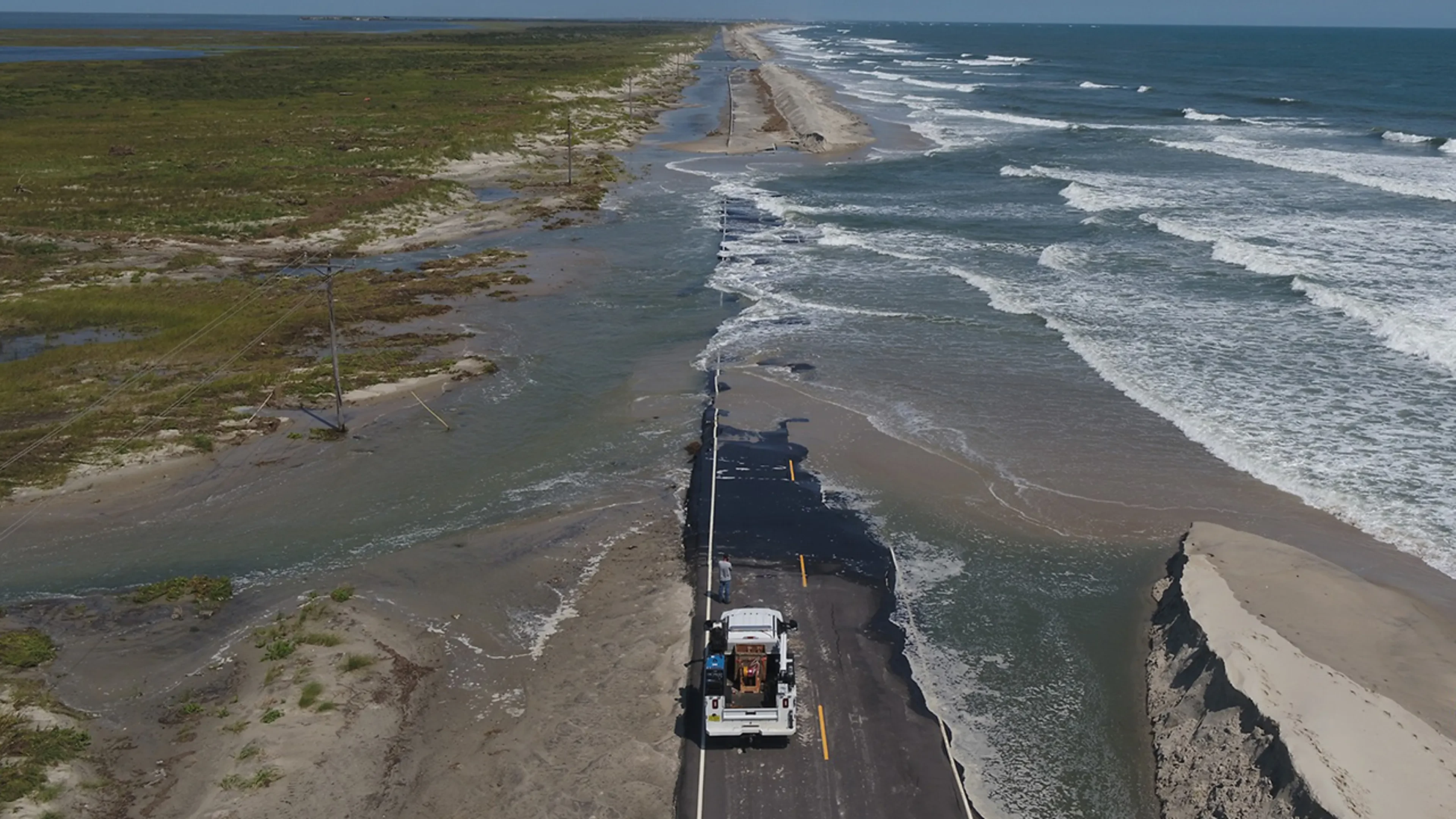
The National Hurricane Center's interest is the detail that elevates this from a familiar autumn nor'easter to a tracked system: roughly a 40 percent chance that the low acquires subtropical characteristics mid-to-late week. Should it organize enough to earn a name, it would be Josephine — the NHC's designated area to watch. Subtropical or not, the hazards are already assigned: coastal flood warnings and advisories stretch from Long Island to North Carolina; forecasters put possible inundation at 1 to 4 feet in the most exposed parts of coastal North Carolina and Virginia; and wind gusts to 45 mph will drive the water and complicate everything from ferry schedules to bridge restrictions. The storm's slow motion is the multiplier — each high tide arrives on top of the last one's leftover water, a process forecasters call tide stacking, and beaches stripped by September's nor'easter have less sand to spend.
Delaware: the advisory, and the warning inside it
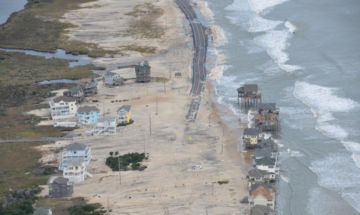
Delaware's slice of the forecast came with a nuance worth understanding, because it captures the whole event. The National Weather Service issued a coastal flood advisory for Kent County, inland Sussex County and the Delaware beaches from 3 to 9 p.m. on Tuesday, October 20. NWS meteorologist Robert Deal said water crests are expected to run about 1.5 feet lower than September's nor'easter produced — the good news — and then immediately qualified it: beach protections eroded by that September storm raise the risk this time even at lower water levels. Dunes are infrastructure. A coast that spent its dune line in September meets October's smaller flood with a smaller wall. Deal also pointed to the back bays — the soundside waters behind the barrier islands — as the most susceptible areas, a standard nor'easter pattern: wind piles water into the bays, and the bays, having nowhere to drain while the wind holds, flood communities that face away from the ocean entirely.
Practical guidance: what to do before the water rises
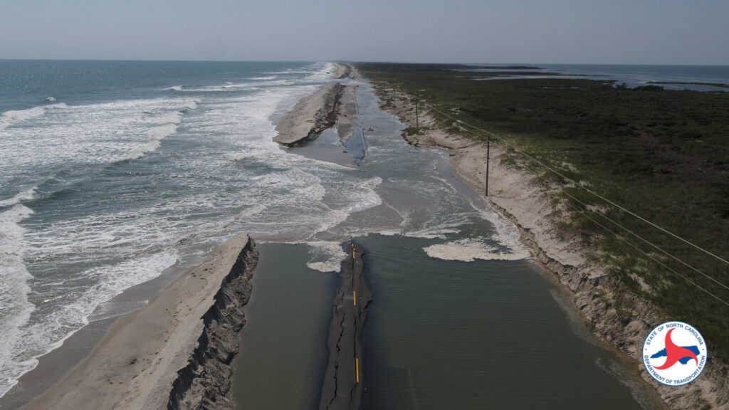
Driving. The standing rule of coastal flooding is absolute: never drive through flooded roads. A foot of moving water can float a car; the 1-to-4-foot inundation forecast for parts of North Carolina and Virginia is well past lethal for vehicles, and flooded pavement hides washed-out roadbeds — NC 12 and other causeway roads can be cut without warning. If a road is barricaded, the detour is the route.
Tides and timing. Flooding peaks at high tide, not when the rain is heaviest. Check your local tide table and treat the two hours either side of high tide — especially Tuesday's cycles, near the storm's late-Tuesday peak — as the danger window. The Delaware advisory window of 3–9 p.m. Tuesday is built around exactly this arithmetic.
Property and preparation. Move vehicles to high ground before the advisory window, not during it. Clear storm drains near your home if it is safe to do so. Charge phones ahead of the 45 mph gusts; outages in coastal flooding are usually scattered but slow to repair while roads are impassable. Soundside and back-bay residents should prepare as seriously as oceanfront ones — in this storm, the bay side is the forecast's stated concern. And if officials order an evacuation for your zone, go early: in a duration event, the first tide cycle that cuts your road may not be the worst one.
Why this matters
Nor'easters like this one are the East Coast's slow climate argument. No single storm proves anything, but the pattern the forecasters keep describing — higher baseline seas, beaches entering each storm with less sand than the last, back-bay flooding in communities built for a quieter water level — is the mechanism by which sea-level rise stops being a projection and becomes a maintenance bill. September's storm spent the dunes; October's, though weaker on paper, bills the coast for the difference. Robert Deal's 1.5-feet-lower-but-riskier formulation is the whole story in one sentence: the hazard is no longer only the water's height, it is the land's declining ability to meet it. For the Outer Banks, where NC 12 is less a road than a recurring negotiation with the Atlantic, this week's storm is another round — tracked, like the hurricane season it shadows, on Signal Post News's storm tracker.
What happens next
The forecast's hinge is Tuesday: peak strength late in the day, the Delaware advisory window in the evening, and the worst tide-stacking where the storm's position holds longest. Improvement is expected Thursday as the low finally pulls away. The NHC's 40 percent subtropical figure will resolve one way or the other by midweek — if Josephine forms, it changes the storm's label, not its water. The lasting questions come after: how much new erosion the already-thin beaches absorbed, whether NC 12 and the Delaware and Virginia causeways held, and how the damage tally from a "minor" nor'easter compares with September's — the comparison that will tell coastal managers whether their defences are keeping pace with the season.
Sources: FOX Weather, Weather.com and Delaware Online, October 19, 2026 (storm position a few hundred miles off the Southeast coast Monday morning; impacts into Wednesday or Thursday, peak late Tuesday; coastal flood warnings and advisories Long Island to North Carolina; 1–4 feet inundation possible in coastal NC/VA; gusts to 45 mph; Delaware coastal flood advisory for Kent, inland Sussex and the beaches, 3–9 p.m. October 20; NWS meteorologist Robert Deal on crests ~1.5 feet below September's storm, eroded beach protections and back-bay risk). National Hurricane Center, October 19, 2026 (~40% chance of subtropical development mid-to-late week; area to watch for the name Josephine).