Nepal Mustang mountain collapse
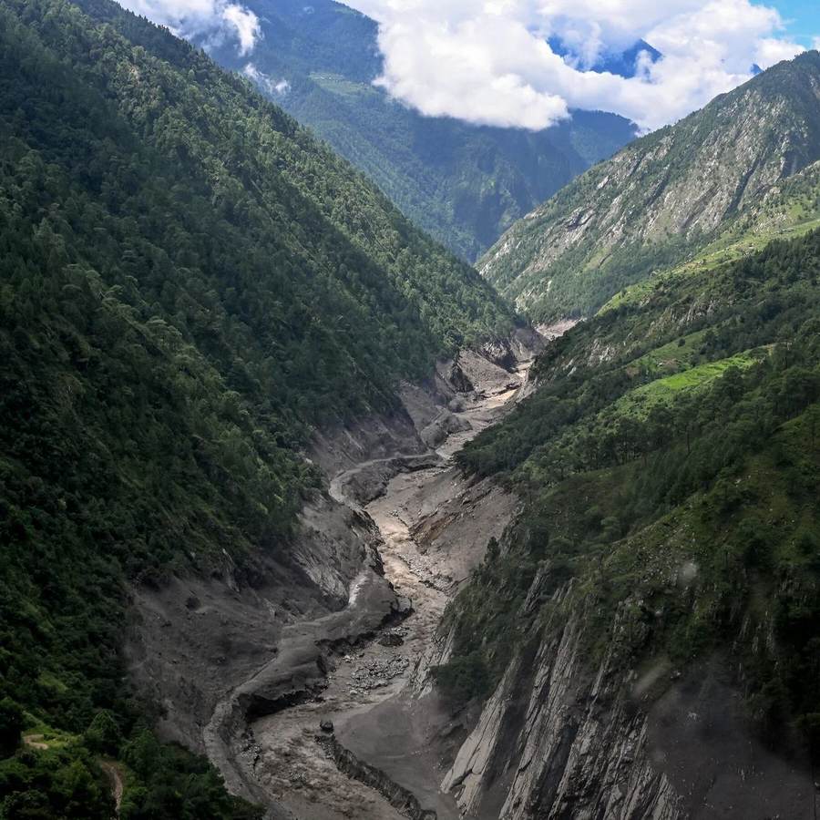
Nepal Mustang mountain collapse footage captured a large section of rain-saturated slope giving way near Lete in Mustang district and plunging toward the Kali Gandaki River, briefly obstructing the watercourse before the river cut back through the debris. The collapse came as days of intense rain drove floods and landslides across western and central Nepal. Broad national reporting put the toll at at least 24 dead and 14 missing across affected districts, while an earlier disaster-authority snapshot cited by other outlets counted 21 deaths and five missing. Those figures cover different reporting cutoffs and should not be treated as a contradiction or as a final total.
What happened along the Kali Gandaki
The slope failure near Lete was rapid: rock, soil and vegetation cascaded down the valley wall in seconds. Witness video showed people reacting as debris reached the swollen river. Reports said the natural dam was temporary, but even a short-lived blockage matters in a narrow Himalayan valley because impounded water can rise behind unstable debris and then surge downstream when a channel opens.
The Kali Gandaki, one of Nepal's major river systems, runs through a corridor where settlements, roads, power infrastructure and tourism routes occupy limited flat ground. Floodwater therefore does not need to cover a vast plain to cause outsized disruption. It can erode a road bench, undermine a bridge approach or isolate a community by removing a single connection.
Why the casualty numbers differ
Disaster totals during a fast-moving emergency are snapshots rather than a single permanent number. A National Disaster Risk Reduction and Management Authority summary cited in Monday reporting listed 21 deaths and five people missing at that stage, including heavy losses in Baglung. Separate broader reports later cited at least 24 deaths and 14 missing across affected districts. The totals can change as local police reports reach the center, missing people are located and deaths from separate rain-triggered incidents are added.
Baglung was among the hardest-hit districts. Reporting described landslides burying homes and a cowshed, while the rising river damaged communities across Gandaki Province. Highways toward Chitwan and links through mountain districts were obstructed, complicating rescue work and the movement of food, fuel and medical supplies.
Why late-monsoon rain is so dangerous
Saturated slopes have little margin left
By late September, hillsides have already absorbed months of monsoon rain. Water fills pores and fractures in soil and rock, adding weight while reducing the friction that helps hold a slope together. Rivers simultaneously erode the base of valley walls. A final burst of rain can therefore trigger failure even if that burst is not the season's most intense.
One collapse can create several hazards
The immediate danger is falling debris, but the secondary risks last longer: blocked rivers, sudden releases, contaminated water, severed roads and unstable slopes above rescue routes. Engineers and local authorities must watch both the blockage site and downstream channels. Reopening a road too quickly can expose crews and residents to a second slide.
Who bears the costs
Mountain households lose first and recover slowest. A destroyed footbridge or washed-out road can cut farmers off from markets and children from schools long after national headlines move on. Tourism operators in the Mustang corridor also face cancellations and uncertain access, while hydropower and transmission operators must protect equipment from sediment and debris. The public sector carries reconstruction costs, but much of the household loss is uninsured.
There are no clear winners in a disaster. However, early warning, disciplined evacuations and verified road closures can prevent a natural hazard from becoming a larger human catastrophe. That makes accurate local reporting and communications infrastructure as important as rescue hardware.
What happens next
Authorities will need to confirm whether the Kali Gandaki channel remains stable, inspect bridges and road foundations, and reconcile district casualty lists. The next rainfall matters: fresh water can reactivate slopes that appear to have settled. Travelers should treat local closure notices as operational information, not inconvenience, until geotechnical inspections are complete.
The wider policy question is whether reconstruction replaces exposed infrastructure in the same footprint or reduces risk through stronger drainage, river setbacks and redundant routes. Nepal's terrain limits easy answers, but repeated monsoon damage makes rebuilding without adaptation progressively more expensive.