Catalonia floods October 2026
- Catalonia floods October 2026
- Barcelona flood October 2026
- Pineda de Mar missing person search
- Vilassar de Mar rainfall record
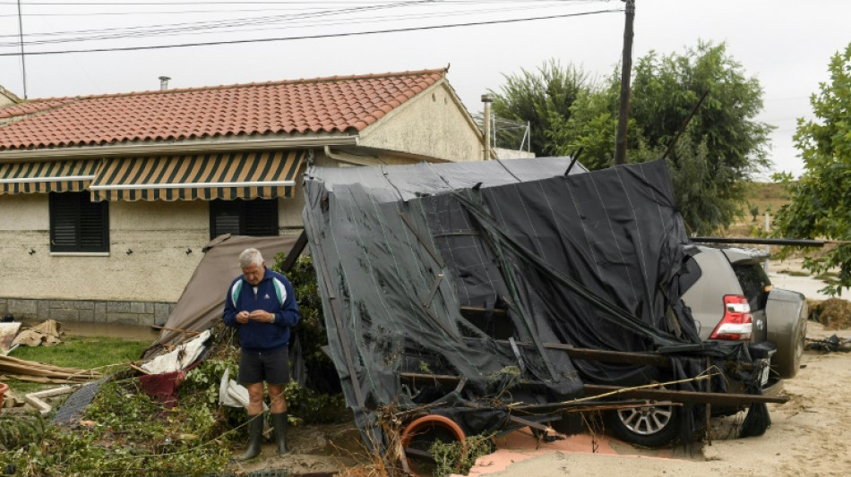
The toll from the Catalonia floods October 2026 stood at two dead and one missing on Monday morning. A man aged about 75 was killed when a wall collapsed at the Caravaning Internacional Costa Brava campsite in Tordera. A second man was found dead inside a flooded underground car park in Montornès del Vallès. Farther up the Maresme coast, rescuers were still searching for a person believed to have been swept into a riera in Pineda de Mar.
The deaths transformed a weekend of dramatic images into a test of whether warnings, restrictions and emergency systems can keep pace with a Mediterranean storm capable of concentrating months of rain into hours. In Vilassar de Mar, 288 litres per square metre fell. Barcelona registered 213 litres per square metre, its heaviest daily total in at least two decades. Reuters reported flooded homes, submerged cars and extensive transport disruption across the region.
What happened: from Saturday's red alert to Monday's search
Saturday night: authorities shut down movement
Catalan authorities moved the INUNCAT flood plan into its emergency phase as forecasts sharpened Saturday. Residents in 20 districts were urged to stay inside and avoid non-essential movement from 8 p.m. Saturday until 2 p.m. Sunday. Shops closed early, football fixtures were called off and Barcelona's Liceu cancelled a performance of Verdi's Aida. The restrictions were disruptive by design: they aimed to remove people from roads and public spaces before the most dangerous overnight period.
Meteocat, Catalonia's official meteorological service, raised the hazard level to the maximum six out of six. Its director, Sarai Sarroca, warned that a “mini-hurricane” could move over land. That was warning language for a potentially compact, violently rotating Mediterranean system—not confirmation that a tropical hurricane had formed. The distinction matters: the operational concern was torrential rain, severe convective wind and rapid local flooding, whatever label ultimately applied to the storm.
Sunday morning: two deaths confirmed
The Catalan fire service received the Tordera alert at 8:11 a.m. Sunday. A wall at the coastal campsite had collapsed, killing the elderly man. President Salvador Illa confirmed the death on X and expressed condolences. In Montornès del Vallès, a family reported a man missing after an underground car park flooded. Rescue teams pumped water for almost two hours before reaching him, according to local reporting compiled by Spain Expat Press.
Elsewhere, the storm produced the familiar but lethal geography of flash flooding. Streets in Palafolls became raging channels. Homes and cars were flooded in Bellvitge and Cornellà. The Besòs rose over its banks, while emergency messages told people near the river to move away from low ground. By 9 a.m. Sunday, emergency lines had received 1,307 calls; more than 4,000 incidents were ultimately recorded.
Monday: travel disruption and a missing-person search
The Pineda de Mar missing person search continued into Monday. The missing person was believed to have been carried away in a riera, one of the seasonal watercourses that can look harmless when dry and become a fast-moving torrent under intense rain. Authorities had not announced a change to the casualty count by Monday morning.
Recovery was incomplete. AFP, via FTNNews, reported that the BV-5159 between La Roca and Vilanova del Vallès, the C-1415a at Castellar del Vallès, the C-352 between Les Franqueses and Canovelles, and the GI-682 at Blanes remained closed in both directions. Southbound queues on the C-58 between Terrassa and Barcelona stretched about 18 kilometres. The R13 and R14 rail lines were partly replaced by buses, while the R1, R2, R4, R7, R8 and R11 also faced disruption.
Why 288 millimetres changes the meaning of “heavy rain”
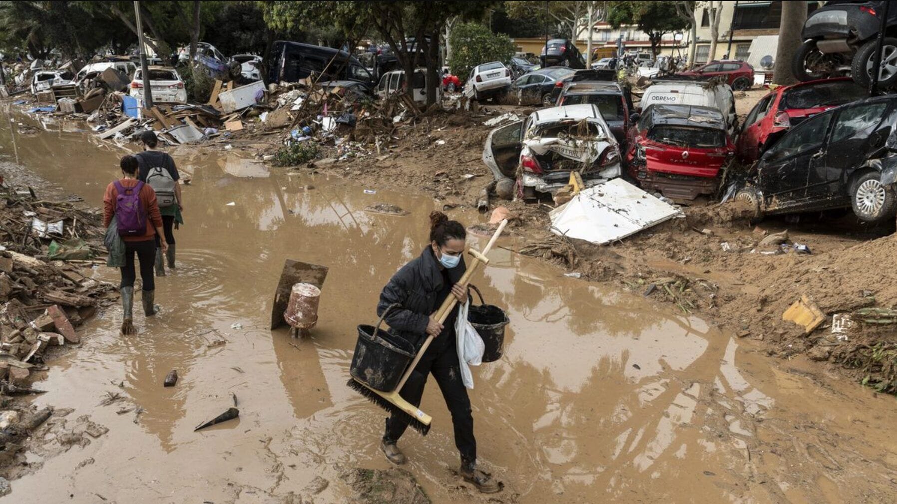
A millimetre of rain over one square metre equals one litre of water. Vilassar de Mar's 288 millimetres therefore represents 288 litres dropped onto every square metre in the gauge's catchment—a mass of water that drainage systems must move almost immediately if streets are to remain usable. Barcelona's 213 millimetres was the city's highest daily total in at least 20 years.
The threat is not captured by the total alone. Rate and location decide whether rain becomes disaster. A city can absorb a long, steady rainfall more effectively than the same amount arriving in violent bursts. Coastal Catalonia is dense, paved and crossed by short drainage paths from hills to the Mediterranean. Water accelerates downhill, meets roads, walls, underpasses and underground garages, and can lose its historic outlet to the sea.
That is why rieras are central to understanding Catalonia flooding today. These seasonal channels may be dry for much of the year. In urbanized areas, some have been confined, diverted or built over, leaving residents to experience the old watercourse as a sudden river running through a modern street. The risk is especially acute where cars or debris block a narrow route, or where below-ground spaces become collection basins.
The storm by the numbers
| Measure | Reported figure | Why it matters |
|---|---|---|
| Vilassar de Mar rain | 288 l/m² | The highest cited local total, equivalent to 288 mm of rain. |
| Barcelona rain | 213 l/m² | The city's heaviest daily rainfall in at least two decades. |
| Red-alert window | 8 p.m. Sat. to 2 p.m. Sun. | Movement and outdoor activity were restricted across 20 districts. |
| Fire-service operations | 2,440 | The scale of pumping, clearing, access and safety work. |
| Rescues | 226 | People removed from immediate danger by firefighters. |
| Emergency calls by 9 a.m. Sunday | 1,307 | A measure of how quickly incidents multiplied overnight. |
The 2,440 operations and 226 rescues reported by firefighters show the difference between rainfall data and emergency workload. Every flooded basement, trapped motorist and blocked access point can require a separate crew. A region can avoid a much larger death toll and still face thousands of high-risk interventions.
Transport, businesses and the logic of a shutdown
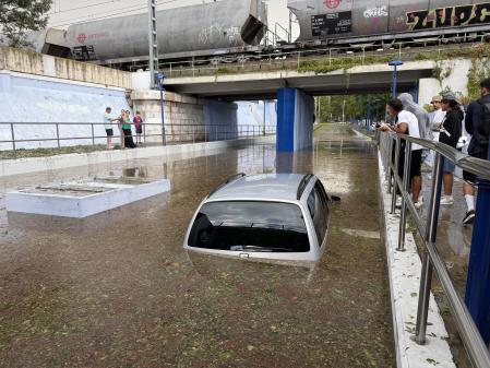
All local trains were disrupted on Saturday. Flights at Barcelona airport were cancelled or delayed. Road closures remained scattered across the region Monday. These failures were not independent: floodwater on a feeder road strands railway staff, a landslide blocks a bus replacement route, and cancelled flights push more passengers toward already disrupted ground transport.
The decision to close shops, cancel matches and stop Aida will inevitably be judged against places where the worst forecast outcome did not occur. That is how preventive action looks when it works: the public sees the cost of cancellation but not the trips, queues and crowds that never entered danger. In a fast-moving weather emergency, the red-alert decision should be assessed against exposure removed, not only damage observed.
President Illa's public warnings and Interior Minister Núria Parlon's calls for caution also show how risk communication moved beyond meteorological charts. The practical message from Generalitat Civil Protection was simple: stay away from rivers, ravines, flooded crossings and underground spaces; do not travel unless necessary; follow emergency instructions. Specific, repeated actions are more useful in a flash flood than abstract descriptions of probability.
DANA, cut-off lows and the memory of Valencia
Spain's most destructive autumn floods often develop when cold air becomes detached from the main upper-atmosphere flow—a cut-off low known in Spanish as a DANA—and interacts with warm, moisture-rich Mediterranean air. The ingredients do not guarantee catastrophe. Their placement, movement and duration determine where convective storms repeatedly form and whether the same drainage basin is hit again and again.
This storm arrives almost two years after the October 2024 Valencia DANA disaster killed more than 220 people. The scale is not comparable: Catalonia's confirmed toll Monday morning was two dead and one missing. But Valencia changed the political meaning of every red alert in eastern Spain. Officials know that delaying warnings can be fatal; residents know a dry channel can become impassable in minutes.
The Catalan response suggests some lessons were absorbed: the INUNCAT emergency phase was activated before the peak, an ES-Alert reached phones, travel was restricted, events were cancelled and thousands of incidents were handled. Yet two deaths and an unresolved search also show the limit of preparedness. A wall can fail at a campsite. An underground garage can fill faster than rescuers can pump it. A person near a riera can disappear before a warning becomes an action.
The climate signal behind Mediterranean deluges
No single flood can be reduced to one cause. Urban surfaces, drainage design, soil saturation, storm track and emergency behavior all shape damage. But the background physics is clear: warmer air can hold more water vapor, and a warmer Mediterranean can supply more moisture and energy to autumn storms. That loads the dice toward heavier downpours when atmospheric conditions align.
The infrastructure question is therefore not whether Catalonia can build a system that never floods. It is whether drainage, zoning, transport design and public alerts are calibrated for rainfall distributions that are changing. Old “record” thresholds are especially dangerous when they are treated as design ceilings rather than historical observations.
The challenge is global. Signal Post News has examined how intense rainfall can overwhelm a megacity in our report on Bangkok's flood disaster zone, and how warming alters exposure in our analysis of climate change and Himalayan flood risk. The geography differs; the planning problem rhymes.
What happens next
The first priority remained the search in Pineda de Mar. Search teams face a difficult landscape: floodwater can carry a person far from the point of entry, while debris, unstable banks and renewed rain can endanger rescuers. Authorities had not announced an outcome by Monday morning.
The second priority is restoring safe movement. Roads cannot simply reopen when surface water falls; engineers must check washed-out shoulders, retaining walls, bridges and slope stability. Rail operators must inspect tracks, signaling and power equipment. The parks of Barcelona remained closed, beaches carried red flags, and a new red warning covered the city's pre-coastal area Monday, according to AFP.
Then comes the slower accounting: damaged homes and vehicles, disrupted businesses, repair costs for municipalities, and questions about whether specific developments sit in paths water is trying to reclaim. Forecasts beyond the published warning window remain uncertain. The responsible outlook is conditional: more intense rain would slow searches and reopen transport risks; a sustained break would shift the work toward inspection, cleanup and claims.
The weekend's clearest lesson is that the Catalonia red alert weather system was not an overreaction. Two deaths, one person missing, more than 200 rescues and Barcelona's heaviest daily rain in two decades show how little margin existed. The restrictions bought time and reduced exposure. They could not remove every hazard.
Sources
Reporting note: Casualties are held at two dead and one missing as of Monday morning, October 5. The “mini-hurricane” description is attributed to Meteocat's Sarai Sarroca and is not presented as a confirmed hurricane classification. Context photographs from 2024 and August 2026 are clearly labeled and do not depict this storm.