World / Environment
A high glacial lake burst above Gasa on Thursday night, washing away the famed Gasa Tshachu hot springs, cutting the road to Laya and sending a flood warning racing down the Mo Chhu and the Sankosh — where more than 10,000 people in West Bengal were moved to safety overnight, while Assam watched the river and waited.
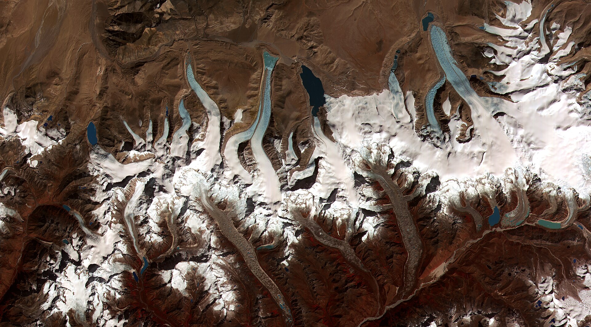
A Bhutan glacial lake outburst flood tore through one of the most remote corners of the Himalaya on Thursday evening, October 29, 2026, after Shintaphu Lake — also spelled Sintaphu — a high-altitude glacial lake below Wakila Mountain in Lungo, Laya Gewog, Gasa district, in northern Bhutan, burst and sent its water pouring into the Mo Chhu River system. By Friday, the flood had washed away infrastructure at the Gasa Tshachu natural hot springs, one of Bhutan’s best-known tourist attractions, severed the road toward the highland community of Laya, and crossed an international border in the dark: downstream in India, officials in West Bengal moved more than 10,000 people out of the path of the Sankosh River overnight, while neighbouring Assam placed two districts on alert. No injuries or loss of life had been reported in Bhutan as of Friday, the state broadcaster BBS said — a outcome officials on both sides of the border credited to an evacuation that began before the water arrived.
What happened at Shintaphu Lake
The Shintaphu Lake outburst began on Thursday evening in one of the least accessible landscapes in Bhutan. Shintaphu sits high below Wakila Mountain above Lungo, in the Laya Gewog of Gasa district, hard against the Tibetan frontier. It is not an obscure pond: Bhutanese assessments have long listed it among the 17 glacial lakes in the kingdom identified as potentially dangerous — lakes held back by walls of loose rock and ice that can fail with little or no warning. When it gave way on Thursday, the released water funnelled into the Sintaphu Chhu and from there into the Mo Chhu River system, gathering force as it fell through steep, narrow valleys toward Gasa town and the hot springs below.
Reuters reported on Friday, October 30, that the flood washed away infrastructure at the Gasa Tshachu natural hot springs, a major tourist attraction whose mineral waters have drawn Bhutanese pilgrims and foreign visitors for generations. BBS, Bhutan’s state broadcaster, said no injuries or loss of life had been reported. The broadcaster also cautioned that the full extent of the damage was hard to assess because the flood arrived in darkness and the river was still flowing strongly; BBS reported that two bailey bridges may also have been washed away, a detail that remained unconfirmed on Friday. Kuensel, Bhutan’s national newspaper, reported that the hot springs area had been evacuated before the flood arrived, and that part of the road to Laya was washed away and closed indefinitely — cutting the surface link to one of the most isolated communities in the country.
A second flood at the same springs
For Gasa, this is a familiar disaster in a new form. Floodwaters reached Taktsemakhang at about 8:15 p.m. on Thursday, where an artificial lake formed at the confluence of the Sintaphu Chhu and the Lungu — or Gangchen Tag — Chhu, a blockage that officials will now have to watch closely, because water ponded behind debris can release again. A section of the Punakha–Gasa highway near the 31.85 km point was washed away and closed. And the Gasa Tshachu site itself was hit once before in recent memory: in 2021, the Mo Chhu changed course and damaged the same springs. Thursday’s Gasa Tshachu hot springs flood is therefore not a freak event at a safe site, but the second strike in five years on infrastructure built beside a river that has already shown it can move.
From the Mo Chhu to the Sankosh: one river, two countries
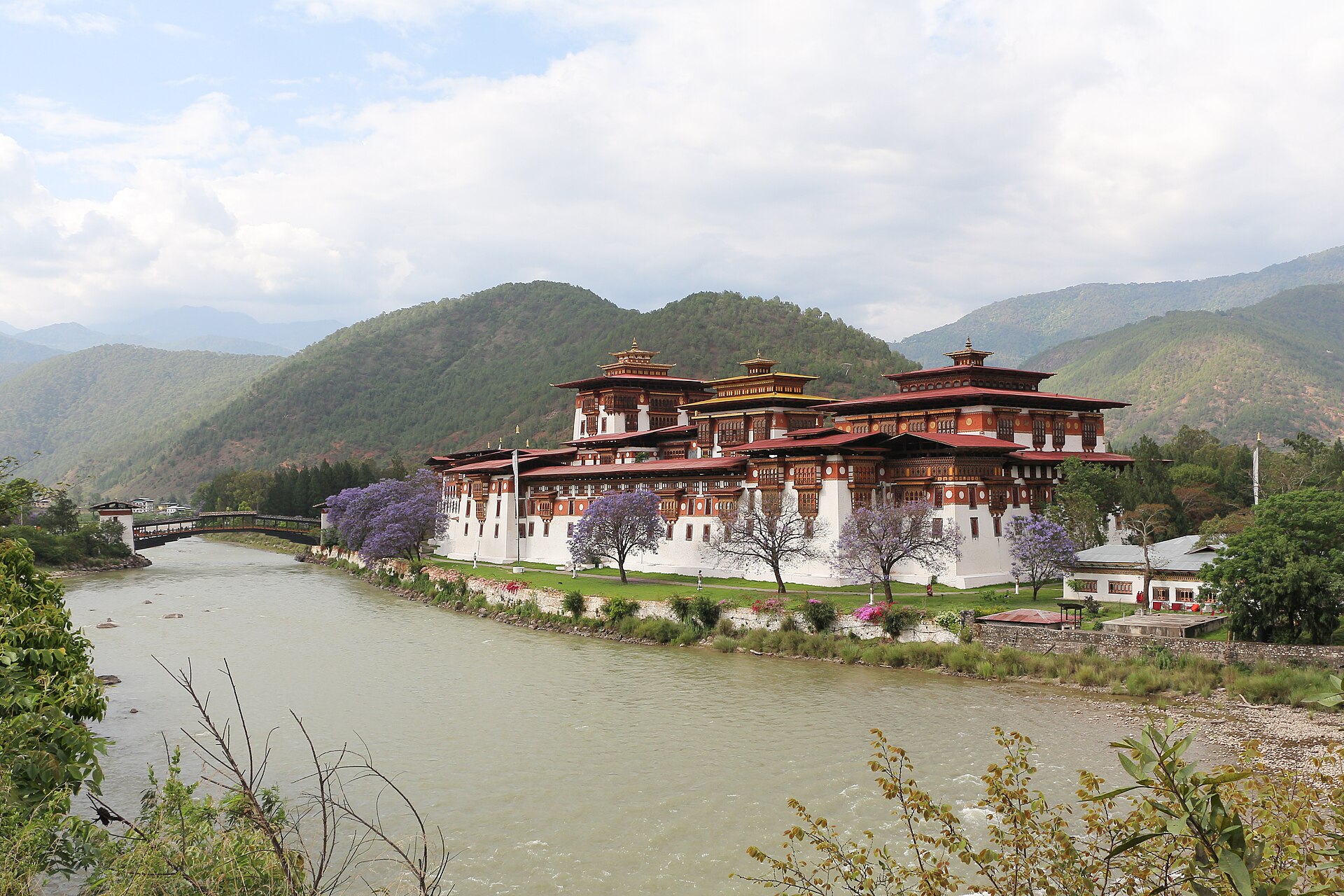
Understanding this flood means following the water. The Mo Chhu River flood that began in Gasa flows south through Gasa and Punakha districts, passes below Punakha Dzong — Bhutan’s great fortress-monastery, set precisely where the Mo Chhu meets the Pho Chhu — and the two rivers together form the Punatsangchhu. That river crosses into India, where it is known as the Sankosh, and the Sankosh in turn flows through West Bengal and Assam before joining the Brahmaputra, one of Asia’s great rivers. A lake that bursts at nearly 4,000 metres in Bhutan is, within a day, a flood-management problem on the plains of India. That is why a Sankosh River flood alert was issued in India on Thursday, within hours of the outburst, and why the story of a remote Himalayan lake became, overnight, a story about tea gardens, forest villages and relief shelters hundreds of kilometres downstream.
India moves thousands in West Bengal; Assam watches, and waits
India’s response began before the water crossed the border. The Central Water Commission issued a special flood advisory on Thursday after receiving a report from the Indian Embassy in Bhutan, warning of a sudden rise in the Sankosh in Alipurduar district in West Bengal and Dhubri district in Assam. In Alipurduar, the response was large and fast. Superintendent of Police Amit Kumar Shaw said about 4,000 to 5,000 people were moved into relief shelters set up in schools, and more than 6,000 others were relocated to safer ground — more than 10,000 people moved in a single district, according to Indian reporting. Forest Minister Manoj Oraon alerted settlements strung along the Sankosh, including the Kumargram tea estate, the Kumargram forest village, Pakriguri and Bholka, where homes and livelihoods sit close to a river that can rise faster than people can pack.
The picture in Assam was different, and the distinction matters. Chief Minister Himanta Biswa Sarma said his government was monitoring Dhubri and Kokrajhar districts. But the Assam State Disaster Management Authority said on Friday that no evacuation had started in Assam and that river levels there had not risen. So the accurate summary of the West Bengal Assam flood evacuations is asymmetric: a mass evacuation in West Bengal, and a watchful alert — not an evacuation — in Assam. Reporting that flattens the two states into a single evacuation story would overstate what Assam’s own disaster authority says happened on its side of the line.
What is not yet confirmed
Three things remain unverified, and readers should hold them separately from the confirmed record. First, the figure of about 7.4 million cubic metres of water released from Shintaphu Lake comes from Indian media reports and has not been confirmed by Bhutanese authorities. Second, the cause and mechanism of the outburst — whether the lake’s moraine dam was overtopped, eroded, undercut by a landslide or an ice or rock avalanche into the lake — are not yet confirmed. Third, the full extent of the damage in Gasa, including the reported loss of two bailey bridges, cannot be confirmed until assessment teams can reach the sites in daylight and the river falls. What is confirmed is narrower and still significant: a dangerous-listed lake burst, a famous hot springs was destroyed or badly damaged, a highway and a mountain road were cut, more than 10,000 people were moved in India, and no casualties had been reported as of Friday.
Why this matters
This is a Himalayan warning that crossed a border within hours, and it exposes the central fact of mountain risk in South Asia: the hazard is stored at altitude, in another country, and the consequences arrive downstream at night. Bhutan holds the lakes; India holds much of the exposed population. Neither side can manage a glacial lake outburst flood Himalayas event alone, and Thursday night showed both halves of that bargain working — Bhutanese warnings and an embassy report moving fast enough for Indian districts to empty riverbanks before the Sankosh rose, and the limits of the system, in which the most basic fact of the event, how much water actually came down, was still unconfirmed a day later. The Gasa flood will be studied far beyond Bhutan because the same geometry — a warming glacier, a growing lake, a steep valley, a border, a crowded plain — repeats itself along the entire Himalayan arc, from Pakistan through Nepal and Bhutan to India’s northeast.
What is a GLOF flood — and why there are more lakes to burst
Anyone asking what is a GLOF flood can start with the dam. A glacial lake outburst flood occurs when the natural dam holding back a glacial lake — typically a ridge of moraine, the loose rock and debris a glacier leaves behind, sometimes stiffened with ice — suddenly fails, or when a landslide or avalanche into the lake sends a wave over the dam and breaches it. The water, often carrying boulders, trees and sediment, can transform a mountain stream into a destructive torrent within minutes, and the flood wave can travel tens or hundreds of kilometres. GLOFs are not caused by rain; they can arrive on a clear night, out of a lake that looked calm the day before.
The reason risk is rising is written into the landscape in the hero image of this article: as the Himalaya warms and its glaciers retreat, meltwater collects in the hollows glaciers leave behind, and new lakes form and existing lakes grow on and beside debris-covered ice. Bhutan alone has some 2,674 glacial lakes, of which a subset — 17 in the assessment cited in this week’s reporting — are classified as potentially dangerous. The region has been warned before, in blood. In 1994, the Luggye glacial lake burst in Lunana, in Bhutan’s far north, sending a flood down the Pho Chhu that killed people in the Punakha valley and reshaped how Bhutan monitors its lakes. In October 2023, India’s South Lhonak lake in Sikkim burst after heavy rain and a slope failure, destroying the Teesta III dam at Chungthang and killing scores of people downstream — the deadliest recent demonstration that a Bhutan GLOF October 2026-style event is a regional, recurring hazard, not a one-off. Shintaphu is the latest entry in a ledger that climate trends keep lengthening.
Who is exposed — and who loses
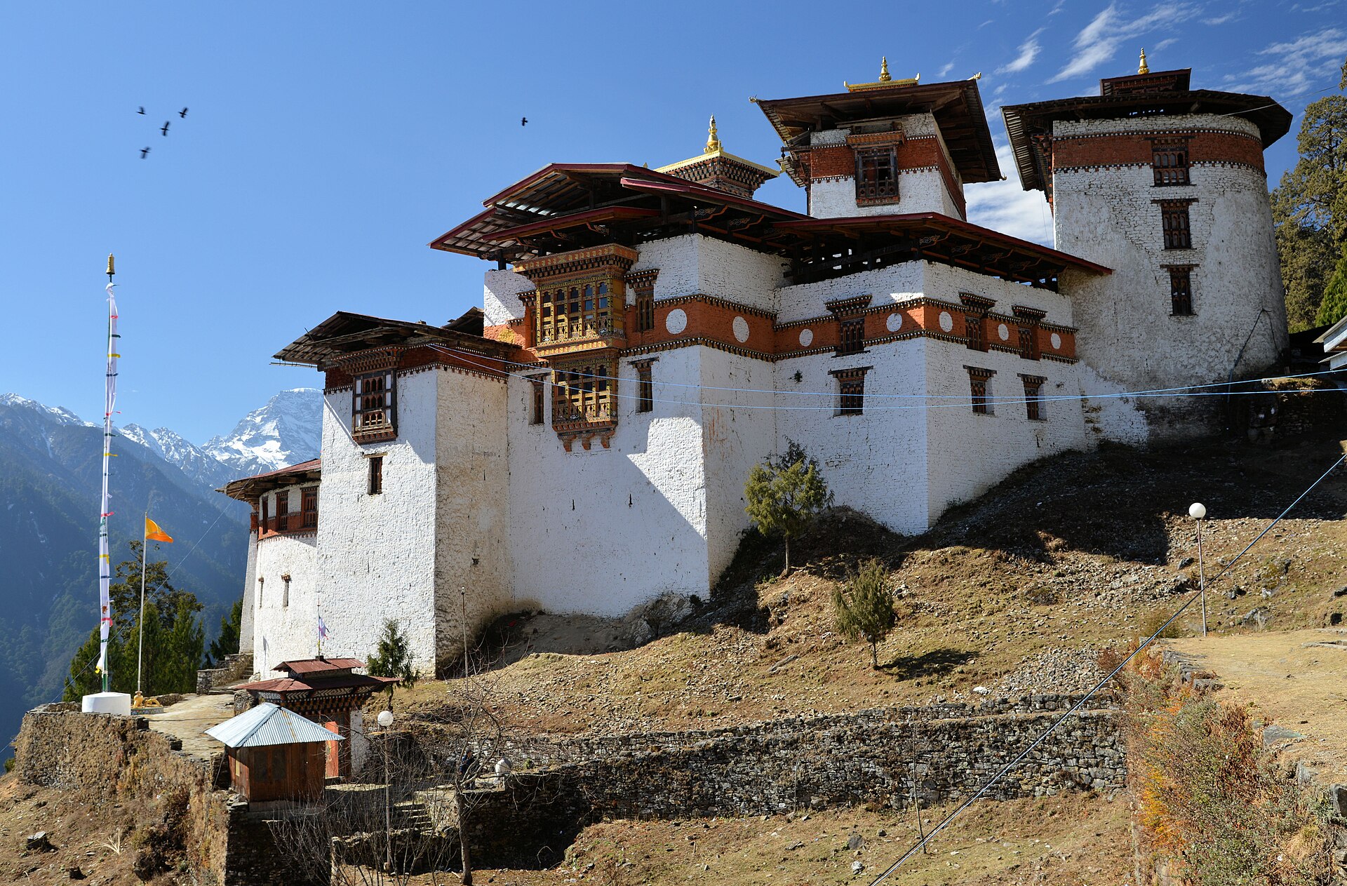
The exposed map runs downhill. First are the Layap, the highland people of Laya Gewog, among Bhutan’s most remote communities, whose road link has now been washed away and closed indefinitely, and the residents of Gasa town and the villages strung along the Mo Chhu. Then comes the Punakha valley, where the dzong, farms, roads and hydropower infrastructure sit in a valley that Bhutan’s own history — 1994 above all — marks as flood-exposed, and the road and bridge network on which everything in the mountains depends; a single washed-out section at the 31.85 km point can isolate a district. Furthest downstream, and most numerous, are the riverbank settlements of India: tea-estate workers at Kumargram, forest villages, and farming communities along the Sankosh in Alipurduar, Dhubri and Kokrajhar, whose exposure is measured not in altitude but in how little warning time a night flood allows.
Nobody benefits from this flood, and the losses are unevenly shared. The clearest loss is cultural as much as economic: Gasa Tshachu is not a interchangeable tourist facility but a springs site used for generations, woven into Bhutanese ideas of healing and pilgrimage, now damaged for the second time in five years. Tourism revenue in one of Bhutan’s poorest and least-visited districts will suffer; so will the households in Alipurduar who spent Thursday night in school shelters and returned, at best, to waterlogged homes. The honest ledger has no winners’ column — only a warning system that kept the casualty count, so far, at zero, and a bill for rebuilding that will land on a small Himalayan kingdom and two Indian states.
A cross-border warning that worked — and where it is still fragile
The most instructive part of Thursday night is what went right. The chain — detection in Bhutan, a report from the Indian Embassy, a special advisory from India’s Central Water Commission, district-level alerts, and evacuations in Alipurduar completed before the Sankosh peaked — is exactly how transboundary early warning is supposed to function, and it rarely functions this smoothly anywhere in the Himalaya. SPN’s coverage of this month’s fatal flash floods in Syria and the Budhi Gandaki flash flood in Nepal shows the counterfactual: floods that arrive faster than warnings kill, and they kill children first. In Gasa and Alipurduar, by contrast, the hot springs were emptied before the water arrived and ten thousand people were moved on the strength of a forecast, not a sighting.
The fragility is just as clear. The system depended on information moving between two governments at night, about a lake in one of the least instrumented landscapes on earth. The volume of the outburst was still unconfirmed a day later; the damage at the springs could not even be assessed in the dark; and the new artificial lake at Taktsemakhang is a reminder that one flood can manufacture the next hazard in a matter of hours. Early warning bought time on Thursday. It did not reduce the amount of water stored in the 16 other dangerous lakes on Bhutan’s list, nor the thousands of lakes beyond it — and time, without monitoring and mitigation at the lakes themselves, is a wasting asset as the lakes grow.
What happens next
The immediate tasks are practical. Indian authorities will keep monitoring the Sankosh, and Assam’s alert for Dhubri and Kokrajhar stands until levels are confirmed safe; West Bengal must decide when the more than 10,000 people in shelters and on safer ground can go home. In Bhutan, engineers and geologists face the new artificial lake at Taktsemakhang, which must be monitored — and, if it threatens to breach, managed — before it becomes a second flood. The Punakha–Gasa highway section and the road to Laya must be assessed and rebuilt, on a timeline that determines how isolated Laya remains heading into winter. And Bhutan’s specialists will have to produce what does not yet exist: a confirmed account of how much water Shintaphu held and released, why its dam failed, and what the outburst implies for the other lakes on the dangerous list — including whether monitoring, early-warning sirens or lake-lowering work needs to accelerate before the next lake, rather than this one, makes the news.
For now, the headline facts stand as BBS and Reuters left them on Friday: a lake burst, a beloved hot springs was washed away, two countries moved quickly, and nobody — so far — has been reported dead. In the Himalaya, that last clause is the one that matters most, and the one that cannot be guaranteed next time.
Sources
- Reuters, “Bhutan glacial lake outburst triggers flood, no injuries reported,” October 30, 2026 (Gasa Tshachu damage; BBS reporting on casualties and assessment difficulties).
- The Business Standard, “West Bengal, Assam on alert after glacial lake outburst in Bhutan,” October 2026 (Central Water Commission advisory; West Bengal and Assam responses).
- TOB News, “Bhutan GLOF triggers flood; Assam and Bengal on high alert,” October 2026 (Sankosh River alert and district monitoring).
- ANI via Latestly, “Glacial lake outburst flood in Bhutan: North Bengal on high alert, thousands relocated, disaster response teams activated,” October 2026 (Alipurduar relocations and official statements). Bhutanese reporting by BBS and Kuensel as cited in the article.
- Photos: NASA/USGS (public domain), Bernard Gagnon (CC BY-SA 4.0) and Christopher J. Fynn (CC BY-SA 3.0), via Wikimedia Commons, as credited in the captions. File photographs — satellite imagery of Bhutan’s glacial lakes, Punakha Dzong and Gasa Dzong — not photographs of the October 29 outburst.