The remnants of Tropical Storm Rachel turned the desert's driest city into a flash-flood zone on Sunday — a record 1.08 inches at Harry Reid Airport, water rushing through streets by the Strip, and a flood watch stretching into Monday morning. In Las Vegas, a little rain is never a little problem.
Track it live: Live hurricane tracker · All trackers
The Las Vegas flash flood began the way desert disasters always begin: with a number that would be unremarkable anywhere else. By 7 a.m. Sunday, Harry Reid International Airport had measured 1.08 inches of rain — smashing the old daily record of 0.78 inches, according to KLAS reporting, and delivering more rain in a single morning than the city saw in its entire 2026 monsoon season. The remnants of Tropical Storm Rachel, pushing deep moisture into the Mojave Desert as a post-tropical system, had arrived in Southern Nevada — and the National Weather Service responded with a flash flood warning for west-central Clark County that named the Las Vegas Strip itself among the locations at risk.
What happened on Sunday
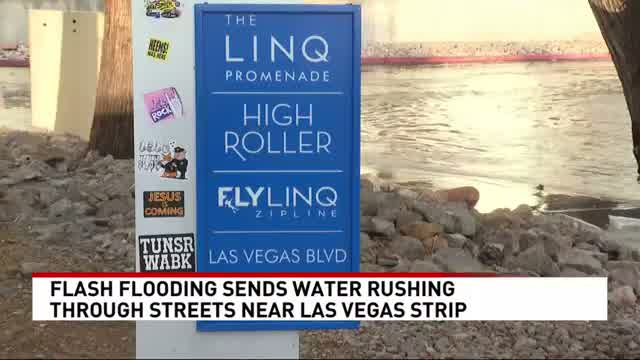
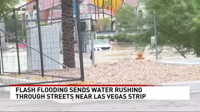
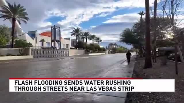
Rainfall was wildly uneven across the valley, which is exactly what makes desert flooding so treacherous. While the airport broke its record, gauges in the northwest valley — Centennial Hills and surrounding areas — recorded more than 2.5 inches, local reporting showed. Radar-indicated heavy rain triggered the NWS flash flood warning Sunday morning, covering Las Vegas, North Las Vegas, Summerlin, Centennial Hills, Spring Valley, Enterprise, the Strip and Downtown. KSNV News 3 Las Vegas captured floodwater rushing through streets near the Strip and behind the LINQ Promenade, with cars stranded around Koval Lane and Winnick Avenue, where police later closed all lanes. Flooding was also reported near the Rio hotel and as far south as Primm Boulevard at Interstate 15. Clark County Public Works crews moved in to clear debris as the water receded.
Why a desert city floods so fast
Las Vegas is built on one of the least forgiving hydrological setups in America. Desert ground bakes into a hardpan that sheds water instead of absorbing it; the city's vast surfaces of asphalt, concrete and parking lots give rainfall nowhere to go. When tropical moisture arrives in volume, runoff concentrates in streets and washes within minutes, and water depth can go from ankle to dangerous faster than a driver can react. That is why the NWS warning language stresses low-water crossings and flooded roads: in the desert, the road itself becomes the river.
Rachel's path explains the scale. The system battered the Southern California coast first — the Naples Island, Treasure Island and Peninsula areas of Long Beach were under evacuation orders late Friday before advisories were lifted Sunday — then its tropical moisture plume swept inland across the desert Southwest, with flood alerts stretching into northwestern Arizona and southeastern California. The NWS flood watch for the region ran through 5 a.m. Monday, joined by a wind advisory until 5 a.m. and a high wind warning through Sunday evening, with southeast gusts hitting 40 mph in the valley and stronger gusts in the mountains.
Why this matters
The flood is a case study in how climate volatility converts rarity into risk. Las Vegas infrastructure — drainage, road design, emergency response — is engineered around the assumption that serious rain is a once-in-a-decade event. When a former tropical cyclone delivers a record daily total plus localized 2.5-inch bursts, the assumption breaks all at once: streets become waterways, traffic arteries like Koval Lane shut down, and crews scramble from debris removal to road closures with no practice season. The economic hit is real too — the Age of Chivalry Renaissance Festival was cancelled, tourists found the Strip's side streets impassable, and a viral video of a Flamingo employee trying to cross rushing floodwater for fear of being fired for arriving late became a symbol of how ordinary workers absorb the cost of extraordinary weather.
What happens next
The immediate danger tapered overnight as the flood watch expired at 5 a.m. Monday, but the weather story isn't finished. Scattered showers and isolated thunderstorms were expected to continue into Monday and possibly Tuesday, with cooler temperatures before drier, sunnier conditions return later in the week, per local forecasts. For residents, the guidance from the NWS remains the standard desert-flood rule: never drive through a flooded road or enter a flowing wash — six inches of moving water can knock a person down, and a foot can sweep a car away.
The longer question is whether Rachel marks a pattern. The 2026 monsoon was wet by local standards, and back-to-back tropical moisture intrusions into the desert Southwest are the kind of event that climate models project will become more frequent as oceans warm and atmospheric moisture capacity rises. One record rainfall day is weather. A season of them is a planning problem — for drainage engineers, for resort operators on the Strip, and for a city whose entire economy depends on people being able to move around it.
Sources
- KSNV News 3 Las Vegas, "Flash flooding sends water rushing through streets near Las Vegas Strip" — youtube.com/watch?v=N3BONQvXnxI
- National Weather Service Las Vegas — flash flood warning, west-central Clark County, Oct 11, 2026; flood watch through 5 a.m. Monday
- KLAS reporting via Hindustan Times — 1.08" at Harry Reid Airport breaks 0.78" daily record; wind advisory/high wind warning details — kokthum.com
- lasvegasnews.co — flash flood warning details, NWS 7:12 a.m. update — lasvegasnews.co
- Primetimer — viral video of Flamingo employee crossing flooded street — primetimer.com